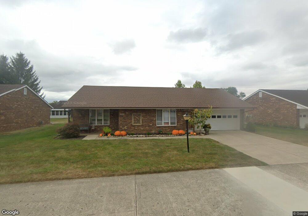
3030 Armsgate Rd Unit 26 Springfield, OH 45503
Estimated Value: $181,000 - $201,000
2
Beds
2
Baths
1,300
Sq Ft
$149/Sq Ft
Est. Value
About This Home
This home is located at 3030 Armsgate Rd Unit 26, Springfield, OH 45503 and is currently estimated at $193,613, approximately $148 per square foot. 3030 Armsgate Rd Unit 26 is a home located in Clark County with nearby schools including Northridge Elementary School, Kenton Ridge Middle & High School, and Emmanuel Christian Academy.
Ownership History
Date
Name
Owned For
Owner Type
Purchase Details
Closed on
Aug 28, 2012
Sold by
Ryan J Paul B
Bought by
Melfi Jill K
Current Estimated Value
Purchase Details
Closed on
Jun 29, 2009
Sold by
Henderson Bruce A and Henderson Connie J
Bought by
Ryan Paul B
Purchase Details
Closed on
Sep 25, 1997
Sold by
Crewe Brian J
Bought by
Henderso Al Bruce A Henderson and Henderso Paul R
Create a Home Valuation Report for This Property
The Home Valuation Report is an in-depth analysis detailing your home's value as well as a comparison with similar homes in the area
Home Values in the Area
Average Home Value in this Area
Purchase History
| Date | Buyer | Sale Price | Title Company |
|---|---|---|---|
| Melfi Jill K | $84,000 | -- | |
| Ryan Paul B | $91,500 | Ohio Real Estate Title | |
| Henderso Al Bruce A Henderson | $92,000 | -- |
Source: Public Records
Tax History
| Year | Tax Paid | Tax Assessment Tax Assessment Total Assessment is a certain percentage of the fair market value that is determined by local assessors to be the total taxable value of land and additions on the property. | Land | Improvement |
|---|---|---|---|---|
| 2025 | $1,234 | $52,870 | $7,350 | $45,520 |
| 2024 | $1,218 | $38,880 | $6,300 | $32,580 |
| 2023 | $1,218 | $38,880 | $6,300 | $32,580 |
| 2022 | $1,240 | $38,880 | $6,300 | $32,580 |
| 2021 | $1,411 | $38,050 | $5,250 | $32,800 |
| 2020 | $1,413 | $38,050 | $5,250 | $32,800 |
| 2019 | $1,441 | $38,050 | $5,250 | $32,800 |
| 2018 | $1,101 | $30,490 | $5,570 | $24,920 |
| 2017 | $936 | $29,827 | $5,565 | $24,262 |
| 2016 | $929 | $29,827 | $5,565 | $24,262 |
| 2015 | $828 | $29,512 | $5,250 | $24,262 |
| 2014 | $828 | $29,512 | $5,250 | $24,262 |
| 2013 | $826 | $29,512 | $5,250 | $24,262 |
Source: Public Records
Map
Nearby Homes
- 1039 Bradford Dr Unit 42
- 1139 Bradford Dr
- 1136 Foxboro Rd Unit 202
- 3052 Brixton Dr E
- 3124 El Camino Dr
- 3135 Imperial Blvd
- 1525 Providence Ave
- 1404 Attleboro Ave
- 1201 Kingsgate Rd
- 1162 Kingsgate Rd
- 732 Grandview Dr Unit 732
- 2943 Tarryton Ln
- 3631 Kingsgate Ln
- 1500 Kingsgate Rd Unit 19430
- 1502 Kingsgate Rd Unit 19432
- 1500 Kingsgate Rd
- 1502 Kingsgate Rd
- 1503 Kingsgate Rd
- 1507 Kingsgate Rd
- 1505 Kingsgate Rd
- 3028 Armsgate Rd
- 3028 Armsgate Rd
- 3029 Armsgate Rd
- 3029 Armsgate Rd
- 3031 Armsgate Rd Unit 17
- 3027 Armsgate Rd
- 3034 Armsgate Rd Unit 31
- 3034 Armsgate Rd Unit 24
- 1026 Armsgate Rd
- 3033 Bradford Dr
- 1033 Bradford Dr Unit 45
- 1025 Armsgate Rd
- 1015 Abington Place Unit 18
- 1079 Abington Place
- 3036 Armsgate Rd
- 3036 Armsgate Rd
- 3030 Bradford Dr
- 3030 Bradford Dr Unit 52
- 1030 Armsgate Rd Unit 29
- 1030 Armsgate Rd
Your Personal Tour Guide
Ask me questions while you tour the home.