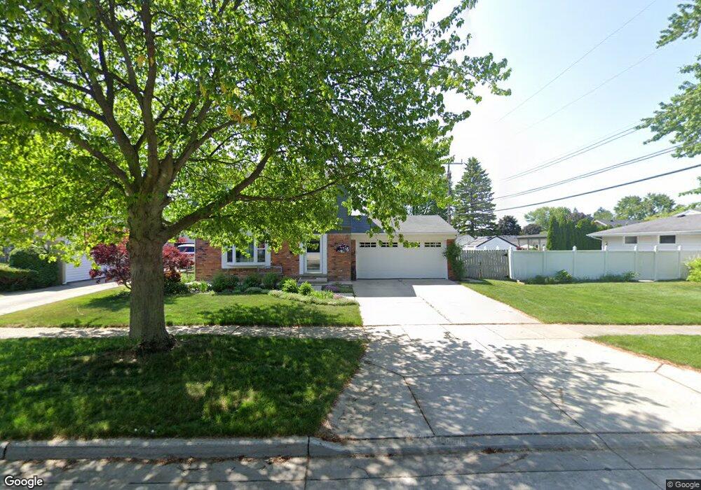
304 Cranbrook Blvd Monroe, MI 48162
Northwest Monroe NeighborhoodEstimated Value: $238,401 - $277,000
3
Beds
2
Baths
1,274
Sq Ft
$203/Sq Ft
Est. Value
About This Home
This home is located at 304 Cranbrook Blvd, Monroe, MI 48162 and is currently estimated at $258,100, approximately $202 per square foot. 304 Cranbrook Blvd is a home located in Monroe County with nearby schools including Monroe High School, St Mary's Catholic Elementary School, and St Michaels Catholic Elementary School.
Ownership History
Date
Name
Owned For
Owner Type
Purchase Details
Closed on
Jun 20, 2002
Sold by
Bennett Timothy
Bought by
Garbo Timothy and Garbo Carla
Current Estimated Value
Home Financials for this Owner
Home Financials are based on the most recent Mortgage that was taken out on this home.
Original Mortgage
$132,000
Outstanding Balance
$56,207
Interest Rate
6.91%
Mortgage Type
New Conventional
Estimated Equity
$201,893
Create a Home Valuation Report for This Property
The Home Valuation Report is an in-depth analysis detailing your home's value as well as a comparison with similar homes in the area
Home Values in the Area
Average Home Value in this Area
Purchase History
| Date | Buyer | Sale Price | Title Company |
|---|---|---|---|
| Garbo Timothy | $165,000 | -- |
Source: Public Records
Mortgage History
| Date | Status | Borrower | Loan Amount |
|---|---|---|---|
| Open | Garbo Timothy | $132,000 |
Source: Public Records
Tax History
| Year | Tax Paid | Tax Assessment Tax Assessment Total Assessment is a certain percentage of the fair market value that is determined by local assessors to be the total taxable value of land and additions on the property. | Land | Improvement |
|---|---|---|---|---|
| 2025 | $2,506 | $113,500 | $113,500 | $0 |
| 2024 | $2,392 | $106,120 | $0 | $0 |
| 2023 | $2,288 | $82,320 | $0 | $0 |
| 2022 | $3,060 | $82,320 | $0 | $0 |
| 2021 | $2,943 | $73,970 | $0 | $0 |
| 2020 | $2,741 | $68,840 | $0 | $0 |
| 2019 | $2,598 | $68,840 | $0 | $0 |
| 2018 | $2,525 | $65,580 | $0 | $0 |
| 2017 | $2,355 | $65,580 | $0 | $0 |
| 2016 | $2,280 | $64,340 | $0 | $0 |
| 2015 | $2,187 | $57,720 | $0 | $0 |
| 2014 | $2,187 | $57,720 | $0 | $0 |
| 2013 | -- | $57,920 | $0 | $0 |
Source: Public Records
Map
Nearby Homes
- 329 Cranbrook Blvd
- 510 Ave de Lafayette
- 202 Orleans Ave
- 568 Rose Crest Blvd
- 0 S Custer Lot B Rd
- 0 S Custer Lot A Rd
- 0 S Custer Lot C Rd
- 664 Central Park Blvd
- 540 S Concetta Common
- 1910 S Custer Rd
- 2706 S Custer Rd
- 707 Donnalee Dr
- 505 John Anderson Ct Unit 62
- 1724 S Custer Rd
- 2742 S Custer Rd
- 943 Western Ave
- 0 N Telegraph Rd Unit 31361948
- 0 N Telegraph Rd Unit 20230102531
- 0 N Telegraph Rd Unit 50199091
- 2042 Cloverdale Dr
- 308 Cranbrook Blvd
- 244 Armitage Dr
- 312 Cranbrook Blvd
- 238 Armitage Dr
- 301 Cranbrook Blvd
- 230 Armitage Dr
- 311 Cranbrook Blvd
- 318 Cranbrook Blvd
- 311 Ave de Lafayette
- 268 Armitage Dr
- 305 Ave de Lafayette
- 321 Cranbrook Blvd
- 315 Ave de Lafayette
- 222 Armitage Dr
- 303 Ave de Lafayette
- 324 Cranbrook Blvd
- 212 Armitage Dr
- 317 Ave de Lafayette
- 274 Armitage Dr
- 241 Armitage Dr
Your Personal Tour Guide
Ask me questions while you tour the home.