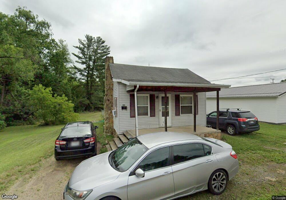
304 N Walnut St Mc Arthur, OH 45651
Estimated Value: $95,888 - $202,000
Studio
1
Bath
780
Sq Ft
$170/Sq Ft
Est. Value
About This Home
This home is located at 304 N Walnut St, Mc Arthur, OH 45651 and is currently estimated at $132,222, approximately $169 per square foot. 304 N Walnut St is a home located in Vinton County with nearby schools including Vinton County High School.
Ownership History
Date
Name
Owned For
Owner Type
Purchase Details
Closed on
Feb 3, 2010
Sold by
Jones Richard M and Jones Jacqueline L
Bought by
Rushim Adam
Current Estimated Value
Purchase Details
Closed on
Jan 16, 2009
Sold by
Workman Michael E
Bought by
Rushin Adam L
Home Financials for this Owner
Home Financials are based on the most recent Mortgage that was taken out on this home.
Original Mortgage
$55,612
Interest Rate
5.19%
Mortgage Type
New Conventional
Create a Home Valuation Report for This Property
The Home Valuation Report is an in-depth analysis detailing your home's value as well as a comparison with similar homes in the area
Purchase History
| Date | Buyer | Sale Price | Title Company |
|---|---|---|---|
| Rushim Adam | -- | None Available | |
| Rushin Adam L | -- | None Available |
Source: Public Records
Mortgage History
| Date | Status | Borrower | Loan Amount |
|---|---|---|---|
| Previous Owner | Rushin Adam L | $55,612 |
Source: Public Records
Tax History
| Year | Tax Paid | Tax Assessment Tax Assessment Total Assessment is a certain percentage of the fair market value that is determined by local assessors to be the total taxable value of land and additions on the property. | Land | Improvement |
|---|---|---|---|---|
| 2025 | $807 | $18,320 | $5,280 | $13,040 |
| 2024 | $809 | $18,320 | $5,280 | $13,040 |
| 2023 | $701 | $13,860 | $3,670 | $10,190 |
| 2022 | $699 | $13,860 | $3,670 | $10,190 |
| 2021 | $697 | $13,860 | $3,670 | $10,190 |
| 2020 | $635 | $11,760 | $3,200 | $8,560 |
| 2019 | $622 | $11,760 | $3,200 | $8,560 |
| 2018 | $609 | $11,760 | $3,200 | $8,560 |
| 2017 | $567 | $10,650 | $2,910 | $7,740 |
| 2016 | $566 | $10,650 | $2,910 | $7,740 |
| 2015 | $564 | $11,140 | $2,700 | $8,440 |
| 2014 | $564 | $11,140 | $2,700 | $8,440 |
Source: Public Records
Map
Nearby Homes
- 306 Outlot St
- 208 Fairview Ave
- 206 N Sugar St
- 0 U S 50
- 206 W Main St
- 304 W High St
- 32103 State Route 93
- 33385 Dixon Rd
- 33819 Wolf Hill Rd Unit (Tract 4 Wolf Hill)
- 64810 Infirmary Rd
- 33747 Wolf Hill Rd Unit (Wolf Hill House)
- 0 Wolf Hill Rd Unit (Tract 7 Wolf Hill)
- 0 Wolf Hill Rd Unit 25468491
- 0 Wolf Hill Rd Unit (Tract 3 Wolf Hill)
- 0 Wolf Hill Rd Unit 25469221
- 0 Wolf Hill Rd Unit (Tract 4 Wolf Hill)
- 0 Wolf Hill Rd Unit (Tract 2 Wolf Hill)
- 0 Wolf Hill Rd Unit 25026051
- 0 Wolf Hill Rd Unit (Tract 5 Wolf Hill)
- 0 Wolf Hill Rd Unit (Tract 6 Wolf Hill)
- 305 N Walnut St
- 307 N Walnut St
- 309 N Walnut St
- 207 E North St
- 303 E North St
- 303 E North St
- 305 E North St
- 205 E North St
- 203 E North St
- 312 N Walnut St
- 311 N Walnut St
- 300 E North St
- 201 E North St
- 306 E North St
- 116 Conren Dr
- 306 Outlot St
- 306 Outlot St
- 306 Outlot St
- 202 E North St
- 209 N Walnut St
Your Personal Tour Guide
Ask me questions while you tour the home.