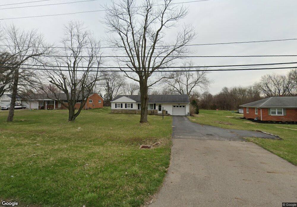
3042 Derr Rd Springfield, OH 45503
Estimated Value: $170,000 - $200,000
3
Beds
2
Baths
1,008
Sq Ft
$184/Sq Ft
Est. Value
About This Home
This home is located at 3042 Derr Rd, Springfield, OH 45503 and is currently estimated at $185,390, approximately $183 per square foot. 3042 Derr Rd is a home located in Clark County with nearby schools including Northridge Elementary School, Kenton Ridge Middle & High School, and Emmanuel Christian Academy.
Ownership History
Date
Name
Owned For
Owner Type
Purchase Details
Closed on
Oct 21, 2005
Sold by
Price Mary J
Bought by
Norman Geoffrey K
Current Estimated Value
Home Financials for this Owner
Home Financials are based on the most recent Mortgage that was taken out on this home.
Original Mortgage
$78,000
Outstanding Balance
$41,085
Interest Rate
5.8%
Mortgage Type
Fannie Mae Freddie Mac
Estimated Equity
$144,305
Create a Home Valuation Report for This Property
The Home Valuation Report is an in-depth analysis detailing your home's value as well as a comparison with similar homes in the area
Home Values in the Area
Average Home Value in this Area
Purchase History
| Date | Buyer | Sale Price | Title Company |
|---|---|---|---|
| Norman Geoffrey K | $78,000 | -- |
Source: Public Records
Mortgage History
| Date | Status | Borrower | Loan Amount |
|---|---|---|---|
| Open | Norman Geoffrey K | $78,000 |
Source: Public Records
Tax History
| Year | Tax Paid | Tax Assessment Tax Assessment Total Assessment is a certain percentage of the fair market value that is determined by local assessors to be the total taxable value of land and additions on the property. | Land | Improvement |
|---|---|---|---|---|
| 2025 | $1,807 | $53,020 | $13,880 | $39,140 |
| 2024 | $1,746 | $42,600 | $13,390 | $29,210 |
| 2023 | $1,746 | $42,600 | $13,390 | $29,210 |
| 2022 | $1,752 | $42,600 | $13,390 | $29,210 |
| 2021 | $1,751 | $36,470 | $10,550 | $25,920 |
| 2020 | $1,753 | $36,470 | $10,550 | $25,920 |
| 2019 | $1,788 | $36,470 | $10,550 | $25,920 |
| 2018 | $1,260 | $24,880 | $6,200 | $18,680 |
| 2017 | $1,071 | $24,879 | $6,199 | $18,680 |
| 2016 | $1,063 | $24,879 | $6,199 | $18,680 |
| 2015 | $1,099 | $24,879 | $6,199 | $18,680 |
| 2014 | $1,099 | $24,879 | $6,199 | $18,680 |
| 2013 | $1,097 | $24,879 | $6,199 | $18,680 |
Source: Public Records
Map
Nearby Homes
- 1039 Bradford Dr Unit 42
- 1139 Bradford Dr
- 1136 Foxboro Rd Unit 202
- 3052 Brixton Dr E
- 3124 El Camino Dr
- 3135 Imperial Blvd
- 1525 Providence Ave
- 1404 Attleboro Ave
- 3211 Haverhill St
- 732 Grandview Dr Unit 732
- 2943 Tarryton Ln
- 1201 Kingsgate Rd
- 3631 Kingsgate Ln
- 2022 Westboro Ave
- 1500 Kingsgate Rd Unit 19430
- 1502 Kingsgate Rd Unit 19432
- 1500 Kingsgate Rd
- 1502 Kingsgate Rd
- 3214 Revels St
- 1503 Kingsgate Rd
- 3024 Derr Rd
- 3100 Derr Rd
- 1025 Armsgate Rd
- 1027 Armsgate Rd Unit 13
- 1027 Armsgate Rd Unit VILLA
- 3022 Derr Rd
- 3027 Armsgate Rd
- 1029 Armsgate Rd Unit 12
- 3120 Derr Rd
- 3029 Armsgate Rd
- 3029 Armsgate Rd
- 1034 Villa Rd
- 1026 Armsgate Rd
- 1031 Armsgate Rd Unit 11
- 3101 Derr Rd
- 1024 Villa Rd
- 3028 Armsgate Rd
- 3028 Armsgate Rd
- 940 Villa Rd
- 1012 Villa Rd
Your Personal Tour Guide
Ask me questions while you tour the home.