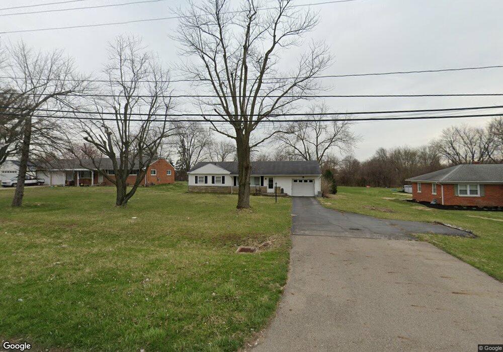
3042 Derr Rd Springfield, OH 45503
Springfield AreaEstimated Value: $167,000 - $199,000
About This Home
This home is located at 3042 Derr Rd, Springfield, OH 45503 and is currently estimated at $187,618, approximately $186 per square foot. 3042 Derr Rd is a home located in Clark County with nearby schools including Northridge Elementary School, Kenton Ridge Middle & High School, and Emmanuel Christian Academy.
Ownership History
We collect this data history from publicly available records. To have your information removed, we recommend requesting removal directly through your county’s website.
Purchase Details
Home Financials for this Owner
Home Financials are based on the most recent Mortgage that was taken out on this home.Home Values in the Area
Average Home Value in this Area
Purchase History
We collect this data history from publicly available records. To have your information removed, we recommend requesting removal directly through your county’s website.
| Date | Buyer | Sale Price | Title Company |
|---|---|---|---|
| $78,000 | -- |
Mortgage History
We collect this data history from publicly available records. To have your information removed, we recommend requesting removal directly through your county’s website.
| Date | Status | Borrower | Loan Amount |
|---|---|---|---|
| Open | $70,200 | ||
| Closed | $78,000 | ||
| Closed | $19,500 | ||
| Previous Owner | $20,000 |
Tax History
We collect this data history from publicly available records. To have your information removed, we recommend requesting removal directly through your county’s website.
| Year | Tax Paid | Tax Assessment Tax Assessment Total Assessment is a certain percentage of the fair market value that is determined by local assessors to be the total taxable value of land and additions on the property. | Land | Improvement |
|---|---|---|---|---|
| 2025 | $1,807 | $53,020 | $13,880 | $39,140 |
| 2024 | $1,746 | $42,600 | $13,390 | $29,210 |
| 2023 | $1,746 | $42,600 | $13,390 | $29,210 |
| 2022 | $1,752 | $42,600 | $13,390 | $29,210 |
| 2021 | $1,751 | $36,470 | $10,550 | $25,920 |
| 2020 | $1,753 | $36,470 | $10,550 | $25,920 |
| 2019 | $1,788 | $36,470 | $10,550 | $25,920 |
| 2018 | $1,260 | $24,880 | $6,200 | $18,680 |
| 2017 | $1,071 | $24,879 | $6,199 | $18,680 |
| 2016 | $1,063 | $24,879 | $6,199 | $18,680 |
| 2015 | $1,099 | $24,879 | $6,199 | $18,680 |
| 2014 | $1,099 | $24,879 | $6,199 | $18,680 |
| 2013 | $1,097 | $24,879 | $6,199 | $18,680 |
Map
- 1031 Armsgate Rd Unit 11
- 1039 Bradford Dr Unit 42
- 1043 Armsgate Rd
- 1045 Bradford Dr
- 1143 Armsgate Rd
- 3015 Colony Ln
- 3116 El Camino Dr Unit 3
- 3135 Imperial Blvd
- 3093 Brixton Dr E Unit 211
- 613 Villa Rd Unit H
- 1143 Derby Rd
- 1141 Brixton Dr W
- 2943 Imperial Blvd
- 3215 Nantucket St
- 2943 Tarryton Ln
- 851 Weybridge Dr
- 2934 Haverhill St
- 1126 Kingsgate Rd
- 939 Torrence Dr
- 2014 Westboro Ave
- 3024 Derr Rd
- 3022 Derr Rd
- 1024 Villa Rd
- 1027 Armsgate Rd Unit 13
- 1027 Armsgate Rd Unit VILLA
- 1012 Villa Rd
- 1034 Villa Rd
- 1029 Armsgate Rd Unit 12
- 3100 Derr Rd
- 1025 Armsgate Rd
- 940 Villa Rd
- 3110 Derr Rd
- 3027 Armsgate Rd
- 1026 Armsgate Rd
- 1030 Armsgate Rd Unit 29
- 1030 Armsgate Rd
- 3101 Derr Rd
- 1046 Villa Rd
- 1033 Armsgate Rd
- 3029 Armsgate Rd
Ask me questions while you tour the home.