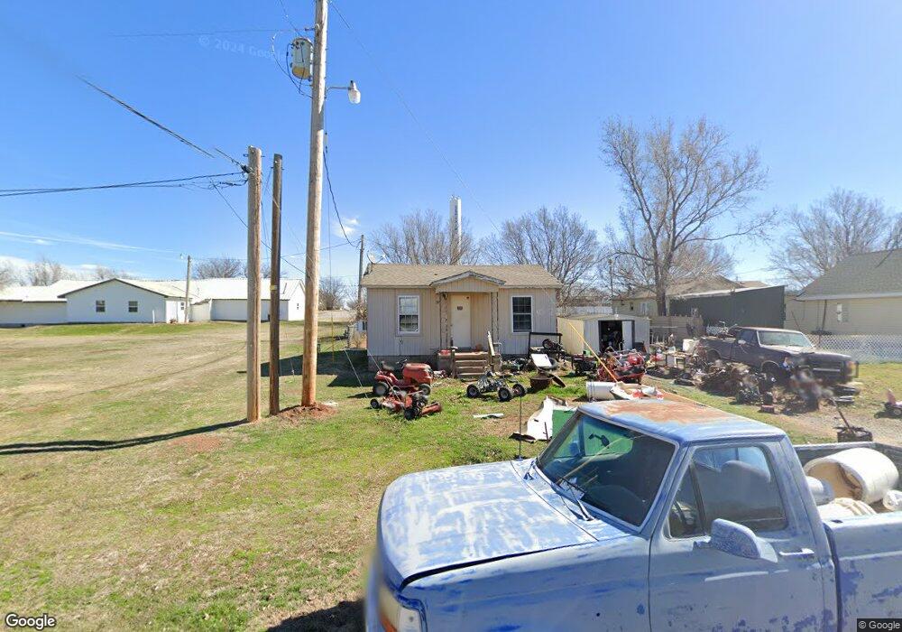
305 Apache Ave Geronimo, OK 73543
Estimated Value: $40,000 - $90,000
1
Bed
1
Bath
552
Sq Ft
$97/Sq Ft
Est. Value
About This Home
This home is located at 305 Apache Ave, Geronimo, OK 73543 and is currently estimated at $53,649, approximately $97 per square foot. 305 Apache Ave is a home located in Comanche County with nearby schools including Geronimo Elementary School and Geronimo High School.
Ownership History
Date
Name
Owned For
Owner Type
Purchase Details
Closed on
May 2, 2022
Sold by
Mclain Michael J and Mclain Pamela R
Bought by
Mclain Michael J and Mclain Pamela R
Current Estimated Value
Purchase Details
Closed on
Jul 27, 2017
Sold by
Melain Michael J and Mclain Pamela
Bought by
Mclah Michael J and Mclain Pamela
Purchase Details
Closed on
Apr 26, 2007
Sold by
Herriage Keith and Herriage Cynthia
Bought by
Mclain Michael J
Home Financials for this Owner
Home Financials are based on the most recent Mortgage that was taken out on this home.
Original Mortgage
$10,000
Interest Rate
6.16%
Mortgage Type
Future Advance Clause Open End Mortgage
Purchase Details
Closed on
Dec 31, 2002
Sold by
Ensley, Robert E Trustee~Of The Bob
Purchase Details
Closed on
Aug 18, 1998
Sold by
Ensley Robert E and Ensley Patsy J
Create a Home Valuation Report for This Property
The Home Valuation Report is an in-depth analysis detailing your home's value as well as a comparison with similar homes in the area
Purchase History
| Date | Buyer | Sale Price | Title Company |
|---|---|---|---|
| Mclain Michael J | -- | Oklahoma Family Title | |
| Mclah Michael J | -- | Title 68 Article 32 | |
| Mclain Michael J | $8,000 | -- | |
| -- | $212,000 | -- | |
| -- | -- | -- |
Source: Public Records
Mortgage History
| Date | Status | Borrower | Loan Amount |
|---|---|---|---|
| Previous Owner | Mclain Michael J | $10,000 |
Source: Public Records
Tax History
| Year | Tax Paid | Tax Assessment Tax Assessment Total Assessment is a certain percentage of the fair market value that is determined by local assessors to be the total taxable value of land and additions on the property. | Land | Improvement |
|---|---|---|---|---|
| 2025 | $191 | $1,960 | $249 | $1,711 |
| 2024 | $190 | $1,959 | $247 | $1,712 |
| 2023 | $190 | $1,776 | $227 | $1,549 |
| 2022 | $172 | $1,693 | $219 | $1,474 |
| 2021 | $148 | $1,465 | $195 | $1,270 |
| 2020 | $147 | $1,395 | $183 | $1,212 |
| 2019 | $139 | $1,330 | $168 | $1,162 |
| 2018 | $129 | $1,266 | $156 | $1,110 |
| 2017 | $128 | $1,205 | $146 | $1,059 |
| 2016 | $115 | $1,148 | $138 | $1,010 |
| 2015 | $110 | $1,094 | $138 | $956 |
| 2014 | $103 | $1,042 | $138 | $904 |
Source: Public Records
Map
Nearby Homes
- 403 Nebraska Ave
- 4 Cheyenne Ln
- 407 Bobwhite Rd
- 6 Cheyenne Ln
- 45th Street SE Baseline Rd
- 11042 SW Sheridan Rd
- 11158 SE 45th St
- TBD SE Holiday Rd
- 0 SE Flower Mound Rd
- 180000 N 2600 Rd
- TBD N 2620 Rd
- 0 Base Line Rd
- 31 SE Prairie View Ln
- 93 SE Prairie View Ln
- 53 SE Prairie View Ln
- 722 SW Butterfield Dr
- 534 SE Lasso Loop
- 2502 & 2504 SW 38th St Unit 3625 & 3637 Wedgewoo
- TBD 4 Mile Rd
- 1315 SW Bishop Rd
- 303 Apache Ave
- 511 E Main St
- 423 E Main St
- 419 E Main St
- 415 E Main St
- 600 Ridgeway St
- 512 E Main St
- 502 E Main St
- 510 E Main St
- 505 Michigan St
- 413 Main St
- 605 Ridgeway St
- 502 Minnesota St
- 308 Kiowa Ave
- 420 Minnesota St
- 202 S Chippewa Ave
- 504 Minnesota St
- 502 Minnesota St
- 601 Wisconsin St
- 625 E Main St
Your Personal Tour Guide
Ask me questions while you tour the home.