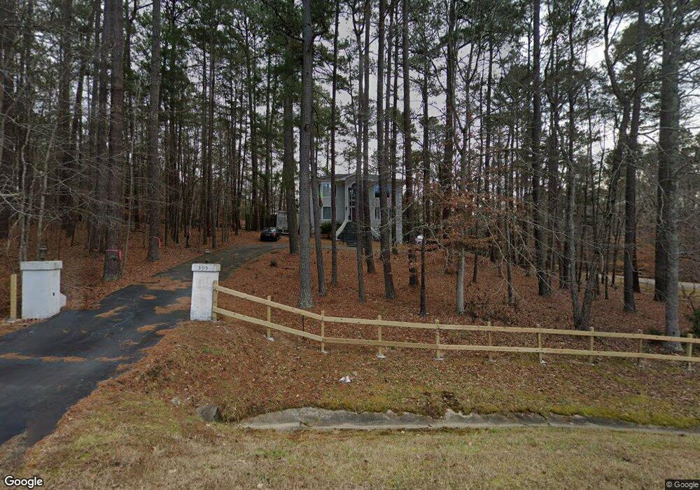
305 Burning Tree Dr Henderson, NC 27537
Estimated Value: $486,000 - $576,000
3
Beds
4
Baths
4,442
Sq Ft
$121/Sq Ft
Est. Value
About This Home
This home is located at 305 Burning Tree Dr, Henderson, NC 27537 and is currently estimated at $535,327, approximately $120 per square foot. 305 Burning Tree Dr is a home located in Vance County with nearby schools including Dabney Elementary School, Vance County High School, and Kerr-Vance Academy.
Ownership History
Date
Name
Owned For
Owner Type
Purchase Details
Closed on
Nov 10, 2025
Sold by
Ogomo Benard
Bought by
Uchumi Co Union Inc
Current Estimated Value
Purchase Details
Closed on
Oct 17, 2019
Sold by
Fink Mary Jane
Bought by
Ogomo Benard J
Home Financials for this Owner
Home Financials are based on the most recent Mortgage that was taken out on this home.
Original Mortgage
$274,550
Interest Rate
3.6%
Mortgage Type
New Conventional
Purchase Details
Closed on
Dec 22, 1997
Bought by
Fink Harry E and Fink Mary
Create a Home Valuation Report for This Property
The Home Valuation Report is an in-depth analysis detailing your home's value as well as a comparison with similar homes in the area
Purchase History
| Date | Buyer | Sale Price | Title Company |
|---|---|---|---|
| Uchumi Co Union Inc | -- | None Listed On Document | |
| Ogomo Benard J | $289,000 | None Available | |
| Fink Harry E | $316,000 | -- |
Source: Public Records
Mortgage History
| Date | Status | Borrower | Loan Amount |
|---|---|---|---|
| Previous Owner | Ogomo Benard J | $274,550 |
Source: Public Records
Tax History
| Year | Tax Paid | Tax Assessment Tax Assessment Total Assessment is a certain percentage of the fair market value that is determined by local assessors to be the total taxable value of land and additions on the property. | Land | Improvement |
|---|---|---|---|---|
| 2025 | $4,189 | $503,517 | $24,960 | $478,557 |
| 2024 | $4,067 | $503,517 | $24,960 | $478,557 |
| 2023 | $2,981 | $292,200 | $20,000 | $272,200 |
| 2022 | $2,981 | $292,200 | $20,000 | $272,200 |
| 2021 | $2,861 | $292,200 | $20,000 | $272,200 |
| 2020 | $2,978 | $292,200 | $20,000 | $272,200 |
| 2019 | $2,973 | $292,200 | $20,000 | $272,200 |
| 2018 | $2,729 | $292,200 | $20,000 | $272,200 |
| 2017 | $2,834 | $292,200 | $20,000 | $272,200 |
| 2016 | $2,834 | $292,200 | $20,000 | $272,200 |
| 2015 | $3,484 | $471,500 | $55,000 | $416,500 |
| 2014 | $4,028 | $471,503 | $55,000 | $416,503 |
Source: Public Records
Map
Nearby Homes
- 1.21 Turner Ln
- 0 Us Hwy 158 Hwy Unit CAR4105253
- 228 Hunters Ridge Rd
- 84 Weybossett Rd
- 1822 Ruin Creek Rd
- 507 E Waycliff Rd
- 29 W Waycliff Rd
- 206 Beechwood Trail
- 42 Tall Pines Dr
- 2111 Coleman Place
- 731 Lakeview Dr
- 122 Watson Dr
- Lot 5 Sidney Hill
- 1842 Lynne Ave
- 106 Orchard Rd
- 00 Oxford Rd Southern Ave Rd
- 1707 Peace St
- 107 Quail Ridge
- 1277 David Ave
- 114 Dorsey Place
- 1.32 Acre Southerland Place
- 1.35 Acre Southerland Place
- 1.98 Acre Southerland Place
- Lot 6 Southerland Place
- Lot 5 Southerland Place
- Lot 4` Southerland Place
- Lot#3 Southerland Place
- Lot #3 Southerland Place
- 290 Burning Tree Dr
- 267 Burning Tree Dr
- 0 Southerland Place Unit 12595
- 0 Southerland Place Unit 2438676
- 0 Southerland Place Unit 2438686
- 0 Southerland Place Unit Lot 4 TR2438369
- 0 Southerland Place Unit Lot 5 TR2438676
- 0 Southerland Place Unit Lot 6 TR2438686
- 0 Southerland Place Unit Lot A 2438369
- 195 Southerland Place
- 248 Burning Tree Dr
- 245 Burning Tree Dr
Your Personal Tour Guide
Ask me questions while you tour the home.