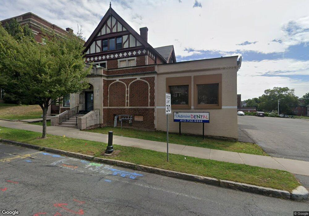
305 State St Springfield, MA 01105
Maple-High Six Corners Neighborhood
Studio
--
Bath
16,786
Sq Ft
41,818
Sq Ft Lot
About This Home
This home is located at 305 State St, Springfield, MA 01105. 305 State St is a home located in Hampden County with nearby schools including Milton Bradley School, South End Middle School, and High School Of Commerce.
Ownership History
Date
Name
Owned For
Owner Type
Purchase Details
Closed on
Apr 21, 2021
Sold by
Avneet Llc
Bought by
State 305 Llc
Home Financials for this Owner
Home Financials are based on the most recent Mortgage that was taken out on this home.
Original Mortgage
$93,000
Outstanding Balance
$84,035
Interest Rate
3.05%
Mortgage Type
Purchase Money Mortgage
Purchase Details
Closed on
Sep 14, 2016
Sold by
Dickinson-Streeter Fun
Bought by
Avneet Llc
Home Financials for this Owner
Home Financials are based on the most recent Mortgage that was taken out on this home.
Original Mortgage
$87,500
Interest Rate
3.43%
Mortgage Type
Commercial
Create a Home Valuation Report for This Property
The Home Valuation Report is an in-depth analysis detailing your home's value as well as a comparison with similar homes in the area
Home Values in the Area
Average Home Value in this Area
Purchase History
| Date | Buyer | Sale Price | Title Company |
|---|---|---|---|
| State 305 Llc | $174,500 | None Available | |
| Avneet Llc | $175,000 | -- |
Source: Public Records
Mortgage History
| Date | Status | Borrower | Loan Amount |
|---|---|---|---|
| Open | State 305 Llc | $93,000 | |
| Previous Owner | Avneet Llc | $87,500 |
Source: Public Records
Tax History
| Year | Tax Paid | Tax Assessment Tax Assessment Total Assessment is a certain percentage of the fair market value that is determined by local assessors to be the total taxable value of land and additions on the property. | Land | Improvement |
|---|---|---|---|---|
| 2025 | $0 | $520,200 | $169,400 | $350,800 |
| 2024 | $0 | $511,200 | $169,400 | $341,800 |
| 2023 | $17,115 | $468,400 | $154,000 | $314,400 |
| 2022 | $16,085 | $448,100 | $144,300 | $303,800 |
| 2021 | $0 | $421,900 | $144,300 | $277,600 |
| 2020 | $16,085 | $385,300 | $144,300 | $241,000 |
| 2019 | $14,384 | $366,000 | $121,500 | $244,500 |
| 2018 | $16,329 | $415,700 | $121,500 | $294,200 |
| 2017 | $10,467 | $267,900 | $121,500 | $146,400 |
| 2016 | $15,174 | $393,100 | $121,500 | $271,600 |
| 2015 | $18,013 | $464,600 | $121,500 | $343,100 |
Source: Public Records
Map
Nearby Homes
- 38 Byers St
- 235 State St Unit 111
- 0 Maple St
- 51 Avon Place
- 140 Chestnut St Unit 706
- 140 Chestnut St Unit 702
- 140 Chestnut St Unit 204
- 140 Chestnut St Unit 619
- 140 Chestnut St Unit 604
- 140 Chestnut St Unit 407
- 101 Oak St
- 63 Oak St
- 849 Worthington St
- 52 Central St Unit 504
- 50 Central St Unit 504
- 229 Central St
- 82 Central St Unit 304
- 66 Central St Unit 404
- 64 Central St Unit 403
- 68 Central St Unit 405
- 281 State St Unit 1F
- 281 State St
- 339 State St
- 41 School St
- 273 State St
- 84 Temple St
- 90 High St Unit 3L
- 90 High St
- 90 High St Unit various
- 92 High St
- 82 Temple St
- 38 School St
- 49 School St
- 43 School St Unit 1L
- 76 Temple St Unit 2
- 76 Temple St Unit 764
- 76 Temple St Unit 763
- 76 Temple St Unit 762
- 76 Temple St Unit 761
- 74 Temple St Unit 744
Your Personal Tour Guide
Ask me questions while you tour the home.