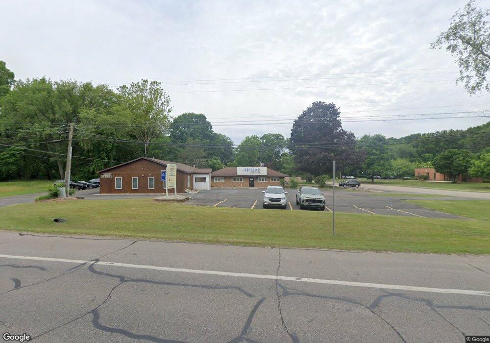
305 Thomas St Allegan, MI 49010
Estimated Value: $1,242,721
Studio
--
Bath
5,850
Sq Ft
$212/Sq Ft
Est. Value
About This Home
This home is located at 305 Thomas St, Allegan, MI 49010 and is currently estimated at $1,242,721, approximately $212 per square foot. 305 Thomas St is a home located in Allegan County with nearby schools including West Ward Elementary School, L.E. White Middle School, and Allegan High School.
Ownership History
Date
Name
Owned For
Owner Type
Purchase Details
Closed on
Jul 2, 2010
Sold by
Nouna Nabil Y
Bought by
Nouna Enterprises Llc
Current Estimated Value
Purchase Details
Closed on
Oct 31, 2005
Sold by
Heft Kirstin G
Bought by
Nouna Nabil
Home Financials for this Owner
Home Financials are based on the most recent Mortgage that was taken out on this home.
Original Mortgage
$388,000
Interest Rate
6.04%
Mortgage Type
Commercial
Purchase Details
Closed on
Mar 3, 2000
Bought by
Heft Kirstin
Create a Home Valuation Report for This Property
The Home Valuation Report is an in-depth analysis detailing your home's value as well as a comparison with similar homes in the area
Home Values in the Area
Average Home Value in this Area
Purchase History
| Date | Buyer | Sale Price | Title Company |
|---|---|---|---|
| Nouna Enterprises Llc | -- | None Available | |
| Nouna Nabil | -- | Chicago Title Of Michigan | |
| Heft Kirstin | -- | -- |
Source: Public Records
Mortgage History
| Date | Status | Borrower | Loan Amount |
|---|---|---|---|
| Previous Owner | Nouna Nabil | $388,000 |
Source: Public Records
Tax History
| Year | Tax Paid | Tax Assessment Tax Assessment Total Assessment is a certain percentage of the fair market value that is determined by local assessors to be the total taxable value of land and additions on the property. | Land | Improvement |
|---|---|---|---|---|
| 2025 | $8,219 | $203,500 | $17,000 | $186,500 |
| 2024 | $7,457 | $210,300 | $16,200 | $194,100 |
| 2023 | $7,457 | $188,500 | $11,600 | $176,900 |
| 2022 | $7,457 | $174,100 | $10,500 | $163,600 |
| 2020 | $7,012 | $163,900 | $13,100 | $150,800 |
| 2019 | $0 | $153,000 | $12,400 | $140,600 |
| 2018 | $0 | $143,300 | $12,400 | $130,900 |
| 2017 | $0 | $130,300 | $9,700 | $120,600 |
| 2016 | $0 | $146,500 | $10,600 | $135,900 |
| 2015 | -- | $146,500 | $10,600 | $135,900 |
| 2014 | -- | $148,300 | $11,000 | $137,300 |
| 2013 | -- | $144,700 | $11,500 | $133,200 |
Source: Public Records
Map
Nearby Homes
Your Personal Tour Guide
Ask me questions while you tour the home.