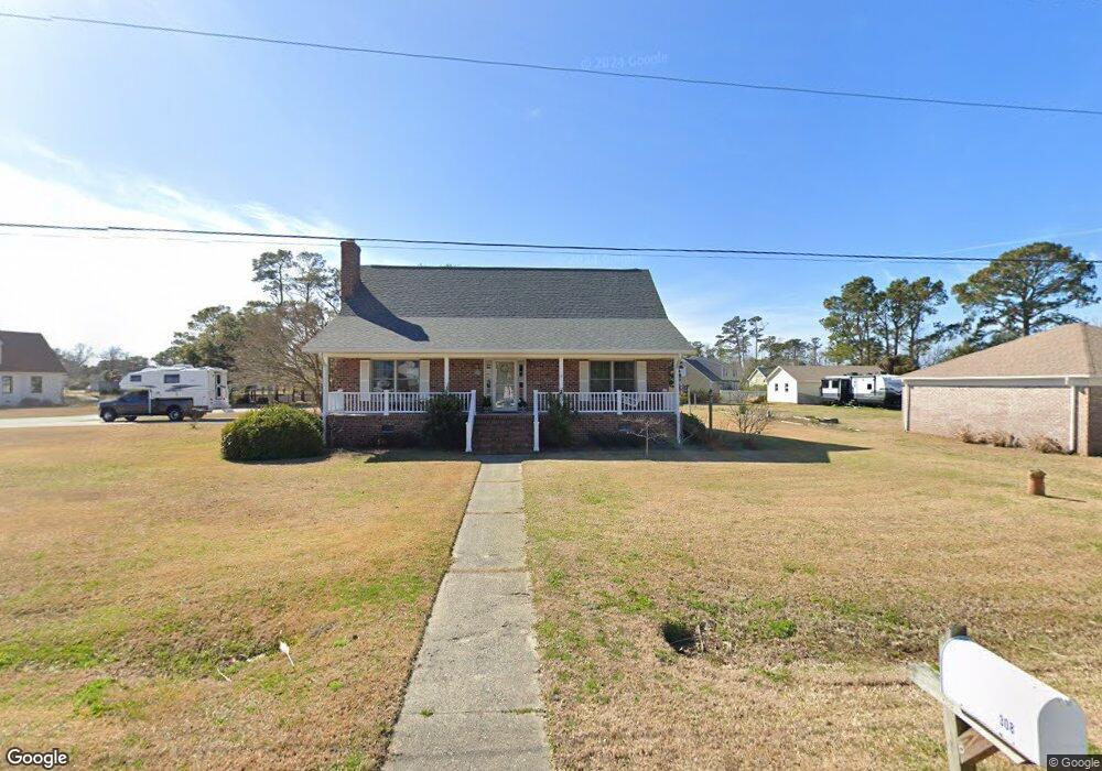
308 Canal Rd Beaufort, NC 28516
Estimated Value: $368,000 - $442,747
3
Beds
2
Baths
2,111
Sq Ft
$194/Sq Ft
Est. Value
About This Home
This home is located at 308 Canal Rd, Beaufort, NC 28516 and is currently estimated at $410,187, approximately $194 per square foot. 308 Canal Rd is a home located in Carteret County with nearby schools including Beaufort Elementary School, Beaufort Middle School, and East Carteret High School.
Ownership History
Date
Name
Owned For
Owner Type
Purchase Details
Closed on
Mar 21, 2022
Sold by
Geer Paul H and Geer Nancy S
Bought by
Geer Paul Hamilton and Simpson Geer Nancy
Current Estimated Value
Purchase Details
Closed on
Jan 30, 2013
Sold by
Geef Nancy S and Smith Nancy S
Bought by
Geer Paul and Geer Nancy S
Home Financials for this Owner
Home Financials are based on the most recent Mortgage that was taken out on this home.
Original Mortgage
$123,000
Interest Rate
3.39%
Mortgage Type
New Conventional
Create a Home Valuation Report for This Property
The Home Valuation Report is an in-depth analysis detailing your home's value as well as a comparison with similar homes in the area
Home Values in the Area
Average Home Value in this Area
Purchase History
We collect this data history from publicly available records. To have your information removed, we recommend requesting removal directly through your county’s website.
| Date | Buyer | Sale Price | Title Company |
|---|---|---|---|
| Geer Paul Hamilton | $13,000 | None Listed On Document | |
| Nancy Simpson Geer Irrevocable Trust | $13,000 | None Listed On Document | |
| Geer Paul Hamilton | -- | None Listed On Document | |
| Geer Paul | -- | None Available |
Source: Public Records
Mortgage History
We collect this data history from publicly available records. To have your information removed, we recommend requesting removal directly through your county’s website.
| Date | Status | Borrower | Loan Amount |
|---|---|---|---|
| Previous Owner | Geer Paul | $123,000 |
Source: Public Records
Tax History
| Year | Tax Paid | Tax Assessment Tax Assessment Total Assessment is a certain percentage of the fair market value that is determined by local assessors to be the total taxable value of land and additions on the property. | Land | Improvement |
|---|---|---|---|---|
| 2025 | $1,532 | $409,661 | $76,218 | $333,443 |
| 2024 | $1,028 | $185,993 | $16,456 | $169,537 |
| 2023 | $1,102 | $185,993 | $16,456 | $169,537 |
| 2022 | $1,083 | $185,993 | $16,456 | $169,537 |
| 2021 | $926 | $185,993 | $16,456 | $169,537 |
| 2020 | $1,138 | $185,993 | $16,456 | $169,537 |
| 2019 | $1,132 | $195,201 | $16,456 | $178,745 |
| 2017 | $1,136 | $195,201 | $16,456 | $178,745 |
| 2016 | $942 | $195,201 | $16,456 | $178,745 |
| 2015 | $923 | $195,201 | $16,456 | $178,745 |
| 2014 | $1,279 | $274,709 | $104,275 | $170,434 |
Source: Public Records
Map
Nearby Homes
- 608 Bronna Rd
- 121 Windswept Ln
- 117 Windswept Ln
- 119 Windswept Ln
- 212 Windswept Ln
- 115 Windswept Ln
- 218 Windswept Ln
- 222 Windswept Ln
- 120 Pearl Dr
- 333 Taylorwood Dr
- 307 Taylorwood Dr
- 157 Sunrise Dr
- 2622 U S 70
- 100 Tiffany Way
- 1603 Courtyard E
- 434 Meeting St
- 402 Taylorwood Dr
- 3102 Highway 70 E
- 3336 Highway 70 E
- 502 Courtyard E
Your Personal Tour Guide
Ask me questions while you tour the home.