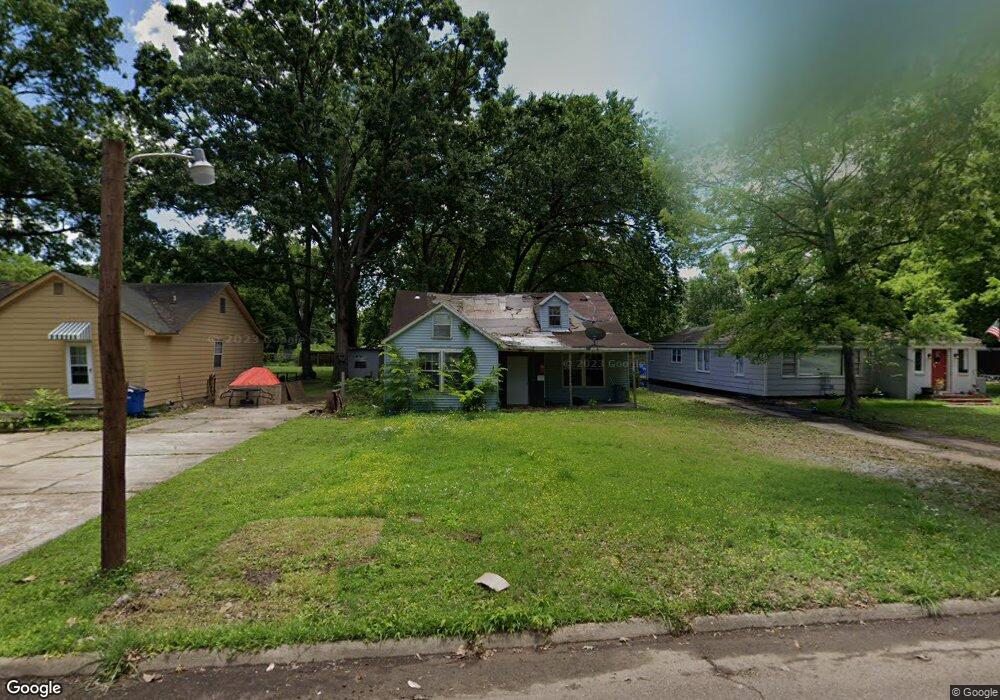
308 W Danner Ave West Memphis, AR 72301
Estimated Value: $66,575 - $144,000
Studio
1
Bath
1,881
Sq Ft
$48/Sq Ft
Est. Value
About This Home
This home is located at 308 W Danner Ave, West Memphis, AR 72301 and is currently estimated at $89,394, approximately $47 per square foot. 308 W Danner Ave is a home located in Crittenden County with nearby schools including Bragg Elementary School, West Junior High School, and The Academies of West Memphis Charter School.
Ownership History
Date
Name
Owned For
Owner Type
Purchase Details
Closed on
Aug 6, 2021
Sold by
Carter Lois E
Bought by
West Memphis Rentals Llc
Current Estimated Value
Purchase Details
Closed on
Dec 1, 2020
Sold by
Beasley Jean and Beasley Cecil
Bought by
Carter Lois E
Purchase Details
Closed on
Nov 21, 2007
Sold by
Stfrancis Levee District
Bought by
Beasley Cecil
Purchase Details
Closed on
Nov 1, 1987
Bought by
Beasely Cecil and Beasely Jean
Purchase Details
Closed on
Nov 1, 1985
Bought by
To
Purchase Details
Closed on
Mar 1, 1980
Bought by
To
Purchase Details
Closed on
Nov 1, 1979
Bought by
To
Purchase Details
Closed on
Mar 1, 1979
Bought by
To
Create a Home Valuation Report for This Property
The Home Valuation Report is an in-depth analysis detailing your home's value as well as a comparison with similar homes in the area
Purchase History
| Date | Buyer | Sale Price | Title Company |
|---|---|---|---|
| West Memphis Rentals Llc | $52,000 | Stewart Title | |
| Carter Lois E | $10,000 | None Available | |
| Beasley Cecil | -- | -- | |
| Beasely Cecil | $36,000 | -- | |
| To | $36,000 | -- | |
| To | $36,000 | -- | |
| To | $6,000 | -- | |
| To | $6,000 | -- | |
| To | $34,000 | -- | |
| To | $34,000 | -- | |
| To | $10,000 | -- | |
| To | $10,000 | -- |
Source: Public Records
Tax History
| Year | Tax Paid | Tax Assessment Tax Assessment Total Assessment is a certain percentage of the fair market value that is determined by local assessors to be the total taxable value of land and additions on the property. | Land | Improvement |
|---|---|---|---|---|
| 2025 | $191 | $3,830 | $2,760 | $1,070 |
| 2024 | $191 | $3,830 | $2,760 | $1,070 |
| 2023 | $191 | $7,368 | $2,760 | $4,608 |
| 2022 | $360 | $7,368 | $2,760 | $4,608 |
| 2021 | $360 | $7,368 | $2,760 | $4,608 |
| 2020 | $333 | $11,980 | $2,760 | $9,220 |
| 2019 | $252 | $6,670 | $1,500 | $5,170 |
| 2018 | $25 | $6,670 | $1,500 | $5,170 |
| 2017 | $25 | $6,670 | $1,500 | $5,170 |
| 2016 | $255 | $6,670 | $1,500 | $5,170 |
| 2015 | $25 | $6,670 | $1,500 | $5,170 |
| 2014 | $233 | $14,120 | $3,600 | $10,520 |
Source: Public Records
Map
Nearby Homes
- 323 W Oliver Ave
- 316 W Cooper Ave
- 223 W Oliver Ave
- 307 W Cooper Ave
- 300 Roosevelt Ave
- 216 Roosevelt Ave
- 300 W Barton Ave
- 303 N Rhodes St
- 126 W Cooper Ave
- 123 W Danner Ave
- 221 W Barton Ave
- 235 W Barton Ave
- 104 Ross Ave
- 112 Ross Ave
- 215 Ross Ave
- 151 Ross Ave
- 303 Pine St
- 301 Pine St
- 222 E Oliver Ave
- 512 Lois Marie Cove
- 306 W Danner Ave
- 310 W Danner Ave
- 314 W Danner Ave
- 309 W Oliver Ave
- 307 W Oliver Ave
- 300 W Danner Ave
- 313 W Oliver Ave
- 305 W Oliver Ave
- 316 W Danner Ave
- 309 W Danner Ave
- 303 W Oliver Ave
- 315 W Oliver Ave
- 313 W Danner Ave
- 305 W Danner Ave
- 315 W Danner Ave
- 301 W Danner Ave
- 301 W Oliver Ave
- 319 W Oliver Ave
- 320 W Danner Ave
- 317 W Danner Ave
Your Personal Tour Guide
Ask me questions while you tour the home.