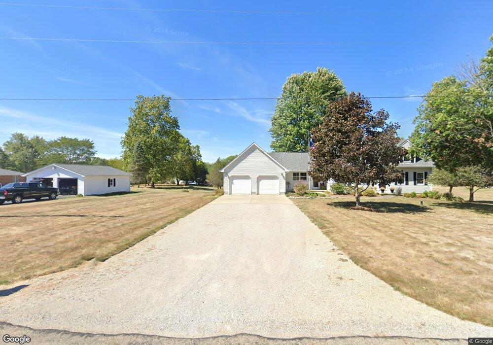
3087 Stringtown Rd NW Lancaster, OH 43130
Estimated Value: $391,417 - $471,000
3
Beds
3
Baths
1,692
Sq Ft
$257/Sq Ft
Est. Value
About This Home
This home is located at 3087 Stringtown Rd NW, Lancaster, OH 43130 and is currently estimated at $435,604, approximately $257 per square foot. 3087 Stringtown Rd NW is a home located in Fairfield County with nearby schools including Bloom Carroll Primary School, Bloom Carroll Intermediate School, and Bloom-Carroll Middle School.
Ownership History
Date
Name
Owned For
Owner Type
Purchase Details
Closed on
Jun 30, 2020
Sold by
Unknown
Bought by
Phillips Robert Keith and Phillips Karen Sue
Current Estimated Value
Purchase Details
Closed on
Jun 4, 1993
Sold by
Lysinger Kenneth A
Bought by
Phillips Robert Keith
Create a Home Valuation Report for This Property
The Home Valuation Report is an in-depth analysis detailing your home's value as well as a comparison with similar homes in the area
Purchase History
| Date | Buyer | Sale Price | Title Company |
|---|---|---|---|
| Phillips Robert Keith | -- | -- | |
| Phillips Robert Keith | -- | None Listed On Document | |
| Phillips Robert Keith | $15,000 | -- |
Source: Public Records
Tax History
| Year | Tax Paid | Tax Assessment Tax Assessment Total Assessment is a certain percentage of the fair market value that is determined by local assessors to be the total taxable value of land and additions on the property. | Land | Improvement |
|---|---|---|---|---|
| 2025 | $8,051 | $123,500 | $32,200 | $91,300 |
| 2024 | $8,051 | $99,770 | $23,100 | $76,670 |
| 2023 | $4,355 | $99,770 | $23,100 | $76,670 |
| 2022 | $4,387 | $99,770 | $23,100 | $76,670 |
| 2021 | $3,383 | $75,470 | $19,250 | $56,220 |
| 2020 | $3,424 | $75,470 | $19,250 | $56,220 |
| 2019 | $3,438 | $75,470 | $19,250 | $56,220 |
| 2018 | $2,881 | $57,110 | $15,400 | $41,710 |
| 2017 | $2,703 | $64,980 | $15,400 | $49,580 |
| 2016 | $2,622 | $64,980 | $15,400 | $49,580 |
| 2015 | $2,507 | $60,490 | $15,400 | $45,090 |
| 2014 | $2,396 | $60,490 | $15,400 | $45,090 |
| 2013 | $2,396 | $60,490 | $15,400 | $45,090 |
Source: Public Records
Map
Nearby Homes
- 2927 Lancaster-Kirkersville Rd NW
- 3485 Lancaster-Kirkersville Rd NW
- 0 Tschopp Rd NE Unit Lot 17 225027320
- 0 Tschopp Rd NE Unit Lot 33 225027324
- 245 Rainbow Dr NE
- 0 Fremar Rd NE Unit Lot1 225007256
- 850 Marquette Dr NE
- 1295 Ginder Rd NW
- 0 Marquette Dr NE Unit Lot 16 225027323
- 0 Marquette Dr NE Unit Lot 5
- 0 Marquette Dr NE Unit Lot 4 225007276
- 4070 Tschopp Rd NE
- 0 Stringtown Rd NW
- 2370 Scenic Dr NE
- 1826 Pleasantview Dr NE
- 1916 Country Place
- 1908 Branch Place
- 0 Old Millersport Rd NE Unit 225010386
- 1800 Ginder Rd NW
- 1101 Beechwood Dr NE
- 3115 Stringtown Rd NW
- 3098 Stringtown Rd NE
- 20 Coonpath Rd NE
- 50 Coonpath Rd NW
- 3141 Stringtown Rd NW
- 0 Coonpath Rd NW
- 0 Coonpath Rd NW Unit 2623828
- 0 Coonpath Rd NW Unit 2447344
- 0 Coonpath Rd NW Unit 2432775
- 0 Coonpath Rd NW Unit 2131582
- 0 Coonpath Rd NW Unit 7 9707259
- 0 Coonpath Rd NW Unit 31938
- 0 Coonpath Rd NW Unit Tract 7 224028097
- 0 Coonpath Rd NW Unit Tract 4 224028093
- 0 Coonpath Rd NW Unit 213032705
- 100 Coonpath Rd NW
- 2 Coonpath Rd NE
- 1 Coonpath Rd NE
- 3 Coonpath Rd NE
- 4 Coonpath Rd NE
Your Personal Tour Guide
Ask me questions while you tour the home.