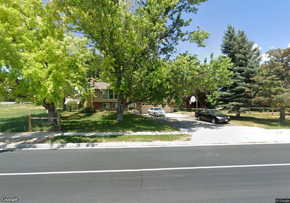
309 E Shepard Ln Kaysville, UT 84037
West Kaysville NeighborhoodEstimated Value: $664,000 - $732,000
4
Beds
3
Baths
2,163
Sq Ft
$322/Sq Ft
Est. Value
About This Home
This home is located at 309 E Shepard Ln, Kaysville, UT 84037 and is currently estimated at $697,400, approximately $322 per square foot. 309 E Shepard Ln is a home located in Davis County with nearby schools including Endeavour Elementary School, Farmington High, and Centennial Junior High School.
Ownership History
Date
Name
Owned For
Owner Type
Purchase Details
Closed on
Feb 7, 2024
Sold by
Andreason Val R and Andreason Madelene S
Bought by
Andreason Family Revocable Living Trust and Andreason
Current Estimated Value
Purchase Details
Closed on
Jan 6, 2005
Sold by
Andreason Val R
Bought by
Andreason Val R and Andreason Madelene S
Purchase Details
Closed on
Dec 1, 2004
Sold by
Andreason Val R and Andreason Madelene S
Bought by
Andreason Val R
Create a Home Valuation Report for This Property
The Home Valuation Report is an in-depth analysis detailing your home's value as well as a comparison with similar homes in the area
Home Values in the Area
Average Home Value in this Area
Purchase History
| Date | Buyer | Sale Price | Title Company |
|---|---|---|---|
| Andreason Family Revocable Living Trust | -- | None Listed On Document | |
| Andreason Val R | -- | Preferred Title & Escrow | |
| Andreason Val R | -- | Preferred Title & Escrow |
Source: Public Records
Tax History
| Year | Tax Paid | Tax Assessment Tax Assessment Total Assessment is a certain percentage of the fair market value that is determined by local assessors to be the total taxable value of land and additions on the property. | Land | Improvement |
|---|---|---|---|---|
| 2025 | $3,003 | $302,791 | $249,350 | $53,441 |
| 2024 | $2,828 | $289,323 | $252,465 | $36,858 |
| 2023 | $2,767 | $498,000 | $429,368 | $68,632 |
| 2022 | $2,805 | $286,001 | $233,283 | $52,718 |
| 2021 | $2,520 | $384,000 | $295,214 | $88,786 |
| 2020 | $2,345 | $343,000 | $255,630 | $87,370 |
| 2019 | $2,276 | $327,000 | $242,496 | $84,504 |
| 2018 | $2,116 | $301,627 | $210,294 | $91,333 |
| 2016 | $1,985 | $151,275 | $104,511 | $46,764 |
| 2015 | $1,966 | $142,311 | $104,511 | $37,800 |
| 2014 | $1,716 | $126,363 | $74,570 | $51,793 |
| 2013 | -- | $122,442 | $51,146 | $71,296 |
Source: Public Records
Map
Nearby Homes
- 1104 N 1880 Loop W
- 1647 W 1410 N
- 1181 Set Ct Unit 2
- 2172 Rifleman Dr
- 1883 Moss Ln Unit 236
- 1843 W Burke Ln Unit 103
- 1572 Stayner Dr
- 163 E 1400 S
- 1467 Brown Ln
- 1316 S 150 E
- 1317 S 150 E
- 1308 S 150 E
- 1482 W Kiera Ct Unit 145
- 1488 W Kiera Ct Unit 148
- 1486 W Kiera Ct Unit 147
- 1484 W Kiera Ct Unit 146
- 1633 W Alpenglow Cir
- 629 Mare Dr
- 1013 N 1100 W
- 1898 W Old Fort Cir N
- 345 E Shepard Ln
- 340 E Shepard Ln
- 2024 S 350 E
- 278 E Shepard Ln
- 373 E Shepard Ln
- 258 E Shepard Ln
- 259 E Shepard Ln
- 2059 S 350 E
- 290 E Shepard Ln
- 2031 S 350 E
- 244 E Shepard Ln
- 237 E Shepard Ln
- 2139 S 275 E
- 2139 S 275 E Unit 205
- 2271 S 350 E
- 1989 S 350 E
- 397 E Shepard Ln
- 2068 S 400 E
- 224 E Shepard Ln
- 2058 S 400 E
Your Personal Tour Guide
Ask me questions while you tour the home.