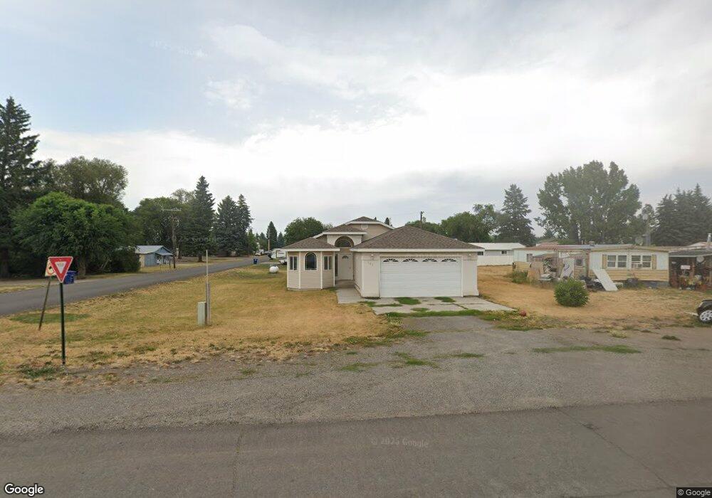
309 Maple St Ashton, ID 83420
Estimated Value: $297,000 - $1,369,000
3
Beds
2
Baths
1,469
Sq Ft
$458/Sq Ft
Est. Value
About This Home
This home is located at 309 Maple St, Ashton, ID 83420 and is currently estimated at $673,149, approximately $458 per square foot. 309 Maple St is a home with nearby schools including Ashton Elementary School and North Fremont Junior/Senior High School.
Ownership History
Date
Name
Owned For
Owner Type
Purchase Details
Closed on
May 5, 2010
Sold by
Armstrong Stuart Lester
Bought by
Armstrong Stuart L
Current Estimated Value
Home Financials for this Owner
Home Financials are based on the most recent Mortgage that was taken out on this home.
Original Mortgage
$123,107
Interest Rate
4.94%
Mortgage Type
New Conventional
Create a Home Valuation Report for This Property
The Home Valuation Report is an in-depth analysis detailing your home's value as well as a comparison with similar homes in the area
Purchase History
| Date | Buyer | Sale Price | Title Company |
|---|---|---|---|
| Armstrong Stuart L | -- | None Available |
Source: Public Records
Mortgage History
| Date | Status | Borrower | Loan Amount |
|---|---|---|---|
| Closed | Armstrong Stuart L | $123,107 |
Source: Public Records
Tax History
| Year | Tax Paid | Tax Assessment Tax Assessment Total Assessment is a certain percentage of the fair market value that is determined by local assessors to be the total taxable value of land and additions on the property. | Land | Improvement |
|---|---|---|---|---|
| 2025 | $1,630 | $173,987 | $22,123 | $151,864 |
| 2024 | $1,585 | $167,395 | $22,123 | $145,272 |
| 2023 | $1,327 | $167,395 | $22,123 | $145,272 |
| 2022 | $1,844 | $119,057 | $20,580 | $98,477 |
| 2021 | $1,827 | $92,061 | $18,007 | $74,054 |
| 2020 | $1,695 | $82,174 | $18,007 | $64,167 |
| 2019 | $1,668 | $82,174 | $18,007 | $64,167 |
| 2018 | $1,604 | $76,241 | $18,007 | $58,234 |
| 2017 | $16 | $67,401 | $17,467 | $49,934 |
| 2016 | $1,519 | $67,401 | $17,467 | $49,934 |
| 2015 | $1,503 | $134,804 | $0 | $0 |
| 2014 | $1,272 | $67,401 | $0 | $0 |
| 2013 | $1,272 | $67,401 | $0 | $0 |
Source: Public Records
Map
Nearby Homes
- 620 N 4th St Unit 1
- 620 N 4th St Unit 2
- 161 Walnut St
- 417 Main St
- 137 Spruce St
- Lot 22 Sunflower Ln
- 4374 Madeline Trail
- 511 Id-47
- 24 S 5th St
- L2 BLK 1 E 1300 Rd N
- 118 N 8th St Unit 2
- 641 Fremont St
- 863 Maple St
- 857 Pine St
- LOTS 1-3 E 1300 Rd N
- 3660 E 1312 N
- 3665 E 1337 N
- 3667 E 1337 N
- 1331 N 3687 E
- L4A B2 N 3706 E
Your Personal Tour Guide
Ask me questions while you tour the home.