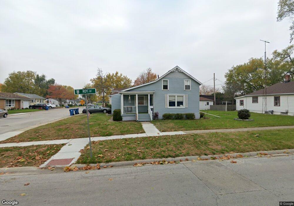
309 N Roy Ave Bourbonnais, IL 60914
Bourbonnais AreaEstimated Value: $135,751 - $194,000
About This Home
This home is located at 309 N Roy Ave, Bourbonnais, IL 60914 and is currently estimated at $163,688. 309 N Roy Ave is a home located in Kankakee County with nearby schools including Alan B. Shepard Elementary School, Liberty Intermediate School, and Bourbonnais Upper Grade Center.
Ownership History
We collect this data history from publicly available records. To have your information removed, we recommend requesting removal directly through your county’s website.
Purchase Details
Home Values in the Area
Average Home Value in this Area
Purchase History
We collect this data history from publicly available records. To have your information removed, we recommend requesting removal directly through your county’s website.
| Date | Buyer | Sale Price | Title Company |
|---|---|---|---|
| $60,000 | Standard Title |
Tax History
We collect this data history from publicly available records. To have your information removed, we recommend requesting removal directly through your county’s website.
| Year | Tax Paid | Tax Assessment Tax Assessment Total Assessment is a certain percentage of the fair market value that is determined by local assessors to be the total taxable value of land and additions on the property. | Land | Improvement |
|---|---|---|---|---|
| 2025 | $3,294 | $40,878 | $3,741 | $37,137 |
| 2024 | $3,294 | $39,629 | $4,594 | $35,035 |
| 2023 | $3,030 | $36,694 | $4,254 | $32,440 |
| 2022 | $2,872 | $33,367 | $4,100 | $29,267 |
| 2021 | $2,778 | $32,072 | $4,010 | $28,062 |
| 2020 | $2,687 | $30,419 | $3,903 | $26,516 |
| 2019 | $2,528 | $28,307 | $3,789 | $24,518 |
| 2018 | $2,376 | $26,522 | $3,733 | $22,789 |
| 2017 | $2,276 | $25,227 | $3,642 | $21,585 |
| 2016 | $2,200 | $24,437 | $3,588 | $20,849 |
| 2015 | $2,116 | $23,212 | $3,552 | $19,660 |
| 2014 | $2,466 | $28,163 | $3,552 | $24,611 |
| 2013 | -- | $29,017 | $3,552 | $25,465 |
Map
- 209-215 E Marsile St
- 213 Belle Aire Ave
- 336 Belle Aire Ave
- 292 Ashley Ave
- 889 Armour Rd
- 899 Armour Rd
- 440 S Cryer Ave
- 778 Woodstock Ln
- 248 Fox Trail Dr
- Lot 5/5A Almar Pkwy
- 695 Cherokee Dr
- 379 Fox Trail Dr
- 773 Stonewall Dr
- 631 Robert Dr
- 901 W North St
- 660 Jonette Ave
- 855 Stonewall Dr
- 22 Jordan Dr
- 480 W Bethel Dr
- 28 Jordan Dr
- 295 N Roy Ave
- 282 E Beaudoin St
- 277 N Roy Ave
- 296 N Roy Ave
- 272 N Roy Ave
- 287 E Greenwood St
- 262 E Beaudoin St
- 287 Greenwood Ave
- lot13 N Roy St
- 261 E Beaudoin St
- 271 E Greenwood St
- 307 E Beaudoin St
- 322 E Beaudoin St
- 331 N Roy Ave
- 254 N Roy Ave
- 248 E Beaudoin St
- 281 E Beaudoin St
- 281 E Beaudoin St
- 327 E Beaudoin St
- 251 N Roy Ave
Ask me questions while you tour the home.