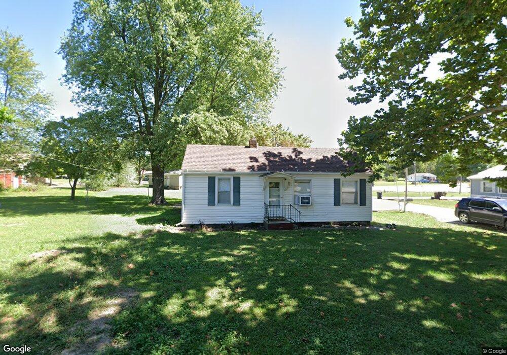
309 S Myrtle St Jamesport, MO 64648
Estimated Value: $65,000 - $193,000
2
Beds
1
Bath
1,124
Sq Ft
$99/Sq Ft
Est. Value
About This Home
This home is located at 309 S Myrtle St, Jamesport, MO 64648 and is currently estimated at $111,386, approximately $99 per square foot. 309 S Myrtle St is a home located in Daviess County with nearby schools including Tri-County Elementary School, Tri-County High School, and Pleasant Hill.
Ownership History
Date
Name
Owned For
Owner Type
Purchase Details
Closed on
Jan 20, 2022
Sold by
Eads Gary L
Bought by
Ackley Heather Renee
Current Estimated Value
Home Financials for this Owner
Home Financials are based on the most recent Mortgage that was taken out on this home.
Original Mortgage
$64,940
Outstanding Balance
$59,358
Interest Rate
3.11%
Mortgage Type
New Conventional
Estimated Equity
$52,028
Purchase Details
Closed on
Mar 14, 2008
Sold by
Huston Jerry Allen and Huston Carolyn
Bought by
Hancock Roy Lee
Create a Home Valuation Report for This Property
The Home Valuation Report is an in-depth analysis detailing your home's value as well as a comparison with similar homes in the area
Purchase History
| Date | Buyer | Sale Price | Title Company |
|---|---|---|---|
| Ackley Heather Renee | -- | Daviess County Land Title | |
| Hancock Roy Lee | -- | -- |
Source: Public Records
Mortgage History
| Date | Status | Borrower | Loan Amount |
|---|---|---|---|
| Open | Ackley Heather Renee | $64,940 |
Source: Public Records
Tax History
| Year | Tax Paid | Tax Assessment Tax Assessment Total Assessment is a certain percentage of the fair market value that is determined by local assessors to be the total taxable value of land and additions on the property. | Land | Improvement |
|---|---|---|---|---|
| 2025 | $475 | $6,433 | $817 | $5,616 |
| 2024 | $483 | $6,329 | $614 | $5,715 |
| 2023 | $476 | $6,329 | $614 | $5,715 |
| 2022 | $476 | $6,329 | $614 | $5,715 |
| 2021 | $457 | $6,329 | $614 | $5,715 |
| 2020 | $471 | $6,329 | $614 | $5,715 |
| 2019 | $459 | $6,329 | $614 | $5,715 |
| 2018 | $455 | $6,329 | $614 | $5,715 |
| 2017 | $435 | $6,329 | $614 | $5,715 |
| 2016 | -- | $6,329 | $614 | $5,715 |
| 2011 | -- | $4,724 | $0 | $0 |
Source: Public Records
Map
Nearby Homes
- 105 E Old Highway 6 N A
- 106 E Main St
- 105 S Grant St
- 24353 300th St
- TBD State Road V
- 00 SW 65th St
- TBD State Highway V
- 0 Quartz and Elm St Unit HMS2584347
- 24984 P Hwy
- 0 250th St
- 22681 Missouri 13
- 193 SW 52nd Ave
- 000 Flint Ave
- 250th St
- 18401 240th St
- 0 SW Poplar Ln
- 18680 State Road Uu
- 0 SW 52nd Ave
- 0 SW 52nd Ave Unit Lot WP004 24524850
- 0 State Road Uu
Your Personal Tour Guide
Ask me questions while you tour the home.