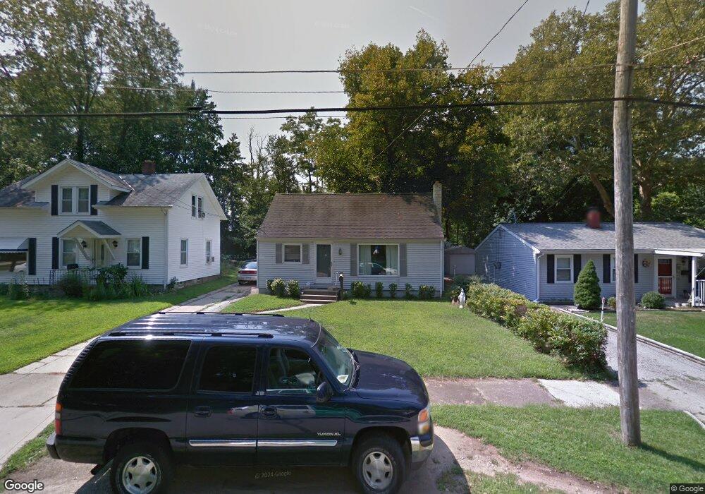
31 Hurst Rd Painesville, OH 44077
Estimated Value: $169,477 - $209,000
3
Beds
1
Bath
768
Sq Ft
$246/Sq Ft
Est. Value
About This Home
This home is located at 31 Hurst Rd, Painesville, OH 44077 and is currently estimated at $189,119, approximately $246 per square foot. 31 Hurst Rd is a home located in Lake County with nearby schools including Henry F. Lamuth Middle School, Riverside Junior/Senior High School, and Hershey Montessori School PreK-Elementary.
Ownership History
Date
Name
Owned For
Owner Type
Purchase Details
Closed on
May 1, 2003
Sold by
Mate Leonard and Mate Geraldine
Bought by
Carlson Martin L and Carlson Sandra D
Current Estimated Value
Home Financials for this Owner
Home Financials are based on the most recent Mortgage that was taken out on this home.
Original Mortgage
$119,951
Outstanding Balance
$51,172
Interest Rate
6.02%
Mortgage Type
Purchase Money Mortgage
Estimated Equity
$137,947
Purchase Details
Closed on
Mar 1, 1977
Bought by
Mate Leonard
Create a Home Valuation Report for This Property
The Home Valuation Report is an in-depth analysis detailing your home's value as well as a comparison with similar homes in the area
Home Values in the Area
Average Home Value in this Area
Purchase History
| Date | Buyer | Sale Price | Title Company |
|---|---|---|---|
| Carlson Martin L | $120,900 | Title Xperts Agency Inc | |
| Mate Leonard | -- | -- |
Source: Public Records
Mortgage History
| Date | Status | Borrower | Loan Amount |
|---|---|---|---|
| Open | Carlson Martin L | $119,951 |
Source: Public Records
Tax History
| Year | Tax Paid | Tax Assessment Tax Assessment Total Assessment is a certain percentage of the fair market value that is determined by local assessors to be the total taxable value of land and additions on the property. | Land | Improvement |
|---|---|---|---|---|
| 2025 | -- | $52,460 | $16,560 | $35,900 |
| 2024 | -- | $52,460 | $16,560 | $35,900 |
| 2023 | $4,199 | $38,530 | $14,340 | $24,190 |
| 2022 | $2,680 | $38,530 | $14,340 | $24,190 |
| 2021 | $2,296 | $38,530 | $14,340 | $24,190 |
| 2020 | $2,085 | $30,820 | $11,470 | $19,350 |
| 2019 | $2,101 | $30,820 | $11,470 | $19,350 |
| 2018 | $2,409 | $33,270 | $8,980 | $24,290 |
| 2017 | $2,712 | $33,270 | $8,980 | $24,290 |
| 2016 | $2,428 | $33,270 | $8,980 | $24,290 |
| 2015 | $1,905 | $33,270 | $8,980 | $24,290 |
| 2014 | $1,937 | $33,270 | $8,980 | $24,290 |
| 2013 | $1,893 | $33,270 | $8,980 | $24,290 |
Source: Public Records
Map
Nearby Homes
- 21 Urban St
- 74 Hawthorne Dr
- 190 Normandy Dr
- 1001 the Capes Blvd
- 163 Hawthorne Dr
- 113 Palm Ct
- 152 Linden Dr
- 1237 Crescent Dr
- 1651 Mentor Ave Unit 1406
- 1651 Mentor Ave Unit 2605
- 1651 Mentor Ave Unit 212
- 535 Cherrywood Ln
- 2014 S Ashwood Ln
- 1997 Spruce Ln
- 519 N Ashwood Ln
- 0 Academy Ct Unit 5189600
- 165 Fairfield Rd
- 10247 Cherry Hill Dr
- 1936 Mentor Ave
- 45 Chatfield Dr
Your Personal Tour Guide
Ask me questions while you tour the home.