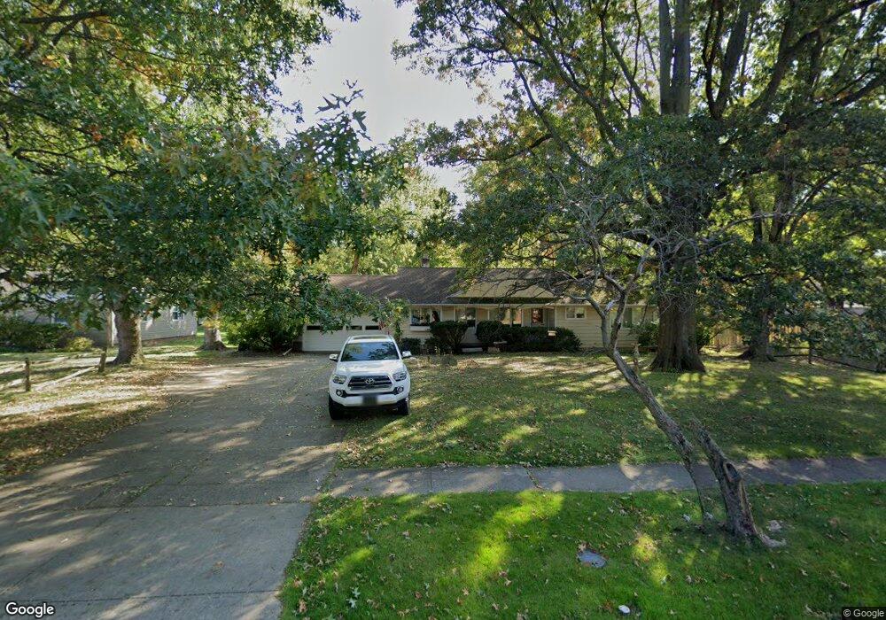
31 Manning Dr Berea, OH 44017
Berea AreaEstimated Value: $99,000 - $244,000
About This Home
This home is located at 31 Manning Dr, Berea, OH 44017 and is currently estimated at $195,000, approximately $126 per square foot. 31 Manning Dr is a home located in Cuyahoga County with nearby schools including Grindstone Elementary School, Berea-Midpark Middle School, and Berea-Midpark High School.
Ownership History
We collect this data history from publicly available records. To have your information removed, we recommend requesting removal directly through your county’s website.
Purchase Details
Purchase Details
Purchase Details
Purchase Details
Purchase Details
Home Values in the Area
Average Home Value in this Area
Purchase History
We collect this data history from publicly available records. To have your information removed, we recommend requesting removal directly through your county’s website.
| Date | Buyer | Sale Price | Title Company |
|---|---|---|---|
| $100,000 | Gateway Title | ||
| -- | -- | ||
| $86,600 | -- | ||
| $80,000 | -- | ||
| -- | -- |
Mortgage History
We collect this data history from publicly available records. To have your information removed, we recommend requesting removal directly through your county’s website.
| Date | Status | Borrower | Loan Amount |
|---|---|---|---|
| Previous Owner | $75,000 | ||
| Previous Owner | $79,000 |
Tax History
We collect this data history from publicly available records. To have your information removed, we recommend requesting removal directly through your county’s website.
| Year | Tax Paid | Tax Assessment Tax Assessment Total Assessment is a certain percentage of the fair market value that is determined by local assessors to be the total taxable value of land and additions on the property. | Land | Improvement |
|---|---|---|---|---|
| 2025 | $4,730 | $72,765 | $22,190 | $50,575 |
| 2024 | $4,221 | $72,765 | $22,190 | $50,575 |
| 2023 | $4,315 | $62,480 | $17,990 | $44,490 |
| 2022 | $4,288 | $62,475 | $17,990 | $44,485 |
| 2021 | $4,252 | $62,480 | $17,990 | $44,490 |
| 2020 | $4,062 | $52,960 | $15,260 | $37,700 |
| 2019 | $3,954 | $151,300 | $43,600 | $107,700 |
| 2018 | $3,850 | $52,960 | $15,260 | $37,700 |
| 2017 | $4,069 | $50,860 | $20,300 | $30,560 |
| 2016 | $4,039 | $50,860 | $20,300 | $30,560 |
| 2015 | $4,016 | $50,860 | $20,300 | $30,560 |
| 2014 | $4,016 | $53,520 | $21,390 | $32,130 |
Map
- 223 Dorland Ave
- 125 Jacqueline Dr
- 21573 Montclare Blvd
- 21470 Jonathan Dr
- 21113 Willow Ln
- 375 S Rocky River Dr
- 80 Hamilton St
- 225 Stanmary Dr
- 8058 Steven David Dr Unit 4214
- 632 Woodmere Dr
- 21072 Cedar Creek Dr
- 7640 S Eastland Rd
- 21032 Breckenridge Ln
- 9862 Fair Rd
- 365 Wallace Dr
- 457 Edgewood Cir
- 341 Girard Dr
- 723 Trotter Ln
- 10249 Fairtree Dr
- 9893 Plum Brook Ln
- 41 Manning Dr
- 19 Manning Dr
- 659 Prospect St
- 692 S Point Trail
- 693 S Point Trail Unit H31
- 691 S Point Trail Unit H32
- 690 S Point Trail
- 17 Manning Dr
- 696 S Point Trail Unit 133
- 695 S Point Trail Unit 136
- 697 S Point Trail Unit I35
- 694 S Point Trail
- 695 S Point Trail Unit I36
- 694 S Point Trail Unit I34
- 665 Prospect St
- 20 Manning Dr
- 61 Manning Dr
- 32 Manning Dr
- 687 S Point Trail Unit G25
- 688 S Point Trail
Ask me questions while you tour the home.