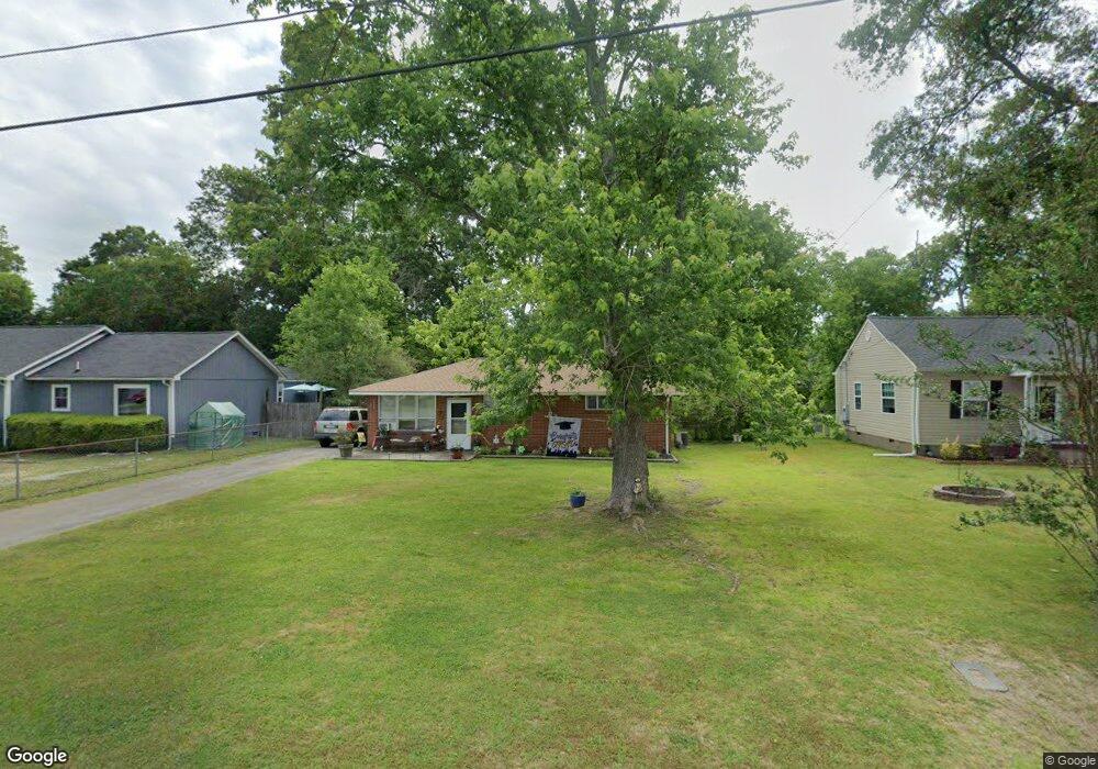
31 Pegram Cir Fort Oglethorpe, GA 30742
Estimated Value: $191,000 - $204,000
3
Beds
1
Bath
1,210
Sq Ft
$165/Sq Ft
Est. Value
About This Home
This home is located at 31 Pegram Cir, Fort Oglethorpe, GA 30742 and is currently estimated at $199,109, approximately $164 per square foot. 31 Pegram Cir is a home located in Catoosa County with nearby schools including Battlefield Primary School, Battlefield Elementary School, and Lakeview Middle School.
Ownership History
Date
Name
Owned For
Owner Type
Purchase Details
Closed on
Mar 9, 2009
Sold by
Shutting Patrick
Bought by
Shutting Kelly
Current Estimated Value
Purchase Details
Closed on
Jan 28, 2008
Sold by
Bradford James D
Bought by
Shutting Patrick R
Home Financials for this Owner
Home Financials are based on the most recent Mortgage that was taken out on this home.
Original Mortgage
$88,900
Interest Rate
6.17%
Mortgage Type
New Conventional
Purchase Details
Closed on
Jul 17, 2007
Sold by
Bradford James D
Bought by
Bradford Catherine
Purchase Details
Closed on
Mar 28, 2003
Bought by
Bradford James D
Create a Home Valuation Report for This Property
The Home Valuation Report is an in-depth analysis detailing your home's value as well as a comparison with similar homes in the area
Home Values in the Area
Average Home Value in this Area
Purchase History
We collect this data history from publicly available records. To have your information removed, we recommend requesting removal directly through your county’s website.
| Date | Buyer | Sale Price | Title Company |
|---|---|---|---|
| Shutting Kelly | -- | -- | |
| Shutting Patrick R | $88,900 | -- | |
| Bradford Catherine | -- | -- | |
| Bradford James D | $50,700 | -- |
Source: Public Records
Mortgage History
We collect this data history from publicly available records. To have your information removed, we recommend requesting removal directly through your county’s website.
| Date | Status | Borrower | Loan Amount |
|---|---|---|---|
| Previous Owner | Shutting Patrick R | $88,900 |
Source: Public Records
Tax History
| Year | Tax Paid | Tax Assessment Tax Assessment Total Assessment is a certain percentage of the fair market value that is determined by local assessors to be the total taxable value of land and additions on the property. | Land | Improvement |
|---|---|---|---|---|
| 2025 | $1,334 | $67,737 | $10,000 | $57,737 |
| 2024 | $1,370 | $55,578 | $7,245 | $48,333 |
| 2023 | $1,076 | $41,942 | $7,245 | $34,697 |
| 2022 | $839 | $33,486 | $7,245 | $26,241 |
| 2021 | $793 | $33,486 | $7,245 | $26,241 |
| 2020 | $863 | $29,229 | $7,245 | $21,984 |
| 2019 | $761 | $29,229 | $7,245 | $21,984 |
| 2018 | $854 | $27,262 | $6,440 | $20,822 |
| 2017 | $735 | $27,132 | $6,440 | $20,692 |
| 2016 | $712 | $25,394 | $6,440 | $18,954 |
| 2015 | -- | $25,394 | $6,440 | $18,954 |
| 2014 | -- | $25,394 | $6,440 | $18,954 |
| 2013 | -- | $25,394 | $6,440 | $18,954 |
Source: Public Records
Map
Nearby Homes
- 43 Pegram Cir
- 47 Elaine Cir
- 29 Polk Cir
- 20 Eaton Cir
- 37 Eaton Cir
- 99 Battlewood Dr
- 59 S Glade Rd
- 2 Polk Cir
- 3 Walker Ave
- 106 Harker Rd
- 215 Battlewood Dr
- 123 General Hays Rd
- 309 Barnhardt Cir
- 1112 Park Forrest Dr
- 1605 Cannon Dr
- 505 Thomas Dr
- 565 Lakeshore Cove Dr
- 124 Coffman Dr
- 203 Barnhardt Cir
- 119 Spinnaker Dr
Your Personal Tour Guide
Ask me questions while you tour the home.