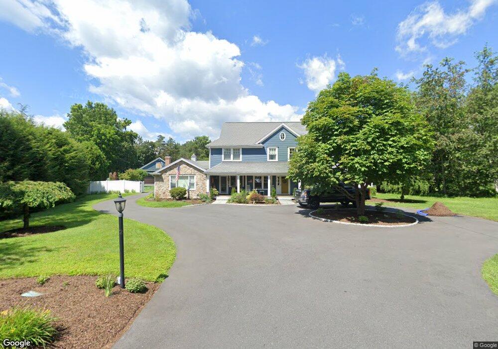
31 Puffer Ln Sudbury, MA 01776
Estimated Value: $872,000 - $1,168,666
3
Beds
2
Baths
1,734
Sq Ft
$596/Sq Ft
Est. Value
About This Home
This home is located at 31 Puffer Ln, Sudbury, MA 01776 and is currently estimated at $1,033,167, approximately $595 per square foot. 31 Puffer Ln is a home located in Middlesex County with nearby schools including Josiah Haynes Elementary School, Ephraim Curtis Middle School, and Lincoln-Sudbury Regional High School.
Ownership History
Date
Name
Owned For
Owner Type
Purchase Details
Closed on
Oct 24, 2023
Sold by
Leanza Salvatore C and Leanza Kelly
Bought by
Leanza Ft and Leanza
Current Estimated Value
Purchase Details
Closed on
Sep 21, 2006
Sold by
Sargeant Murry Hn and Sargeant Marilyn W
Bought by
Leanza Salvatore C and Leanza Kelly
Home Financials for this Owner
Home Financials are based on the most recent Mortgage that was taken out on this home.
Original Mortgage
$220,000
Interest Rate
6.59%
Mortgage Type
Purchase Money Mortgage
Create a Home Valuation Report for This Property
The Home Valuation Report is an in-depth analysis detailing your home's value as well as a comparison with similar homes in the area
Home Values in the Area
Average Home Value in this Area
Purchase History
| Date | Buyer | Sale Price | Title Company |
|---|---|---|---|
| Leanza Ft | -- | None Available | |
| Leanza Salvatore C | $437,000 | -- |
Source: Public Records
Mortgage History
| Date | Status | Borrower | Loan Amount |
|---|---|---|---|
| Previous Owner | Leanza Salvatore C | $220,000 |
Source: Public Records
Tax History
| Year | Tax Paid | Tax Assessment Tax Assessment Total Assessment is a certain percentage of the fair market value that is determined by local assessors to be the total taxable value of land and additions on the property. | Land | Improvement |
|---|---|---|---|---|
| 2025 | $16,818 | $1,148,800 | $441,000 | $707,800 |
| 2024 | $16,191 | $1,108,200 | $428,200 | $680,000 |
| 2023 | $15,308 | $970,700 | $396,600 | $574,100 |
| 2022 | $14,743 | $816,800 | $364,200 | $452,600 |
| 2021 | $6,988 | $747,200 | $364,200 | $383,000 |
| 2020 | $13,786 | $747,200 | $364,200 | $383,000 |
| 2019 | $6,285 | $747,200 | $364,200 | $383,000 |
| 2018 | $13,259 | $739,500 | $388,200 | $351,300 |
| 2017 | $12,728 | $717,500 | $369,400 | $348,100 |
| 2016 | $12,353 | $694,000 | $355,400 | $338,600 |
| 2015 | $11,864 | $674,100 | $341,800 | $332,300 |
| 2014 | $11,860 | $657,800 | $331,800 | $326,000 |
Source: Public Records
Map
Nearby Homes
- 41 Old Coach Rd
- 19 Skyview Ln
- 96 Mossman Rd
- 228 Mossman Rd
- 20 Cobblestone Place
- 22 Starview Dr
- 377 Willis Rd
- 68 Longfellow Rd
- 8-10 Concord Road (&356 Bostonpost)
- 821 Concord Rd
- 55 Maynard Farm Rd
- 48 Chanticleer Rd
- 20 Northwood Dr Unit 303
- 8 Snowberry Ln
- 6 Chanticleer Rd
- 401 Emery Ln Unit 408
- 6 Canterbury Dr
- 108 Hawks Perch Unit 108
- 40 Rookery Ln Unit 5
- 72 Rookery Ln Unit 3
Your Personal Tour Guide
Ask me questions while you tour the home.