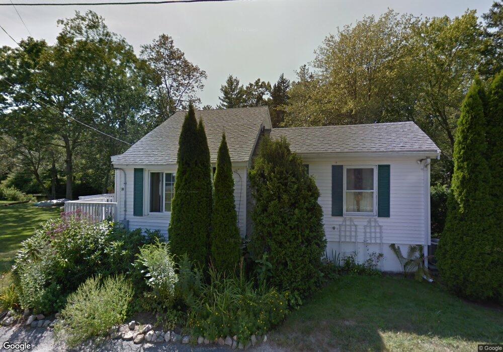
31 Riverside Dr North Reading, MA 01864
Estimated Value: $533,000 - $701,000
3
Beds
1
Bath
1,038
Sq Ft
$602/Sq Ft
Est. Value
About This Home
This home is located at 31 Riverside Dr, North Reading, MA 01864 and is currently estimated at $625,063, approximately $602 per square foot. 31 Riverside Dr is a home located in Middlesex County with nearby schools including Batchelder School, North Reading Middle School, and North Reading High School.
Ownership History
Date
Name
Owned For
Owner Type
Purchase Details
Closed on
Mar 31, 2025
Sold by
Tempesta Laura H
Bought by
Laura H Tempesta Ret and Tempesta
Current Estimated Value
Purchase Details
Closed on
Jul 30, 2003
Sold by
Pelmas Robert H and Pelmas Nancy R
Bought by
Tempesta Eric M and Tempesta Laura H
Home Financials for this Owner
Home Financials are based on the most recent Mortgage that was taken out on this home.
Original Mortgage
$252,000
Interest Rate
5.28%
Mortgage Type
Purchase Money Mortgage
Purchase Details
Closed on
Dec 29, 1998
Sold by
Simpson Mark C and Simpson Carolyn A
Bought by
Pelmas Robert H and Pelmas Nancy R
Create a Home Valuation Report for This Property
The Home Valuation Report is an in-depth analysis detailing your home's value as well as a comparison with similar homes in the area
Home Values in the Area
Average Home Value in this Area
Purchase History
We collect this data history from publicly available records. To have your information removed, we recommend requesting removal directly through your county’s website.
| Date | Buyer | Sale Price | Title Company |
|---|---|---|---|
| Laura H Tempesta Ret | -- | None Available | |
| Laura H Tempesta Ret | -- | None Available | |
| Tempesta Eric M | $280,000 | -- | |
| Tempesta Eric M | $280,000 | -- | |
| Pelmas Robert H | $169,900 | -- |
Source: Public Records
Mortgage History
We collect this data history from publicly available records. To have your information removed, we recommend requesting removal directly through your county’s website.
| Date | Status | Borrower | Loan Amount |
|---|---|---|---|
| Previous Owner | Tempesta Eric M | $252,000 |
Source: Public Records
Tax History
| Year | Tax Paid | Tax Assessment Tax Assessment Total Assessment is a certain percentage of the fair market value that is determined by local assessors to be the total taxable value of land and additions on the property. | Land | Improvement |
|---|---|---|---|---|
| 2025 | $8,002 | $612,700 | $367,500 | $245,200 |
| 2024 | $7,679 | $581,300 | $346,200 | $235,100 |
| 2023 | $7,459 | $533,200 | $318,400 | $214,800 |
| 2022 | $7,260 | $484,000 | $289,400 | $194,600 |
| 2021 | $10,274 | $444,600 | $263,400 | $181,200 |
Source: Public Records
Map
Nearby Homes
Your Personal Tour Guide
Ask me questions while you tour the home.