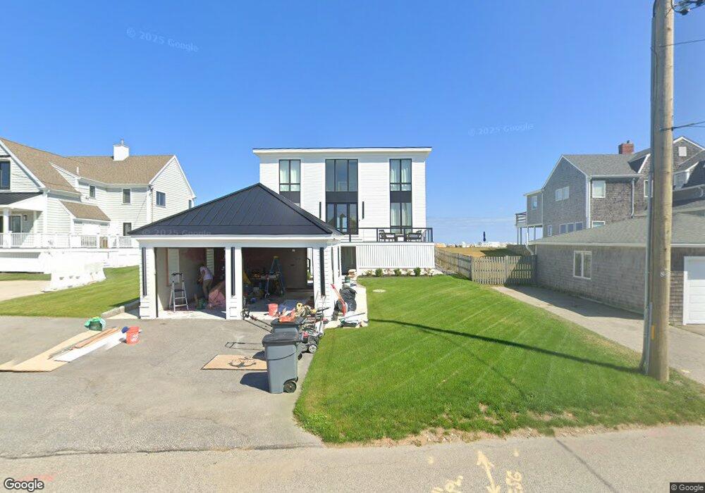
31 Surfside Rd Scituate, MA 02066
Estimated Value: $2,132,000 - $3,234,343
4
Beds
3
Baths
3,280
Sq Ft
$814/Sq Ft
Est. Value
About This Home
This home is located at 31 Surfside Rd, Scituate, MA 02066 and is currently estimated at $2,669,836, approximately $813 per square foot. 31 Surfside Rd is a home located in Plymouth County with nearby schools including Wampatuck Elementary School, Lester J. Gates Middle School, and Scituate High School.
Ownership History
Date
Name
Owned For
Owner Type
Purchase Details
Closed on
Dec 1, 2021
Sold by
Jobesu T
Bought by
Oneill Stephen J and Oneil Kellie
Current Estimated Value
Home Financials for this Owner
Home Financials are based on the most recent Mortgage that was taken out on this home.
Original Mortgage
$1,120,000
Outstanding Balance
$1,029,830
Interest Rate
3.09%
Mortgage Type
Purchase Money Mortgage
Estimated Equity
$1,640,006
Create a Home Valuation Report for This Property
The Home Valuation Report is an in-depth analysis detailing your home's value as well as a comparison with similar homes in the area
Home Values in the Area
Average Home Value in this Area
Purchase History
We collect this data history from publicly available records. To have your information removed, we recommend requesting removal directly through your county’s website.
| Date | Buyer | Sale Price | Title Company |
|---|---|---|---|
| Oneill Stephen J | $1,575,000 | None Available |
Source: Public Records
Mortgage History
We collect this data history from publicly available records. To have your information removed, we recommend requesting removal directly through your county’s website.
| Date | Status | Borrower | Loan Amount |
|---|---|---|---|
| Open | Oneill Stephen J | $1,120,000 |
Source: Public Records
Tax History
| Year | Tax Paid | Tax Assessment Tax Assessment Total Assessment is a certain percentage of the fair market value that is determined by local assessors to be the total taxable value of land and additions on the property. | Land | Improvement |
|---|---|---|---|---|
| 2025 | $23,362 | $2,338,500 | $1,435,600 | $902,900 |
| 2024 | $15,483 | $1,494,500 | $1,450,100 | $44,400 |
| 2023 | $16,661 | $1,652,400 | $1,318,300 | $334,100 |
| 2022 | $16,661 | $1,320,200 | $1,096,400 | $223,800 |
| 2021 | $14,687 | $1,101,800 | $901,800 | $200,000 |
| 2020 | $14,398 | $1,066,500 | $867,000 | $199,500 |
| 2019 | $14,384 | $1,046,900 | $850,000 | $196,900 |
| 2018 | $14,953 | $1,071,900 | $867,600 | $204,300 |
| 2017 | $15,103 | $1,071,900 | $867,600 | $204,300 |
| 2016 | $15,059 | $1,065,000 | $867,600 | $197,400 |
| 2015 | $14,322 | $1,093,300 | $895,900 | $197,400 |
Source: Public Records
Map
Nearby Homes
- 81 Surfside Rd
- 430 Hatherly Rd Unit Exhibit “A”
- 430 Hatherly Rd Unit Exhibit “B”
- 14 Bayberry Rd
- 6 Tilden Ave
- 105 Ann Vinal Rd
- 67 Border St
- 14 Christopher Ln
- 1 Bailey's Island Rd
- 26 Mordecai Lincoln Rd
- 684 Country Way
- 701 Country Way
- 96 Black Horse Ln
- 817 Country Way
- 392 S Main St
- 799 Country Way
- 485 Country Way
- 38 Booth Hill Rd
- 124 Elm St Unit 307
- 5 Brand Blvd Unit 5
- 29 Surfside Rd
- 33 Surfside Rd
- 27 Surfside Rd
- 35 Surfside Rd
- 37 Surfside Rd
- 37 Surfside Rd Unit 1
- 30 Surfside Rd
- 25 Surfside Rd
- 34 Surfside Rd
- 41 Surfside Rd
- 36 Surfside Rd
- 28 Surfside Rd
- 26 Surfside Rd
- 26 Surfside Rd Unit a
- 32 Surfside Rd
- 32 Surfside Rd
- 39 Surfside Rd
- 23 Surfside Rd Unit na
- 23 Surfside Rd
- 23 Surfside Rd Unit 1
Your Personal Tour Guide
Ask me questions while you tour the home.