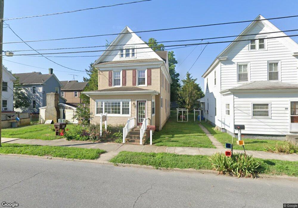
311 Byrn St Cambridge, MD 21613
Estimated Value: $201,149 - $341,000
Studio
2
Baths
1,648
Sq Ft
$161/Sq Ft
Est. Value
About This Home
This home is located at 311 Byrn St, Cambridge, MD 21613 and is currently estimated at $265,037, approximately $160 per square foot. 311 Byrn St is a home located in Dorchester County with nearby schools including Choptank Elementary School, Mace's Lane Middle School, and Cambridge-South Dorchester High School.
Ownership History
Date
Name
Owned For
Owner Type
Purchase Details
Closed on
Aug 5, 2025
Sold by
Brohawn Sylvia
Bought by
401K Llc
Current Estimated Value
Purchase Details
Closed on
Feb 19, 1999
Sold by
Maryland Housing Fund
Bought by
Brohawn Sylvia
Purchase Details
Closed on
Nov 13, 1998
Sold by
Hyler Joann E
Bought by
Maryland Housing Fund
Purchase Details
Closed on
Nov 30, 1995
Sold by
Evey Katherine K
Bought by
Hyler Joann E
Create a Home Valuation Report for This Property
The Home Valuation Report is an in-depth analysis detailing your home's value as well as a comparison with similar homes in the area
Home Values in the Area
Average Home Value in this Area
Purchase History
| Date | Buyer | Sale Price | Title Company |
|---|---|---|---|
| 401K Llc | -- | None Listed On Document | |
| Brohawn Sylvia | $42,500 | -- | |
| Maryland Housing Fund | $50,000 | -- | |
| Hyler Joann E | $63,000 | -- |
Source: Public Records
Mortgage History
| Date | Status | Borrower | Loan Amount |
|---|---|---|---|
| Closed | Brohawn Sylvia | -- |
Source: Public Records
Tax History
| Year | Tax Paid | Tax Assessment Tax Assessment Total Assessment is a certain percentage of the fair market value that is determined by local assessors to be the total taxable value of land and additions on the property. | Land | Improvement |
|---|---|---|---|---|
| 2025 | $3,005 | $160,000 | $36,300 | $123,700 |
| 2024 | $2,570 | $149,533 | $0 | $0 |
| 2023 | $2,570 | $139,067 | $0 | $0 |
| 2022 | $2,377 | $128,600 | $36,300 | $92,300 |
| 2020 | $2,296 | $121,733 | $0 | $0 |
| 2019 | $2,256 | $118,300 | $26,200 | $92,100 |
| 2018 | $1,936 | $104,267 | $0 | $0 |
| 2017 | $1,675 | $90,233 | $0 | $0 |
| 2016 | -- | $76,200 | $0 | $0 |
| 2015 | $1,592 | $76,200 | $0 | $0 |
| 2014 | $1,592 | $76,200 | $0 | $0 |
Source: Public Records
Map
Nearby Homes
- 309 Maryland Ave
- 206 Maryland Ave
- 205 Byrn St
- 343 Shipyard Dr
- 700 Cattail Cove
- 700 Cattail Cove
- 301 Dorchester Ave
- 317 Shipyard Dr Unit 67
- 10 Riverside Wharf
- 311 Riverside Ln
- 340 Shipyard Dr
- 26 Riverside Wharf
- 322 Shipyard Dr Unit 82
- 413 Waterfield Ct
- 200 Market Square
- 202 Muir St
- 900 Marshy Cove
- 900 Marshy Cove
- 900 Marshy Cove
- 510 Marshy Cove
- 107 Aurora St
- 309 Byrn St
- 308 Maryland Ave
- 310 Maryland Ave
- 307 Byrn St
- 105 Aurora St
- 312 Maryland Ave
- 304 Maryland Ave
- 103 Aurora St
- 305 Byrn St
- 101 Aurora St
- 302 Maryland Ave
- 102 Franklin St
- 303 Byrn St
- 104 Franklin St
- 400 Maryland Ave
- 100 Franklin St Unit 1
- 100 Franklin St
- 100 Aurora St
- 102 Aurora St
Your Personal Tour Guide
Ask me questions while you tour the home.