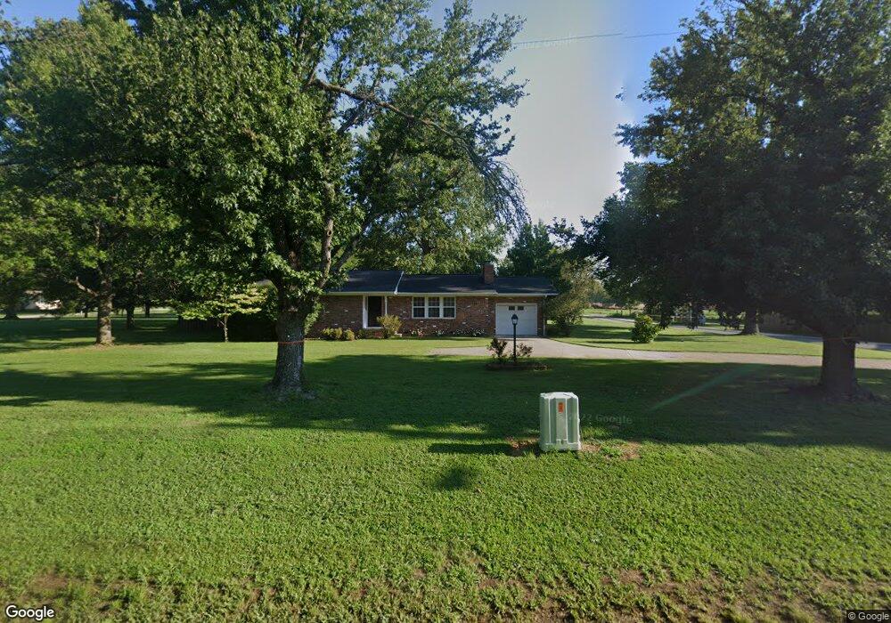
311 S Robin Rd Gentry, AR 72734
Estimated Value: $241,082 - $416,000
Studio
--
Bath
1,504
Sq Ft
$211/Sq Ft
Est. Value
About This Home
This home is located at 311 S Robin Rd, Gentry, AR 72734 and is currently estimated at $318,027, approximately $211 per square foot. 311 S Robin Rd is a home with nearby schools including Gentry Intermediate School, Gentry Primary School, and Gentry Middle School.
Ownership History
Date
Name
Owned For
Owner Type
Purchase Details
Closed on
Mar 14, 2025
Sold by
Danny Feemster Revocable Trust and Wava Feemster Revocable Trust
Bought by
Barker Norman Brent and Barker Amber N
Current Estimated Value
Purchase Details
Closed on
Sep 11, 1997
Bought by
Barker and Barker 13Ac
Purchase Details
Closed on
Dec 5, 1996
Bought by
Feemster Tr W
Purchase Details
Closed on
Nov 25, 1996
Bought by
Feemster Rev Trust
Purchase Details
Closed on
Mar 2, 1992
Bought by
Barker
Create a Home Valuation Report for This Property
The Home Valuation Report is an in-depth analysis detailing your home's value as well as a comparison with similar homes in the area
Home Values in the Area
Average Home Value in this Area
Purchase History
We collect this data history from publicly available records. To have your information removed, we recommend requesting removal directly through your county’s website.
| Date | Buyer | Sale Price | Title Company |
|---|---|---|---|
| Barker Norman Brent | $45,000 | Waco Title | |
| Barker | -- | -- | |
| Feemster Tr W | -- | -- | |
| Feemster Rev Trust | -- | -- | |
| Feemster Rev Trust (1/2Int) | -- | -- | |
| Barker | $68,000 | -- |
Source: Public Records
Tax History
| Year | Tax Paid | Tax Assessment Tax Assessment Total Assessment is a certain percentage of the fair market value that is determined by local assessors to be the total taxable value of land and additions on the property. | Land | Improvement |
|---|---|---|---|---|
| 2025 | $902 | $46,019 | $7,000 | $39,019 |
| 2024 | $981 | $50,566 | $11,550 | $39,016 |
| 2023 | $981 | $36,800 | $8,250 | $28,550 |
| 2022 | $659 | $36,800 | $8,250 | $28,550 |
| 2021 | $657 | $36,800 | $8,250 | $28,550 |
| 2020 | $661 | $24,750 | $2,970 | $21,780 |
| 2019 | $661 | $24,750 | $2,970 | $21,780 |
| 2018 | $686 | $24,750 | $2,970 | $21,780 |
| 2017 | $686 | $24,750 | $2,970 | $21,780 |
| 2016 | $686 | $24,750 | $2,970 | $21,780 |
| 2015 | $981 | $20,780 | $2,400 | $18,380 |
| 2014 | $631 | $20,780 | $2,400 | $18,380 |
Source: Public Records
Map
Nearby Homes
- 252 S Eastern Ave
- 9.09 Acres E 3rd St Hwy 12
- 12041 S Robin Rd
- 190 Allen Ave
- 12029 S Edmondson Rd
- 10879 Arkansas 59
- 120 S Collins Ave
- 0 SE 1st St
- 1728 Pittman St
- 1732 Pittman St
- 1704 Edens St
- 1729 Pittman St
- 1720 Edens St
- 1708 Edens St
- 1733 Pittman St
- 1732 Edens St
- 1737 Pittman St
- 104 W 3rd St
- 19161 Old Springtown Rd
- 1311 Valley Dr
- 1320 E 3rd St
- 249 S Robin Rd
- 300 S Virginia St
- ? Virginia St
- 0 Virginia St Unit 1025972
- 371 S Virginia Ave
- 333 S Virginia Ave
- 333 S Virginia St
- 309 S Virginia St
- 1121 E 3rd St
- 202 S Virginia St
- 229 S Virginia St
- 1165 Scott St
- 1151 Scott St
- 2013 Maple Ct
- 2009 Maple Ct
- 2005 Maple Ct
- 2004 Maple Ct
- 2012 Maple Ct
- 215 S Virginia St
Your Personal Tour Guide
Ask me questions while you tour the home.