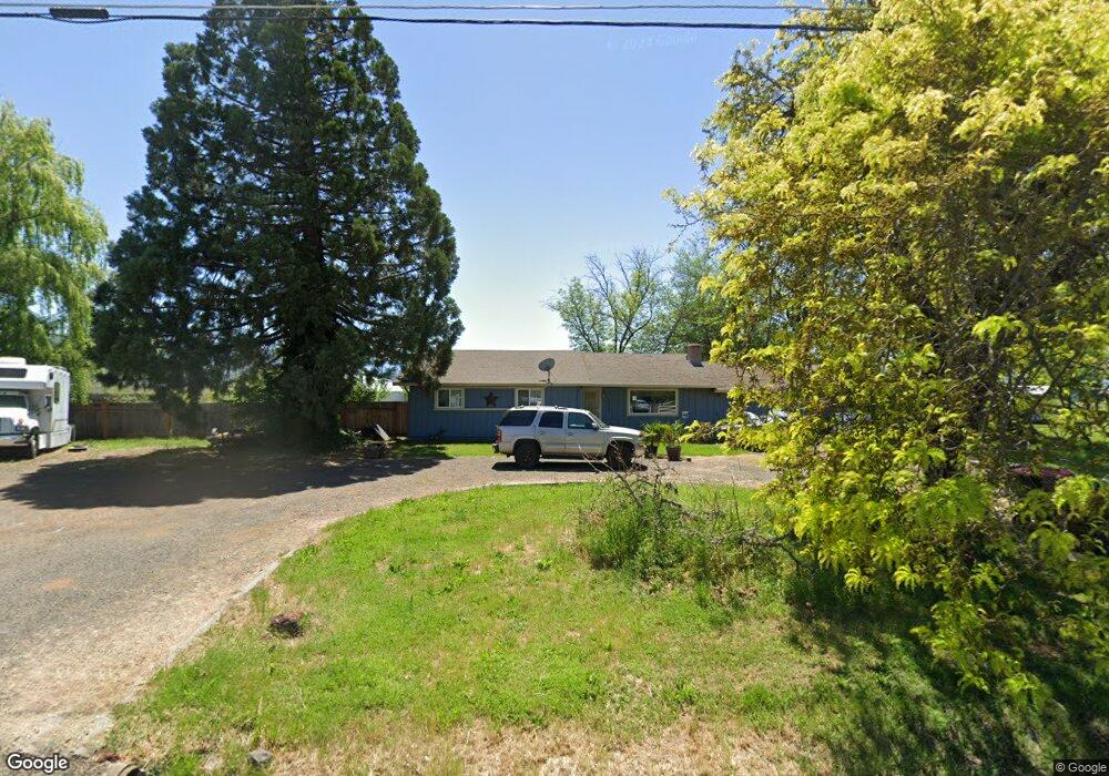
3112 Randall Ave Central Point, OR 97502
Estimated Value: $416,000 - $448,460
About This Home
This home is located at 3112 Randall Ave, Central Point, OR 97502 and is currently estimated at $431,487, approximately $288 per square foot. 3112 Randall Ave is a home located in Jackson County with nearby schools including Abraham Lincoln Elementary School, Hedrick Middle School, and North Medford High School.
Ownership History
We collect this data history from publicly available records. To have your information removed, we recommend requesting removal directly through your county’s website.
Purchase Details
Home Financials for this Owner
Home Financials are based on the most recent Mortgage that was taken out on this home.Purchase Details
Home Financials for this Owner
Home Financials are based on the most recent Mortgage that was taken out on this home.Purchase Details
Purchase Details
Purchase Details
Home Financials for this Owner
Home Financials are based on the most recent Mortgage that was taken out on this home.Purchase Details
Purchase Details
Home Financials for this Owner
Home Financials are based on the most recent Mortgage that was taken out on this home.Purchase History
We collect this data history from publicly available records. To have your information removed, we recommend requesting removal directly through your county’s website.
| Date | Buyer | Sale Price | Title Company |
|---|---|---|---|
| $365,000 | Ticor Title | ||
| -- | Amerititle | ||
| $125,000 | First American Title | ||
| $245,862 | None Available | ||
| -- | None Available | ||
| -- | -- | ||
| $203,000 | Lawyers Title Insurance Corp |
Mortgage History
We collect this data history from publicly available records. To have your information removed, we recommend requesting removal directly through your county’s website.
| Date | Status | Borrower | Loan Amount |
|---|---|---|---|
| Open | $300,000 | ||
| Previous Owner | $120,000 | ||
| Previous Owner | $220,000 | ||
| Previous Owner | $182,700 |
Tax History
We collect this data history from publicly available records. To have your information removed, we recommend requesting removal directly through your county’s website.
| Year | Tax Paid | Tax Assessment Tax Assessment Total Assessment is a certain percentage of the fair market value that is determined by local assessors to be the total taxable value of land and additions on the property. | Land | Improvement |
|---|---|---|---|---|
| 2026 | $2,487 | $202,700 | -- | -- |
| 2025 | $2,438 | $196,800 | $81,550 | $115,250 |
| 2024 | $2,438 | $191,070 | $91,430 | $99,640 |
| 2023 | $2,363 | $185,510 | $88,770 | $96,740 |
| 2022 | $2,307 | $185,510 | $88,770 | $96,740 |
| 2021 | $2,249 | $180,110 | $86,190 | $93,920 |
| 2020 | $2,196 | $174,870 | $83,690 | $91,180 |
| 2019 | $2,145 | $164,840 | $78,900 | $85,940 |
| 2018 | $2,091 | $160,040 | $76,600 | $83,440 |
| 2017 | $2,057 | $160,040 | $76,600 | $83,440 |
| 2016 | $2,018 | $150,860 | $72,210 | $78,650 |
| 2015 | $1,933 | $150,860 | $72,210 | $78,650 |
| 2014 | $1,905 | $142,210 | $68,060 | $74,150 |
Map
- 5900 Mcloughlin Dr
- 2705 Randall Ave
- 6950 Pico Dr
- 6013 Foothill Rd
- 7410 Desert View Dr
- 7431 Jerae Place
- 2523 Agate Meadows Dr
- 2494 Agate Meadows
- 2799 Avenue A
- 2695 Avenue A
- 7515 Gladstone Ave
- 2685 Avenue A
- 7422 Denman Ct
- 7414 Denman Ct
- 2422 Granite Ct
- 3251 Antelope Rd
- 3643 Amelia Way
- 3412 Sonny Ln
- 3428 Sonny Ln
- 7665 24th St
- 3097 Randall Ave
- 0 McLoughlin Tl1300 2700 Dr Unit 102972200
- 3147 Randall Ave
- 3077 Randall Ave
- 3160 Randall Ave
- 6188 Mcloughlin Dr
- 6188 Mclaughlin Dr
- TL2700 Mcloughlin Dr
- 3207 Randall Ave
- 3235 Randall Ave
- 6221 Mcloughlin Dr
- 6261 Mcloughlin Dr
- 6350 Mcloughlin Dr
- 6350 Mcloughlin Dr
- 6233 Mclaughlin Dr
- 6221 Mclaughlin Dr
- 6201 Mclaughlin Dr
- 6303 Mcloughlin Dr
- 6261 Mclaughlin Dr
- 6303 Mcloughlin Dr
Ask me questions while you tour the home.