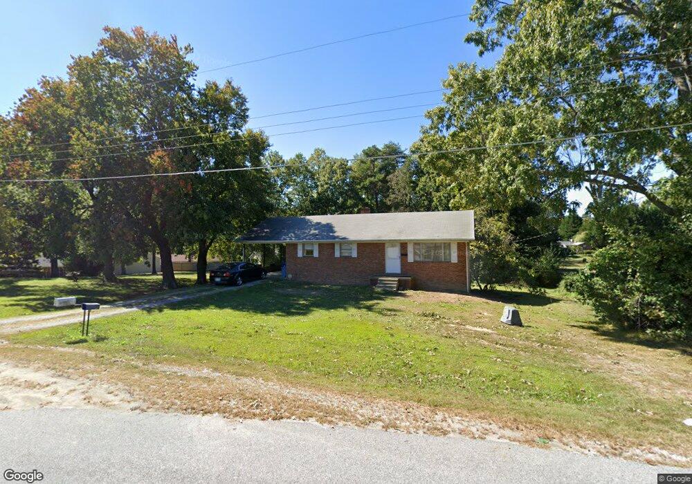
312 Janice Dr High Point, NC 27263
Greater High Point NeighborhoodEstimated Value: $126,000 - $211,000
About This Home
This home is located at 312 Janice Dr, High Point, NC 27263 and is currently estimated at $171,017, approximately $140 per square foot. 312 Janice Dr is a home located in Guilford County with nearby schools including Allen Jay Elementary School, Southern Guilford Middle, and Southern Guilford High School.
Ownership History
We collect this data history from publicly available records. To have your information removed, we recommend requesting removal directly through your county’s website.
Purchase Details
Purchase Details
Home Financials for this Owner
Home Financials are based on the most recent Mortgage that was taken out on this home.Purchase Details
Home Values in the Area
Average Home Value in this Area
Purchase History
We collect this data history from publicly available records. To have your information removed, we recommend requesting removal directly through your county’s website.
| Date | Buyer | Sale Price | Title Company |
|---|---|---|---|
| -- | None Listed On Document | ||
| $80,000 | None Available | ||
| -- | -- |
Mortgage History
We collect this data history from publicly available records. To have your information removed, we recommend requesting removal directly through your county’s website.
| Date | Status | Borrower | Loan Amount |
|---|---|---|---|
| Closed | $64,000 |
Tax History
We collect this data history from publicly available records. To have your information removed, we recommend requesting removal directly through your county’s website.
| Year | Tax Paid | Tax Assessment Tax Assessment Total Assessment is a certain percentage of the fair market value that is determined by local assessors to be the total taxable value of land and additions on the property. | Land | Improvement |
|---|---|---|---|---|
| 2025 | $867 | $98,900 | $20,000 | $78,900 |
| 2024 | $867 | $98,900 | $20,000 | $78,900 |
| 2023 | $867 | $98,900 | $20,000 | $78,900 |
| 2022 | $867 | $98,900 | $20,000 | $78,900 |
| 2021 | $714 | $81,400 | $20,000 | $61,400 |
| 2020 | $714 | $81,400 | $20,000 | $61,400 |
| 2019 | $357 | $81,400 | $0 | $0 |
| 2018 | $0 | $81,400 | $0 | $0 |
| 2017 | $344 | $81,400 | $0 | $0 |
| 2016 | $353 | $80,700 | $0 | $0 |
| 2015 | $355 | $80,700 | $0 | $0 |
| 2014 | $359 | $80,700 | $0 | $0 |
Map
- 826 Graylyn Dr
- 106 Northview Place
- 715 Baker Rd
- 611 A Liberty Rd
- 1010/1012 Gaines Ave
- 2101 Jefferson Ct
- 2706 Miriam Ct
- 908 Chesapeake Ln
- 1011 Gaines Ave
- 825 Hopewell St
- 3604 Akers Ct
- 332 Wynnewood Dr
- 408 Kaye St
- 3604 Rocklane Dr
- 3702 Hudson St
- 126 Apollo Cir
- 2391 Bellemeade St
- 611 Liberty Rd
- 000 Liberty Rd
- 10526 Main N Main St Unit 2
Ask me questions while you tour the home.