Estimated Value: $113,000 - $198,000
About This Home
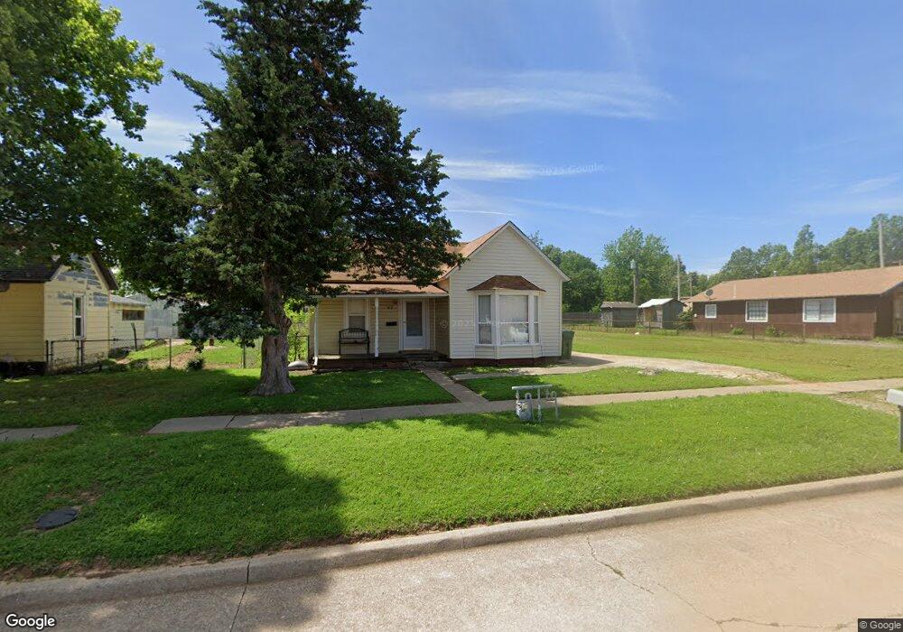
This home is located at 312 Maple St, Yukon, OK 73099 and is currently estimated at $136,678, approximately $91 per square foot. 312 Maple St is a home located in Canadian County with nearby schools including Central Elementary School, Independence Elementary School, and Yukon Middle School.
Ownership History
We collect this data history from publicly available records. To have your information removed, we recommend requesting removal directly through your county’s website.
Purchase Details
Purchase Details
Purchase Details
Purchase Details
Purchase Details
Home Values in the Area
Average Home Value in this Area
Purchase History
We collect this data history from publicly available records. To have your information removed, we recommend requesting removal directly through your county’s website.
| Date | Buyer | Sale Price | Title Company |
|---|---|---|---|
| $62,500 | -- | ||
| $45,000 | -- | ||
| -- | -- | ||
| -- | -- | ||
| $23,000 | -- |
Mortgage History
We collect this data history from publicly available records. To have your information removed, we recommend requesting removal directly through your county’s website.
| Date | Status | Borrower | Loan Amount |
|---|---|---|---|
| Closed | $6,140 |
Tax History
We collect this data history from publicly available records. To have your information removed, we recommend requesting removal directly through your county’s website.
| Year | Tax Paid | Tax Assessment Tax Assessment Total Assessment is a certain percentage of the fair market value that is determined by local assessors to be the total taxable value of land and additions on the property. | Land | Improvement |
|---|---|---|---|---|
| 2025 | $840 | $8,190 | $1,733 | $6,457 |
| 2024 | $805 | $7,800 | $1,733 | $6,067 |
| 2023 | $805 | $7,429 | $1,733 | $5,696 |
| 2022 | $770 | $7,075 | $1,733 | $5,342 |
| 2021 | $740 | $6,774 | $1,733 | $5,041 |
| 2020 | $696 | $6,452 | $1,733 | $4,719 |
| 2019 | $665 | $6,145 | $1,733 | $4,412 |
| 2018 | $635 | $5,852 | $1,733 | $4,119 |
| 2017 | $605 | $5,573 | $1,733 | $3,840 |
| 2016 | $584 | $5,381 | $1,733 | $3,648 |
| 2015 | -- | $5,180 | $1,733 | $3,447 |
| 2014 | -- | $5,230 | $1,733 | $3,497 |
Map
- 3440 Pagoda Pead Dr
- 3412 Pagoda Pead Dr
- 3332 Pagoda Pead Dr
- 3308 Pagoda Pead Dr
- 3604 Northover Ridge Dr
- 118 Pine Ave
- 11020 SW 34th Terrace
- 12205 Birch Ave
- 12100 Birch Ave
- 2004 Aminas Way
- 402 Yukon Ave
- 207 Birch Ave
- 707 S 2nd St
- 114 N 6th St
- 428 S 8th St
- 13920 Kamber Dr
- 9504 NW 115th St
- 11840 Kameron Way
- 11848 Kameron Way
- 9701 Laredo Ln
- 11708 Corie Nicole Ln
- 11704 Corie Nicole Ln
- 11812 Corie Nicole Ln
- 10905 SW 22nd St
- 10936 SW 22nd St
- 10920 SW 22nd St
- 10925 SW 22nd St
- 10921 SW 22nd St
- 10917 SW 22nd St
- 10909 SW 22nd St
- 10901 SW 22nd St
- 10929 SW 22nd St
- 10933 SW 22nd St
- 11813 Corie Nicole Ln
- 11800 Corie Nicole Ln
- 11832 Corie Nicole Ln
- 11805 Corie Nicole Ln
- 319 Oak Ave
- 313 Oak Ave
- 323 Oak Ave
Ask me questions while you tour the home.