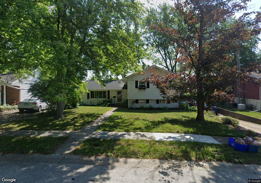
312 Whitefield Rd Springfield, IL 62704
Pasfield Park Place NeighborhoodEstimated Value: $206,000 - $219,418
3
Beds
2
Baths
2,100
Sq Ft
$101/Sq Ft
Est. Value
About This Home
This home is located at 312 Whitefield Rd, Springfield, IL 62704 and is currently estimated at $212,355, approximately $101 per square foot. 312 Whitefield Rd is a home located in Sangamon County with nearby schools including Dubois Elementary School, U.S. Grant Middle School, and Springfield High School.
Ownership History
Date
Name
Owned For
Owner Type
Purchase Details
Closed on
Jun 26, 2009
Current Estimated Value
Purchase Details
Closed on
May 29, 2009
Purchase Details
Closed on
Oct 31, 2008
Purchase Details
Closed on
Jan 31, 2002
Purchase Details
Closed on
Apr 30, 1999
Purchase Details
Closed on
May 12, 1994
Create a Home Valuation Report for This Property
The Home Valuation Report is an in-depth analysis detailing your home's value as well as a comparison with similar homes in the area
Home Values in the Area
Average Home Value in this Area
Purchase History
We collect this data history from publicly available records. To have your information removed, we recommend requesting removal directly through your county’s website.
| Date | Buyer | Sale Price | Title Company |
|---|---|---|---|
| -- | -- | -- | |
| -- | $136,500 | -- | |
| -- | -- | -- | |
| -- | $119,500 | -- | |
| -- | $114,900 | -- | |
| -- | $102,000 | -- |
Source: Public Records
Tax History
| Year | Tax Paid | Tax Assessment Tax Assessment Total Assessment is a certain percentage of the fair market value that is determined by local assessors to be the total taxable value of land and additions on the property. | Land | Improvement |
|---|---|---|---|---|
| 2024 | $4,787 | $62,986 | $9,332 | $53,654 |
| 2023 | $4,556 | $57,532 | $8,524 | $49,008 |
| 2022 | $4,353 | $54,574 | $8,086 | $46,488 |
| 2021 | $4,188 | $52,530 | $7,783 | $44,747 |
| 2020 | $4,106 | $52,609 | $7,795 | $44,814 |
| 2019 | $4,028 | $52,426 | $7,768 | $44,658 |
| 2018 | $3,637 | $49,049 | $7,730 | $41,319 |
| 2017 | $3,555 | $48,415 | $7,630 | $40,785 |
| 2016 | $3,478 | $47,709 | $7,519 | $40,190 |
| 2015 | $3,439 | $47,139 | $7,429 | $39,710 |
| 2014 | $3,370 | $46,835 | $7,381 | $39,454 |
| 2013 | $3,295 | $46,667 | $7,382 | $39,285 |
Source: Public Records
Map
Nearby Homes
- 9 Blackberry Run
- 2118 W Lawrence Ave
- 232 Dickinson Rd
- 2134 W Lawrence Ave
- 1910 Jeanette Ln Unit 3
- 2138 W Lawrence Ave
- 1913 Jeanette Ln Unit 8
- 1901 Jeanette Ln Unit 6
- 1909 Jeanette Ln Unit 4
- 1638 W Capitol Ave
- 509 Rosehill Ave
- 924 Westview Dr
- 524 Rosehill Ave
- 1900 Parkview Dr
- 24 Sunnyside Dr
- 2223 Cardinal Dr
- 12 N Oxford Rd
- 400 S Adelia St
- 917 S Cleveland Ave
- 329 S Park Ave
- 308 Whitefield Rd
- 316 Whitefield Rd
- 304 Whitefield Rd
- 320 Whitefield Rd
- 313 Whitefield Rd
- 309 Whitefield Rd
- 2061 W Monroe St
- 2061 W Monroe St Unit H
- 2061 W Monroe St Unit 7
- 2061 W Monroe St Unit F
- 2061 W Monroe St Unit D
- 2061 W Monroe St Unit 3
- 2061 W Monroe St
- 2061 W Monroe St Unit A
- 2061 W Monroe St Unit 3
- 2061 W Monroe St Unit E OR 5
- 2061 W Monroe St Unit 8
- 2061 W Monroe St Unit 5
- 2061 W Monroe St
- 2061 W Monroe St
Your Personal Tour Guide
Ask me questions while you tour the home.