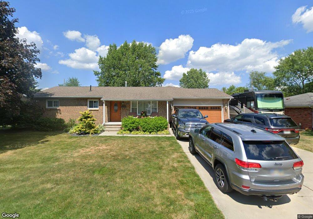
313 Indian Rd Wauseon, OH 43567
Estimated Value: $183,000 - $317,000
About This Home
This home is located at 313 Indian Rd, Wauseon, OH 43567 and is currently estimated at $265,823, approximately $234 per square foot. 313 Indian Rd is a home located in Fulton County with nearby schools including Wauseon Primary School, Wauseon Elementary School, and Wauseon Middle School.
Ownership History
We collect this data history from publicly available records. To have your information removed, we recommend requesting removal directly through your county’s website.
Purchase Details
Home Values in the Area
Average Home Value in this Area
Purchase History
We collect this data history from publicly available records. To have your information removed, we recommend requesting removal directly through your county’s website.
| Date | Buyer | Sale Price | Title Company |
|---|---|---|---|
| -- | -- |
Tax History
We collect this data history from publicly available records. To have your information removed, we recommend requesting removal directly through your county’s website.
| Year | Tax Paid | Tax Assessment Tax Assessment Total Assessment is a certain percentage of the fair market value that is determined by local assessors to be the total taxable value of land and additions on the property. | Land | Improvement |
|---|---|---|---|---|
| 2025 | $4,038 | $83,860 | $10,150 | $73,710 |
| 2024 | $4,038 | $83,860 | $10,150 | $73,710 |
| 2023 | $4,172 | $83,860 | $10,150 | $73,710 |
| 2022 | $3,686 | $63,070 | $8,470 | $54,600 |
| 2021 | $3,880 | $63,070 | $8,470 | $54,600 |
| 2020 | $3,617 | $63,070 | $8,470 | $54,600 |
| 2019 | $3,341 | $57,260 | $8,120 | $49,140 |
| 2018 | $2,915 | $57,260 | $8,120 | $49,140 |
| 2017 | $2,872 | $57,260 | $8,120 | $49,140 |
| 2016 | $2,771 | $49,070 | $8,120 | $40,950 |
| 2015 | $2,604 | $49,070 | $8,120 | $40,950 |
| 2014 | $2,469 | $49,070 | $8,120 | $40,950 |
| 2013 | $2,881 | $52,860 | $8,790 | $44,070 |
Map
- 263 W Chestnut St
- 231 W Chestnut St
- 228 Vine St
- 134 W Lincoln St
- 749 Parkside Dr
- 231 Mckinley St
- 728 Fairway Dr Unit 5
- 203 E Leggett St
- 744 Fairway Dr Unit 29
- 744 Fairway Dr Unit 26
- 794 Fairway Dr
- 312 Cherry St
- 420 N Brunell St
- 203 E Oak St
- 414 Edgewood Dr
- 316 E Oak St
- 525 3rd St
- 150 N Shoop Ave
- 555 Wood St
- 248 W Willow St
Ask me questions while you tour the home.