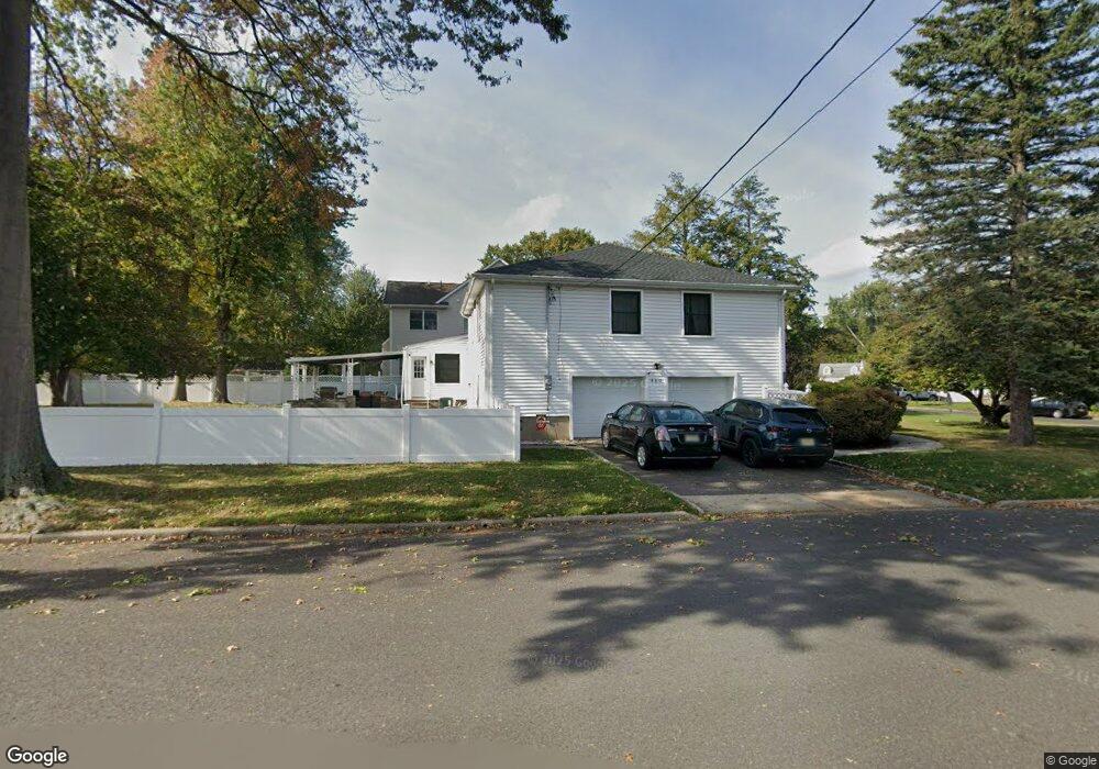
313 Maple St Garwood, NJ 07027
Estimated Value: $727,000
Studio
--
Bath
--
Sq Ft
523
Sq Ft Lot Lot
About This Home
This home is located at 313 Maple St, Garwood, NJ 07027 and is currently estimated at $727,000. 313 Maple St is a home located in Union County with nearby schools including Washington Elementary School, Roosevelt Intermediate School, and Westfield Senior High School.
Ownership History
Date
Name
Owned For
Owner Type
Purchase Details
Closed on
May 14, 2009
Sold by
Fox & Foxx Development Llc
Bought by
Lawson Stephen G
Current Estimated Value
Purchase Details
Closed on
Aug 2, 2007
Sold by
Mazzilli John
Bought by
Fox & Foxx Development Llc
Home Financials for this Owner
Home Financials are based on the most recent Mortgage that was taken out on this home.
Original Mortgage
$275,000
Interest Rate
6.19%
Mortgage Type
Purchase Money Mortgage
Purchase Details
Closed on
Jun 13, 2007
Sold by
Simone Maria and Simone Mary
Bought by
Mazzilli John
Home Financials for this Owner
Home Financials are based on the most recent Mortgage that was taken out on this home.
Original Mortgage
$275,000
Interest Rate
6.19%
Mortgage Type
Purchase Money Mortgage
Create a Home Valuation Report for This Property
The Home Valuation Report is an in-depth analysis detailing your home's value as well as a comparison with similar homes in the area
Home Values in the Area
Average Home Value in this Area
Purchase History
| Date | Buyer | Sale Price | Title Company |
|---|---|---|---|
| Lawson Stephen G | $861,275 | None Available | |
| Fox & Foxx Development Llc | $460,000 | None Available | |
| Mazzilli John | $375,000 | Multiple |
Source: Public Records
Mortgage History
| Date | Status | Borrower | Loan Amount |
|---|---|---|---|
| Previous Owner | Mazzilli John | $275,000 |
Source: Public Records
Tax History
| Year | Tax Paid | Tax Assessment Tax Assessment Total Assessment is a certain percentage of the fair market value that is determined by local assessors to be the total taxable value of land and additions on the property. | Land | Improvement |
|---|---|---|---|---|
| 2025 | $42 | $1,500 | $1,500 | -- |
| 2024 | $41 | $1,500 | $1,500 | $0 |
| 2023 | $41 | $1,500 | $1,500 | $0 |
| 2022 | $39 | $1,500 | $1,500 | $0 |
| 2021 | $38 | $1,500 | $1,500 | $0 |
| 2020 | $38 | $1,500 | $1,500 | $0 |
| 2019 | $132 | $1,300 | $1,300 | $0 |
| 2018 | $129 | $1,300 | $1,300 | $0 |
| 2017 | $126 | $1,300 | $1,300 | $0 |
| 2016 | $122 | $1,300 | $1,300 | $0 |
| 2015 | $121 | $1,300 | $1,300 | $0 |
| 2014 | $117 | $1,300 | $1,300 | $0 |
Source: Public Records
Map
Nearby Homes
- 214 Maple St
- 438 3rd Ave
- 435 3rd Ave
- 529 Benson Place
- 5 Liberty Ct
- 484 4th Ave Unit 9
- 400 Salter Place
- 312 3rd Ave
- 312 Wells St
- 1008 Cranford Ave
- 629 Tremont Ave
- 564 Spruce Ave
- 634 Lenox Ave
- 95 3rd Ave
- 512 Gallows Hill Rd
- 314 South Ave E Unit 2
- 820 E Broad St
- 603 Brookside Place
- 424 Saint Marks Ave
- 4 Indian Spring Rd
Your Personal Tour Guide
Ask me questions while you tour the home.