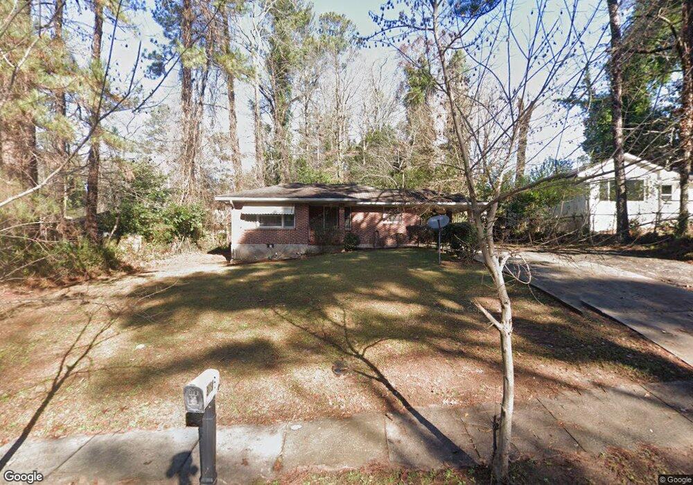
3136 Mcafee Rd Decatur, GA 30032
Estimated Value: $179,000 - $203,000
About This Home
This home is located at 3136 Mcafee Rd, Decatur, GA 30032 and is currently estimated at $189,143, approximately $192 per square foot. 3136 Mcafee Rd is a home located in DeKalb County with nearby schools including Snapfinger Elementary School, Columbia Middle School, and Columbia High School.
Ownership History
We collect this data history from publicly available records. To have your information removed, we recommend requesting removal directly through your county’s website.
Purchase Details
Purchase Details
Home Financials for this Owner
Home Financials are based on the most recent Mortgage that was taken out on this home.Home Values in the Area
Average Home Value in this Area
Purchase History
We collect this data history from publicly available records. To have your information removed, we recommend requesting removal directly through your county’s website.
| Date | Buyer | Sale Price | Title Company |
|---|---|---|---|
| -- | -- | ||
| $62,000 | -- |
Mortgage History
We collect this data history from publicly available records. To have your information removed, we recommend requesting removal directly through your county’s website.
| Date | Status | Borrower | Loan Amount |
|---|---|---|---|
| Previous Owner | $57,000 |
Tax History
We collect this data history from publicly available records. To have your information removed, we recommend requesting removal directly through your county’s website.
| Year | Tax Paid | Tax Assessment Tax Assessment Total Assessment is a certain percentage of the fair market value that is determined by local assessors to be the total taxable value of land and additions on the property. | Land | Improvement |
|---|---|---|---|---|
| 2025 | $3,370 | $66,560 | $23,296 | $43,264 |
| 2024 | $3,472 | $69,000 | $23,320 | $45,680 |
| 2023 | $3,472 | $60,040 | $23,320 | $36,720 |
| 2022 | $2,557 | $50,360 | $13,320 | $37,040 |
| 2021 | $2,389 | $46,520 | $13,320 | $33,200 |
| 2020 | $2,099 | $39,920 | $11,400 | $28,520 |
| 2019 | $2,090 | $39,720 | $11,400 | $28,320 |
| 2018 | $1,136 | $24,000 | $11,400 | $12,600 |
| 2017 | $1,045 | $15,840 | $3,040 | $12,800 |
| 2016 | $1,211 | $19,560 | $3,040 | $16,520 |
| 2014 | $878 | $11,720 | $3,040 | $8,680 |
Map
- 1968 Rosewood Rd
- 1997 Glendale Dr
- 1973 Glendale Dr
- 1950 Glendale Dr
- 1911 Rosewood Rd
- 1929 Bandera Dr
- 1914 Derrill Dr
- 1954 Wildwood Dr
- 1994 Shamrock Dr
- 2118 Glendale Dr
- 1881 Derrill Dr
- 2125 Glendale Dr
- 1864 Ridgeland Dr
- 1903 S Columbia Place
- 1863 Ridgeland Dr
- 1979 Creekside Ct
- 1908 S Columbia Place
- 2995 Katherine Valley Rd
- 1964 Pinedale Place
- 2009 Oak Park Ln Unit 2009
- 3142 Mcafee Rd
- 3130 Mcafee Rd
- 1996 Rosewood Rd
- 2001 Laurel Ln
- 1990 Rosewood Rd
- 1997 Laurel Ln
- 1991 Laurel Ln
- 1984 Rosewood Rd
- 3133 Mcafee Rd
- 3137 Mcafee Rd
- 1985 Laurel Ln
- 2003 Rosewood Rd
- 3145 Mcafee Rd
- 1978 Rosewood Rd
- 1995 Rosewood Rd
- 3151 Mcafee Rd
- 1979 Laurel Ln
- 3121 Mcafee Rd
- 2000 Laurel Ln
- 2018 Rosewood Rd
Ask me questions while you tour the home.