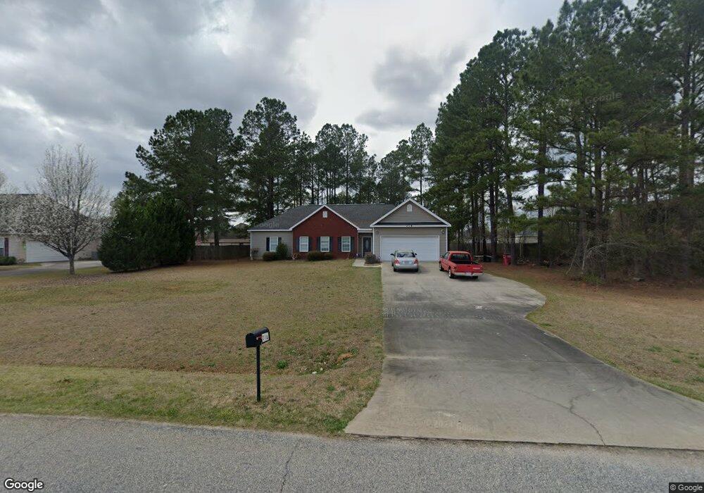
314 Amanda Dr Macon, GA 31216
Estimated Value: $249,009 - $297,000
About This Home
This home is located at 314 Amanda Dr, Macon, GA 31216 and is currently estimated at $277,752, approximately $147 per square foot. 314 Amanda Dr is a home located in Bibb County with nearby schools including Heard Elementary School, Rutland Middle School, and Rutland High School.
Ownership History
We collect this data history from publicly available records. To have your information removed, we recommend requesting removal directly through your county’s website.
Purchase Details
Home Financials for this Owner
Home Financials are based on the most recent Mortgage that was taken out on this home.Purchase Details
Purchase History
We collect this data history from publicly available records. To have your information removed, we recommend requesting removal directly through your county’s website.
| Date | Buyer | Sale Price | Title Company |
|---|---|---|---|
| $156,900 | None Available | ||
| $156,900 | -- |
Mortgage History
We collect this data history from publicly available records. To have your information removed, we recommend requesting removal directly through your county’s website.
| Date | Status | Borrower | Loan Amount |
|---|---|---|---|
| Open | $1,333,653 |
Tax History
We collect this data history from publicly available records. To have your information removed, we recommend requesting removal directly through your county’s website.
| Year | Tax Paid | Tax Assessment Tax Assessment Total Assessment is a certain percentage of the fair market value that is determined by local assessors to be the total taxable value of land and additions on the property. | Land | Improvement |
|---|---|---|---|---|
| 2025 | $2,515 | $102,330 | $7,360 | $94,970 |
| 2024 | $2,476 | $97,478 | $7,360 | $90,118 |
| 2023 | $1,947 | $76,681 | $7,360 | $69,321 |
| 2022 | $2,648 | $76,481 | $9,200 | $67,281 |
| 2021 | $2,535 | $66,705 | $9,200 | $57,505 |
| 2020 | $2,295 | $59,114 | $7,360 | $51,754 |
| 2019 | $2,201 | $56,239 | $7,360 | $48,879 |
| 2018 | $3,551 | $56,239 | $7,360 | $48,879 |
| 2017 | $1,892 | $50,489 | $7,360 | $43,129 |
| 2016 | $1,747 | $50,489 | $7,360 | $43,129 |
| 2015 | $2,472 | $50,489 | $7,360 | $43,129 |
| 2014 | $2,476 | $50,489 | $7,360 | $43,129 |
Map
- 297 Amanda Dr
- 515 Amanda Way
- 201 Liberty Trace
- 6045 Cara Dr
- 6629 Hawkinsville Rd
- 5910 Houston Rd
- 3150 Holleman Dr
- 6432 Ponderosa Dr
- 6266 Houston Rd
- 4068 Liberty Estates Dr
- 3038 Debra Ann Dr
- 308 Ellis Ct
- 516 Beacham Ct W
- 189 Stonefield Cir
- 2154 Allen Rd
- 3290 Bridgewood Dr
- 3294 Bridgewood Dr
- 7070 Sofkee Place
- 2165 Griffin Rd
- 3533 Bridgewood Dr
Ask me questions while you tour the home.