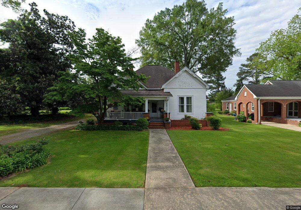
315 Cedar St Carrollton, GA 30117
Estimated Value: $239,295 - $314,000
3
Beds
2
Baths
1,744
Sq Ft
$161/Sq Ft
Est. Value
About This Home
This home is located at 315 Cedar St, Carrollton, GA 30117 and is currently estimated at $280,574, approximately $160 per square foot. 315 Cedar St is a home located in Carroll County with nearby schools including Carrollton Elementary School, Carrollton Upper Elementary School, and Carrollton Middle School.
Ownership History
Date
Name
Owned For
Owner Type
Purchase Details
Closed on
Jul 5, 2024
Sold by
Almon Ronald C
Bought by
Almon William C
Current Estimated Value
Purchase Details
Closed on
Aug 27, 2019
Sold by
Almon William C
Bought by
548 Newnan Llc
Purchase Details
Closed on
Apr 3, 2003
Sold by
Almon Charles H
Bought by
Almon William C and Almon Ronald C
Purchase Details
Closed on
Apr 1, 1976
Bought by
Almon Charles H
Create a Home Valuation Report for This Property
The Home Valuation Report is an in-depth analysis detailing your home's value as well as a comparison with similar homes in the area
Home Values in the Area
Average Home Value in this Area
Purchase History
| Date | Buyer | Sale Price | Title Company |
|---|---|---|---|
| Almon William C | $174,500 | -- | |
| 548 Newnan Llc | $835,000 | -- | |
| Almon William C | -- | -- | |
| Almon Charles H | -- | -- |
Source: Public Records
Tax History
| Year | Tax Paid | Tax Assessment Tax Assessment Total Assessment is a certain percentage of the fair market value that is determined by local assessors to be the total taxable value of land and additions on the property. | Land | Improvement |
|---|---|---|---|---|
| 2025 | $2,667 | $100,702 | $20,189 | $80,513 |
| 2024 | $2,752 | $100,702 | $20,189 | $80,513 |
| 2023 | $2,752 | $93,337 | $20,189 | $73,148 |
| 2022 | $2,105 | $72,123 | $13,460 | $58,663 |
| 2021 | $1,758 | $60,226 | $9,970 | $50,256 |
| 2020 | $1,617 | $55,335 | $9,970 | $45,365 |
| 2019 | $1,549 | $52,509 | $10,774 | $41,735 |
| 2018 | $1,421 | $47,473 | $10,774 | $36,699 |
| 2017 | $1,428 | $47,473 | $10,774 | $36,699 |
| 2016 | $1,436 | $47,473 | $10,774 | $36,699 |
| 2015 | $958 | $31,003 | $7,812 | $23,192 |
| 2014 | $962 | $31,004 | $7,812 | $23,192 |
Source: Public Records
Map
Nearby Homes
- 322 Cedar St
- 509 Cedar St
- 230 West Ave
- 230 West Ave Unit 5
- 201 Stewart St
- 320 West Ave
- 215 West Ave
- 209 Hill Dr
- 541 N White St Unit 12
- 541 N White St Unit 11
- 110 Town Walk Ln
- 0 Ward St Unit 10390499
- 301 Bradley A305 St
- 111 Riversong Rd (Tract 26) Unit 55
- 0 Mcadams St Unit 151781
- 301 Bradley St Unit C4
- 103 Deese Ct
- 1515 Pleasant Ridge Rd
- 161 Springwood Dr
- 406 Harmon Ave
- 309 Cedar St
- 323 Cedar St
- 305 Cedar St
- 301 Cedar St
- 304 Cedar St Unit D
- 304 Cedar St Unit C
- 536 Newnan St
- 316 Cedar St
- 536 Newnan St
- 302 Cedar St Unit A
- 302 Cedar St Unit B
- 302 Cedar St Unit C
- 409 Cedar St
- 306 Cedar St Unit B
- 306 Cedar St
- 402 Cedar St
- 75 Bankhead Hwy Unit B
- 219 Cedar St
- 116 Jones St
- 220 Cedar St
Your Personal Tour Guide
Ask me questions while you tour the home.