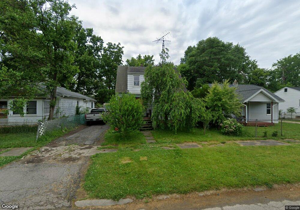
3152 Woodrow Ave Flint, MI 48506
Potter Longway NeighborhoodEstimated Value: $44,000 - $68,000
3
Beds
1
Bath
1,005
Sq Ft
$56/Sq Ft
Est. Value
About This Home
This home is located at 3152 Woodrow Ave, Flint, MI 48506 and is currently estimated at $56,359, approximately $56 per square foot. 3152 Woodrow Ave is a home located in Genesee County with nearby schools including Potter School, Richfield Public School Academy, and Richfield Early Learning Center.
Ownership History
Date
Name
Owned For
Owner Type
Purchase Details
Closed on
Dec 11, 2024
Sold by
Massie Lester
Bought by
Anderson Michael
Current Estimated Value
Purchase Details
Closed on
Apr 25, 2023
Sold by
Stewart Valerie
Bought by
Massie Lester and Massie Bonnie
Purchase Details
Closed on
Sep 1, 2020
Sold by
Massie Lester M and Massie Bonnie J
Bought by
Massie Lester M and Massie Bonnie
Purchase Details
Closed on
Apr 16, 2003
Sold by
Petty Scott Allen and Petty Rebecca
Bought by
Massie Lester M
Create a Home Valuation Report for This Property
The Home Valuation Report is an in-depth analysis detailing your home's value as well as a comparison with similar homes in the area
Home Values in the Area
Average Home Value in this Area
Purchase History
We collect this data history from publicly available records. To have your information removed, we recommend requesting removal directly through your county’s website.
| Date | Buyer | Sale Price | Title Company |
|---|---|---|---|
| Anderson Michael | $23,000 | -- | |
| Massie Lester | -- | None Listed On Document | |
| Massie Lester M | -- | None Available | |
| Massie Lester M | $24,000 | -- |
Source: Public Records
Tax History
| Year | Tax Paid | Tax Assessment Tax Assessment Total Assessment is a certain percentage of the fair market value that is determined by local assessors to be the total taxable value of land and additions on the property. | Land | Improvement |
|---|---|---|---|---|
| 2025 | $895 | $23,800 | $0 | $0 |
| 2024 | $835 | $21,400 | $0 | $0 |
| 2023 | $820 | $16,800 | $0 | $0 |
| 2022 | $0 | $13,200 | $0 | $0 |
| 2021 | $829 | $12,300 | $0 | $0 |
| 2020 | $768 | $8,900 | $0 | $0 |
| 2019 | $756 | $7,500 | $0 | $0 |
| 2018 | $738 | $7,400 | $0 | $0 |
| 2017 | $918 | $0 | $0 | $0 |
| 2016 | $912 | $0 | $0 | $0 |
| 2015 | -- | $0 | $0 | $0 |
| 2014 | -- | $0 | $0 | $0 |
| 2012 | -- | $13,700 | $0 | $0 |
Source: Public Records
Map
Nearby Homes
- 3149 Whittier Ave
- 3232 Dale Ave
- 2701 Branch Rd
- 3137 Davison Rd
- 3413 Churchill Ave
- 3018 Dakota Ave
- 3243 Dakota Ave
- 3016 Oklahoma Ave
- 3238 Leith St
- 3614 Holly Ave
- 2415 N Dort Hwy
- 2613 Woodrow Ave
- 3617 Davison Rd
- 3600 Davison Rd
- 2212 Hoff St
- 2601 Bennett Ave
- 2426 Hoff St
- 2616 Maryland Ave
- 3421 Brewster St
- 2321 Levern St
- 3148 Woodrow Ave
- 3156 Woodrow Ave
- 3144 Woodrow Ave
- 3145 Whittier Ave
- 3140 Woodrow Ave
- 3202 Woodrow Ave
- 3153 Woodrow Ave
- 3136 Woodrow Ave
- 3133 Whittier Ave
- 3147 Woodrow Ave
- 3137 Woodrow Ave
- 3201 Whittier Ave
- 3129 Whittier Ave
- 3208 Woodrow Ave
- 3133 Woodrow Ave
- 3132 Woodrow Ave
- 3207 Whittier Ave
- 3201 Woodrow Ave
- 3125 Whittier Ave
- 3210 Woodrow Ave
Your Personal Tour Guide
Ask me questions while you tour the home.