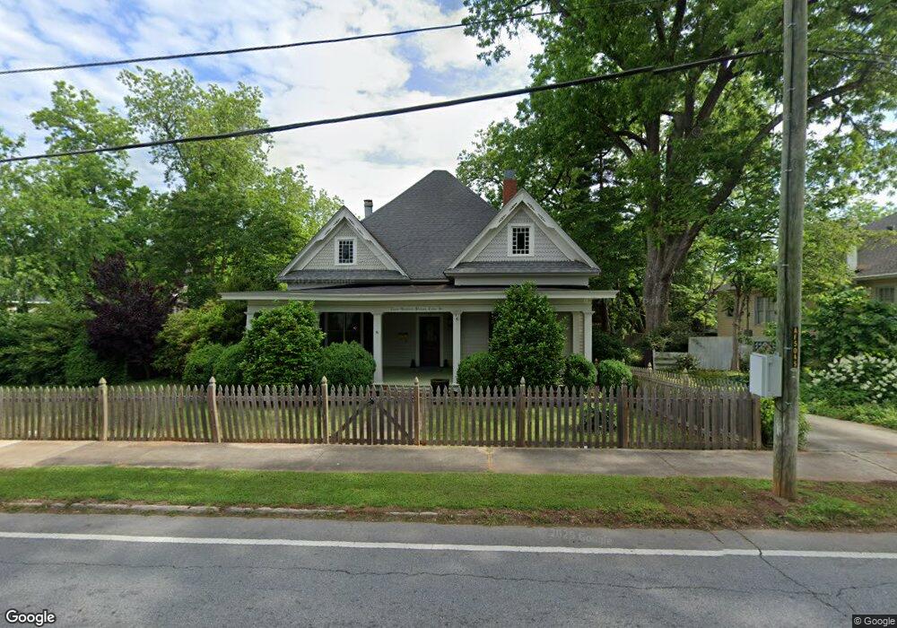
316 Cedar St Carrollton, GA 30117
Estimated Value: $361,000 - $386,976
3
Beds
2
Baths
2,016
Sq Ft
$184/Sq Ft
Est. Value
About This Home
This home is located at 316 Cedar St, Carrollton, GA 30117 and is currently estimated at $369,994, approximately $183 per square foot. 316 Cedar St is a home located in Carroll County with nearby schools including Carrollton Elementary School, Carrollton Upper Elementary School, and Carrollton Middle School.
Ownership History
Date
Name
Owned For
Owner Type
Purchase Details
Closed on
Jul 28, 2006
Sold by
Austin William E
Bought by
Banford Heidi
Current Estimated Value
Home Financials for this Owner
Home Financials are based on the most recent Mortgage that was taken out on this home.
Original Mortgage
$128,000
Outstanding Balance
$75,564
Interest Rate
6.74%
Mortgage Type
New Conventional
Estimated Equity
$294,430
Purchase Details
Closed on
Aug 11, 2003
Sold by
Austin Wm E and Austin Norma J
Bought by
Austin William E and Austin Norma J
Purchase Details
Closed on
Jan 16, 1990
Bought by
Austin
Create a Home Valuation Report for This Property
The Home Valuation Report is an in-depth analysis detailing your home's value as well as a comparison with similar homes in the area
Home Values in the Area
Average Home Value in this Area
Purchase History
We collect this data history from publicly available records. To have your information removed, we recommend requesting removal directly through your county’s website.
| Date | Buyer | Sale Price | Title Company |
|---|---|---|---|
| Banford Heidi | $160,000 | -- | |
| Austin William E | -- | -- | |
| Austin | $92,000 | -- |
Source: Public Records
Mortgage History
We collect this data history from publicly available records. To have your information removed, we recommend requesting removal directly through your county’s website.
| Date | Status | Borrower | Loan Amount |
|---|---|---|---|
| Open | Banford Heidi | $128,000 |
Source: Public Records
Tax History
| Year | Tax Paid | Tax Assessment Tax Assessment Total Assessment is a certain percentage of the fair market value that is determined by local assessors to be the total taxable value of land and additions on the property. | Land | Improvement |
|---|---|---|---|---|
| 2025 | $3,362 | $149,836 | $34,318 | $115,518 |
| 2024 | $3,467 | $149,836 | $34,318 | $115,518 |
| 2023 | $3,467 | $139,516 | $34,318 | $105,198 |
| 2022 | $2,155 | $84,405 | $22,879 | $61,526 |
| 2021 | $1,823 | $69,959 | $16,947 | $53,012 |
| 2020 | $1,706 | $64,812 | $16,947 | $47,865 |
| 2019 | $1,631 | $60,923 | $16,947 | $43,976 |
| 2018 | $1,568 | $57,259 | $16,947 | $40,312 |
| 2017 | $1,576 | $57,259 | $16,947 | $40,312 |
| 2016 | $1,585 | $57,259 | $16,947 | $40,312 |
| 2015 | $1,669 | $59,406 | $13,656 | $45,751 |
| 2014 | $1,676 | $59,407 | $13,656 | $45,751 |
Source: Public Records
Map
Nearby Homes
- 322 Cedar St
- 410 Cedar St
- 230 West Ave
- 230 West Ave Unit 5
- 320 West Ave
- 215 West Ave
- 541 N White St Unit 12
- 541 N White St Unit 11
- 541 N White St
- 110 Town Walk Ln
- 0 Ward St Unit 10390499
- 111 Riversong Rd (Tract 26) Unit 55
- 0 Mcadams St Unit 151781
- 103 Deese Ct
- 301 Bradley A305 St
- 301 Bradley St Unit C4
- 1515 Pleasant Ridge Rd
- 161 Springwood Dr
- 2990 US Highway 27 Unit 230
- 406 Harmon Ave
- 304 Cedar St Unit D
- 304 Cedar St Unit C
- 305 Cedar St
- 309 Cedar St
- 306 Cedar St Unit B
- 306 Cedar St
- 302 Cedar St Unit A
- 302 Cedar St Unit B
- 302 Cedar St Unit C
- 315 Cedar St
- 323 Cedar St
- 402 Cedar St
- 301 Cedar St
- 220 Cedar St
- 219 Cedar St
- 409 Cedar St
- 216 Cedar St
- 215 Cedar St
- 116 Jones St
- 536 Newnan St
Your Personal Tour Guide
Ask me questions while you tour the home.