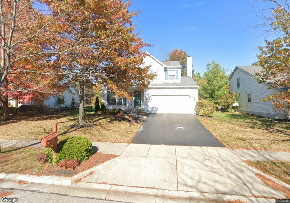
317 Pecan Ct Delaware, OH 43015
Estimated Value: $396,000 - $410,000
4
Beds
3
Baths
1,821
Sq Ft
$221/Sq Ft
Est. Value
About This Home
This home is located at 317 Pecan Ct, Delaware, OH 43015 and is currently estimated at $402,321, approximately $220 per square foot. 317 Pecan Ct is a home located in Delaware County with nearby schools including Laura Woodward Elementary School, John C. Dempsey Middle School, and Rutherford B. Hayes High School.
Ownership History
Date
Name
Owned For
Owner Type
Purchase Details
Closed on
Jun 6, 2012
Sold by
Langton Keith D and Langton Catherine J
Bought by
Langton Keith David and Langton Catherine Jane
Current Estimated Value
Purchase Details
Closed on
Jun 24, 2004
Sold by
Davis Michael L and Davis Angela R
Bought by
Langton Keith D and Langton Catherine J
Home Financials for this Owner
Home Financials are based on the most recent Mortgage that was taken out on this home.
Original Mortgage
$172,375
Interest Rate
5.25%
Mortgage Type
Purchase Money Mortgage
Purchase Details
Closed on
Nov 6, 1998
Sold by
M/I Schottenstein Homes
Bought by
Davis Michael L and Davis Angela R
Home Financials for this Owner
Home Financials are based on the most recent Mortgage that was taken out on this home.
Original Mortgage
$136,250
Interest Rate
6.72%
Mortgage Type
New Conventional
Purchase Details
Closed on
Apr 2, 1998
Sold by
Delanco
Bought by
M/I Schottenstein Homes Inc
Create a Home Valuation Report for This Property
The Home Valuation Report is an in-depth analysis detailing your home's value as well as a comparison with similar homes in the area
Home Values in the Area
Average Home Value in this Area
Purchase History
We collect this data history from publicly available records. To have your information removed, we recommend requesting removal directly through your county’s website.
| Date | Buyer | Sale Price | Title Company |
|---|---|---|---|
| Langton Keith David | -- | None Available | |
| Langton Keith D | -- | -- | |
| Davis Michael L | $161,410 | -- | |
| M/I Schottenstein Homes Inc | $30,000 | -- |
Source: Public Records
Mortgage History
We collect this data history from publicly available records. To have your information removed, we recommend requesting removal directly through your county’s website.
| Date | Status | Borrower | Loan Amount |
|---|---|---|---|
| Previous Owner | Langton Keith D | $172,375 | |
| Previous Owner | Davis Michael L | $136,250 |
Source: Public Records
Tax History
| Year | Tax Paid | Tax Assessment Tax Assessment Total Assessment is a certain percentage of the fair market value that is determined by local assessors to be the total taxable value of land and additions on the property. | Land | Improvement |
|---|---|---|---|---|
| 2025 | $5,368 | $107,910 | $27,130 | $80,780 |
| 2024 | $5,095 | $107,910 | $27,130 | $80,780 |
| 2023 | $5,104 | $107,910 | $27,130 | $80,780 |
| 2022 | $4,448 | $81,620 | $17,710 | $63,910 |
| 2021 | $4,547 | $81,620 | $17,710 | $63,910 |
| 2020 | $4,599 | $81,620 | $17,710 | $63,910 |
| 2019 | $4,313 | $69,370 | $16,100 | $53,270 |
| 2018 | $4,373 | $69,370 | $16,100 | $53,270 |
| 2017 | $3,873 | $59,050 | $13,300 | $45,750 |
| 2016 | $3,396 | $59,050 | $13,300 | $45,750 |
| 2015 | $3,415 | $59,050 | $13,300 | $45,750 |
| 2014 | $3,470 | $59,050 | $13,300 | $45,750 |
| 2013 | $3,489 | $59,050 | $13,300 | $45,750 |
Source: Public Records
Map
Nearby Homes
- 232 Beech Dr
- 240 Dogwood Dr
- 233 Dogwood Dr
- 22 Tabilore Loop
- 40 Tabilore Loop
- 108 Dogwood Dr
- 233 Devon Rd
- 1490 Stratford Rd
- 1410 Stratford Rd
- 840 River Oaks Dr
- 11 Oak Glen Dr
- 45 Elba Ct
- 1211 Rivercrest Dr S Unit E
- 233 Fairway Rd
- 1077 Ruth Crossing
- 722 Belleview Ct
- 1011 Skipton Loop
- 306 Passina Rd
- 449 Bunty Station Rd
- 194 Bucklewell Dr
Your Personal Tour Guide
Ask me questions while you tour the home.