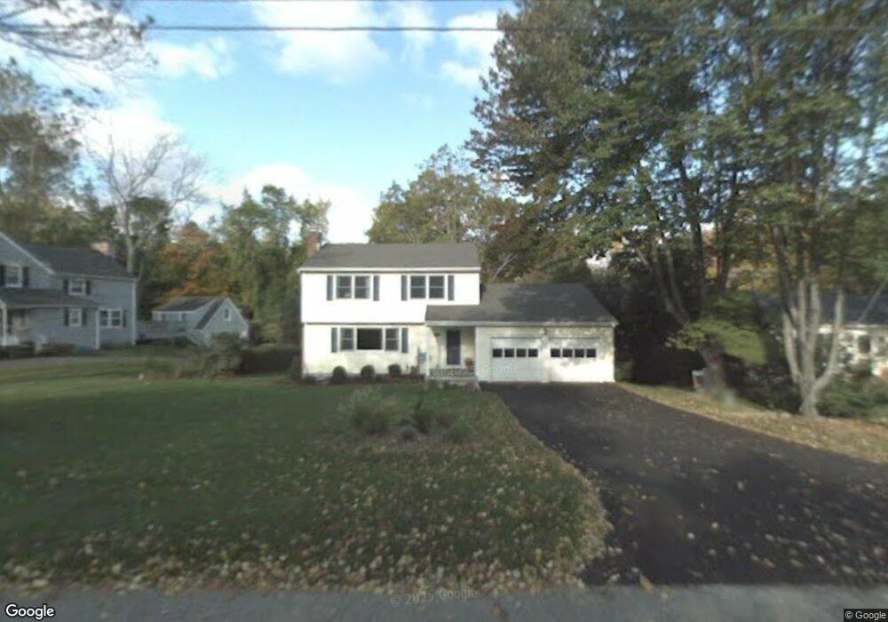
318 Dunnlea Rd Fairfield, CT 06824
University NeighborhoodEstimated Value: $1,411,527 - $1,983,000
About This Home
This home is located at 318 Dunnlea Rd, Fairfield, CT 06824 and is currently estimated at $1,567,632, approximately $698 per square foot. 318 Dunnlea Rd is a home located in Fairfield County with nearby schools including Riverfield Elementary School, Roger Ludlowe Middle School, and Fairfield Ludlowe High School.
Ownership History
We collect this data history from publicly available records. To have your information removed, we recommend requesting removal directly through your county’s website.
Purchase Details
Home Financials for this Owner
Home Financials are based on the most recent Mortgage that was taken out on this home.Home Values in the Area
Average Home Value in this Area
Purchase History
We collect this data history from publicly available records. To have your information removed, we recommend requesting removal directly through your county’s website.
| Date | Buyer | Sale Price | Title Company |
|---|---|---|---|
| $680,000 | -- | ||
| $680,000 | -- |
Mortgage History
We collect this data history from publicly available records. To have your information removed, we recommend requesting removal directly through your county’s website.
| Date | Status | Borrower | Loan Amount |
|---|---|---|---|
| Open | $194,000 | ||
| Open | $524,000 | ||
| Closed | $544,000 |
Tax History
We collect this data history from publicly available records. To have your information removed, we recommend requesting removal directly through your county’s website.
| Year | Tax Paid | Tax Assessment Tax Assessment Total Assessment is a certain percentage of the fair market value that is determined by local assessors to be the total taxable value of land and additions on the property. | Land | Improvement |
|---|---|---|---|---|
| 2025 | $13,810 | $486,430 | $246,750 | $239,680 |
| 2024 | $13,571 | $486,430 | $246,750 | $239,680 |
| 2023 | $13,382 | $486,430 | $246,750 | $239,680 |
| 2022 | $13,250 | $486,430 | $246,750 | $239,680 |
| 2021 | $13,124 | $486,430 | $246,750 | $239,680 |
| 2020 | $13,945 | $520,520 | $244,160 | $276,360 |
| 2019 | $13,945 | $520,520 | $244,160 | $276,360 |
| 2018 | $12,418 | $471,100 | $244,160 | $226,940 |
| 2017 | $12,164 | $471,100 | $244,160 | $226,940 |
| 2016 | $11,989 | $471,100 | $244,160 | $226,940 |
| 2015 | $12,300 | $496,160 | $257,110 | $239,050 |
| 2014 | $11,773 | $482,510 | $257,110 | $225,400 |
Map
- 240 Henry St
- 200 Henry St
- 170 Dunnlea Rd
- 63 Henry St
- 647 Bronson Rd
- 12 Sconset Dr
- 147 Carriage Dr
- 211 High Meadow Rd
- 329 Bronson Rd
- 161 Sherwood Dr
- 164 Ludlowe Rd
- 385 Unquowa Rd Unit 385
- 464 Round Hill Rd
- 245 Unquowa Rd Unit 44
- 245 Unquowa Rd Unit 126
- 245 Unquowa Rd Unit 27
- 240 N Cedar Rd
- 844 Mill Hill Terrace
- 280 Mill Hill Rd
- 79 Fairfield Place
Ask me questions while you tour the home.