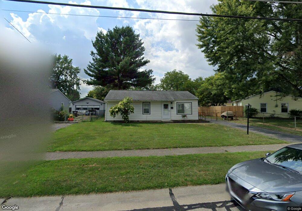
3187 Hyannis Dr Cincinnati, OH 45251
Estimated Value: $149,000 - $182,000
3
Beds
1
Bath
1,014
Sq Ft
$165/Sq Ft
Est. Value
About This Home
This home is located at 3187 Hyannis Dr, Cincinnati, OH 45251 and is currently estimated at $167,594, approximately $165 per square foot. 3187 Hyannis Dr is a home located in Hamilton County with nearby schools including Taylor Elementary School, Pleasant Run Elementary School, and Pleasant Run Middle School.
Ownership History
Date
Name
Owned For
Owner Type
Purchase Details
Closed on
Sep 30, 1994
Sold by
Nichols Ronald G and Nichols Mary J
Bought by
Witt Terry and Witt Rhonda L
Current Estimated Value
Home Financials for this Owner
Home Financials are based on the most recent Mortgage that was taken out on this home.
Original Mortgage
$49,000
Interest Rate
8.6%
Create a Home Valuation Report for This Property
The Home Valuation Report is an in-depth analysis detailing your home's value as well as a comparison with similar homes in the area
Home Values in the Area
Average Home Value in this Area
Purchase History
| Date | Buyer | Sale Price | Title Company |
|---|---|---|---|
| Witt Terry | -- | -- |
Source: Public Records
Mortgage History
| Date | Status | Borrower | Loan Amount |
|---|---|---|---|
| Previous Owner | Witt Terry | $49,000 |
Source: Public Records
Tax History
| Year | Tax Paid | Tax Assessment Tax Assessment Total Assessment is a certain percentage of the fair market value that is determined by local assessors to be the total taxable value of land and additions on the property. | Land | Improvement |
|---|---|---|---|---|
| 2025 | $2,088 | $36,033 | $8,222 | $27,811 |
| 2023 | $1,950 | $36,033 | $8,222 | $27,811 |
| 2022 | $1,726 | $25,988 | $7,249 | $18,739 |
| 2021 | $1,714 | $25,988 | $7,249 | $18,739 |
| 2020 | $1,728 | $25,988 | $7,249 | $18,739 |
| 2019 | $1,497 | $20,958 | $5,845 | $15,113 |
| 2018 | $1,344 | $20,958 | $5,845 | $15,113 |
| 2017 | $1,276 | $20,958 | $5,845 | $15,113 |
| 2016 | $1,280 | $20,762 | $5,901 | $14,861 |
| 2015 | $1,291 | $20,762 | $5,901 | $14,861 |
| 2014 | $1,293 | $20,762 | $5,901 | $14,861 |
| 2013 | $1,295 | $21,855 | $6,213 | $15,642 |
Source: Public Records
Map
Nearby Homes
- 3113 Laverne Dr
- 3211 Heritage Square Dr
- 3192 Elkhorn Dr
- 3225 Heritage Square Dr
- 9620 Crosley Farm Dr
- 3123 Niagara St
- 3111 Niagara St
- 3120 Birchway Dr
- 3080 Aries Ct
- 9642 Crosley Farm Dr
- 2937 Hyannis Dr
- 3013 Niagara St
- 9503 Haddington Ct
- 9710 Loralinda Dr
- 2974 Libra Ln
- 2934 Windsong Dr
- 2909 Glenaire Dr
- 3287 Niagara St
- 2866 Windsong Dr
- 9561 Trafalgar Ct
- 3175 Hyannis Dr
- 9490 Loralinda Dr
- 3163 Hyannis Dr
- 3182 Glenaire Dr
- 3168 Glenaire Dr
- 9466 Loralinda Dr
- 3186 Hyannis Dr
- 3174 Hyannis Dr
- 3156 Glenaire Dr
- 9510 Loralinda Dr
- 3151 Hyannis Dr
- 3162 Hyannis Dr
- 3142 Glenaire Dr
- 9491 Loralinda Dr
- 9483 Loralinda Dr
- 9471 Loralinda Dr
- 3137 Hyannis Dr
- 9501 Loralinda Dr
- 3150 Hyannis Dr
- 9461 Loralinda Dr
Your Personal Tour Guide
Ask me questions while you tour the home.