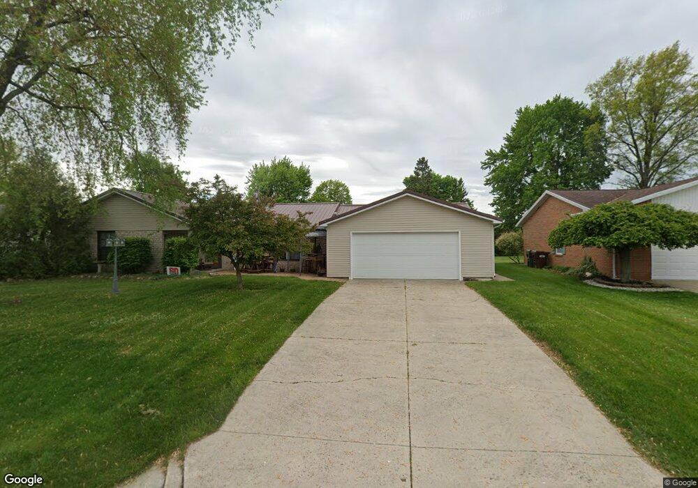
319 Brett Ln Spencerville, OH 45887
Estimated Value: $176,000 - $204,000
3
Beds
2
Baths
1,708
Sq Ft
$110/Sq Ft
Est. Value
About This Home
This home is located at 319 Brett Ln, Spencerville, OH 45887 and is currently estimated at $187,986, approximately $110 per square foot. 319 Brett Ln is a home located in Allen County with nearby schools including Spencerville Elementary School, Spencerville Middle School, and Spencerville High School.
Ownership History
Date
Name
Owned For
Owner Type
Purchase Details
Closed on
Mar 27, 1995
Sold by
Barnes Darrell
Bought by
Clum Spencer and Clum Patricia
Current Estimated Value
Home Financials for this Owner
Home Financials are based on the most recent Mortgage that was taken out on this home.
Original Mortgage
$54,000
Interest Rate
8.82%
Mortgage Type
New Conventional
Purchase Details
Closed on
May 27, 1994
Sold by
Golden Albert D
Bought by
Barnes Darrell L and Barnes Maxine A
Purchase Details
Closed on
Aug 22, 1986
Bought by
Golden Albert D
Create a Home Valuation Report for This Property
The Home Valuation Report is an in-depth analysis detailing your home's value as well as a comparison with similar homes in the area
Purchase History
| Date | Buyer | Sale Price | Title Company |
|---|---|---|---|
| Clum Spencer | $74,200 | -- | |
| Barnes Darrell L | $18,000 | -- | |
| Golden Albert D | $53,500 | -- |
Source: Public Records
Mortgage History
| Date | Status | Borrower | Loan Amount |
|---|---|---|---|
| Closed | Clum Spencer | $54,000 |
Source: Public Records
Tax History
| Year | Tax Paid | Tax Assessment Tax Assessment Total Assessment is a certain percentage of the fair market value that is determined by local assessors to be the total taxable value of land and additions on the property. | Land | Improvement |
|---|---|---|---|---|
| 2024 | $1,546 | $46,800 | $8,510 | $38,290 |
| 2023 | $1,322 | $37,420 | $6,790 | $30,630 |
| 2022 | $1,336 | $37,420 | $6,790 | $30,630 |
| 2021 | $1,315 | $37,420 | $6,790 | $30,630 |
| 2020 | $1,253 | $34,310 | $6,480 | $27,830 |
| 2019 | $1,253 | $34,310 | $6,480 | $27,830 |
| 2018 | $1,262 | $34,310 | $6,480 | $27,830 |
| 2017 | $1,245 | $34,310 | $6,480 | $27,830 |
| 2016 | $1,225 | $34,310 | $6,480 | $27,830 |
| 2015 | $1,214 | $34,310 | $6,480 | $27,830 |
| 2014 | $1,214 | $33,850 | $6,090 | $27,760 |
| 2013 | $1,228 | $33,850 | $6,090 | $27,760 |
Source: Public Records
Map
Nearby Homes
- 417 W 4th St
- 303 N Canal St
- 305 N Broadway St
- 408 N Mulberry St
- 313 S Broadway St
- 449 N Main St
- 522 S Broadway St
- 00 Kleinoeder Rd
- 115 Oakland Ave
- 21302 Masters Rd
- 3000 S Sunderland Rd
- 3000 Sunderland Rd
- 8240 Spencerville Rd
- 0 N Conant Rd
- 22284 Ohio 198
- 7630 Spencerville Rd
- 7570 Fort Amanda Rd
- 7551 Fort Amanda Rd
- 00 National Rd
- 19059 Wittington St
Your Personal Tour Guide
Ask me questions while you tour the home.