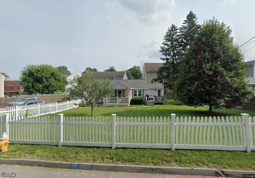
32 Aroostook St Worcester, MA 01606
Summit NeighborhoodEstimated Value: $365,000 - $436,000
3
Beds
1
Bath
1,256
Sq Ft
$321/Sq Ft
Est. Value
About This Home
This home is located at 32 Aroostook St, Worcester, MA 01606 and is currently estimated at $402,563, approximately $320 per square foot. 32 Aroostook St is a home located in Worcester County with nearby schools including Norrback Avenue Elementary School, Jacob Hiatt Magnet School, and Chandler Magnet.
Ownership History
Date
Name
Owned For
Owner Type
Purchase Details
Closed on
Jul 10, 2002
Sold by
Cassidy Francis W
Bought by
Beardsley Andrew A and Gould Albert E
Current Estimated Value
Home Financials for this Owner
Home Financials are based on the most recent Mortgage that was taken out on this home.
Original Mortgage
$60,000
Outstanding Balance
$25,634
Interest Rate
6.82%
Mortgage Type
Purchase Money Mortgage
Estimated Equity
$376,929
Purchase Details
Closed on
Jul 8, 2002
Sold by
Beardsley Andrew A and Gould Albert E
Bought by
Hylton Bradford L and Bedard Wendy E
Home Financials for this Owner
Home Financials are based on the most recent Mortgage that was taken out on this home.
Original Mortgage
$60,000
Outstanding Balance
$25,634
Interest Rate
6.82%
Mortgage Type
Purchase Money Mortgage
Estimated Equity
$376,929
Create a Home Valuation Report for This Property
The Home Valuation Report is an in-depth analysis detailing your home's value as well as a comparison with similar homes in the area
Home Values in the Area
Average Home Value in this Area
Purchase History
We collect this data history from publicly available records. To have your information removed, we recommend requesting removal directly through your county’s website.
| Date | Buyer | Sale Price | Title Company |
|---|---|---|---|
| Beardsley Andrew A | $313,900 | -- | |
| Hylton Bradford L | $190,000 | -- |
Source: Public Records
Mortgage History
We collect this data history from publicly available records. To have your information removed, we recommend requesting removal directly through your county’s website.
| Date | Status | Borrower | Loan Amount |
|---|---|---|---|
| Open | Hylton Bradford L | $60,000 |
Source: Public Records
Tax History
| Year | Tax Paid | Tax Assessment Tax Assessment Total Assessment is a certain percentage of the fair market value that is determined by local assessors to be the total taxable value of land and additions on the property. | Land | Improvement |
|---|---|---|---|---|
| 2025 | $4,748 | $360,000 | $118,800 | $241,200 |
| 2024 | $4,650 | $338,200 | $118,800 | $219,400 |
| 2023 | $4,488 | $313,000 | $103,300 | $209,700 |
| 2022 | $3,970 | $261,000 | $82,700 | $178,300 |
| 2021 | $3,801 | $233,500 | $66,100 | $167,400 |
| 2020 | $3,652 | $214,800 | $66,100 | $148,700 |
| 2019 | $3,431 | $190,600 | $59,600 | $131,000 |
| 2018 | $3,332 | $176,200 | $59,600 | $116,600 |
| 2017 | $3,387 | $176,200 | $59,600 | $116,600 |
| 2016 | $3,291 | $159,700 | $43,900 | $115,800 |
| 2015 | $3,205 | $159,700 | $43,900 | $115,800 |
| 2014 | $3,121 | $159,700 | $43,900 | $115,800 |
Source: Public Records
Map
Nearby Homes
- 59 Castine St
- 6 Idalla Ave
- 117 Malden St
- 7 Darrow St
- 10 Malden St
- 328 Brooks St
- 239 Woodland St Unit 3
- 149 Woodland St
- 29R E Mountain St
- 38 Juniper Ln
- 521 Burncoat St
- 16 Oxford St
- 14 Angell Brook Dr
- 32 Steele St
- 15 Birmingham Rd
- 402 Prospect St
- 25 Kings Mountain Dr
- 100 Assumption Ave
- 86 Saint Nicholas Ave
- 3 Enaya Cir
- 30 Aroostook St
- 34 Aroostook St
- 48 Castine St
- 48 Castine St Unit n/a
- 48 Castine St
- 46 Castine St
- 46 Castine St Unit 46
- 46 Castine St Unit .
- 44 Castine St
- 44 Castine St Unit 44
- 50 Castine St
- 50 Castine St Unit 1
- 28 Aroostook St
- 28 Aroostook St Unit 1
- 42 Castine St
- 36 Aroostook St
- 4 Dixfield St
- 25 Aroostook St
- 40 Castine St
- 2 Dixfield St
Your Personal Tour Guide
Ask me questions while you tour the home.