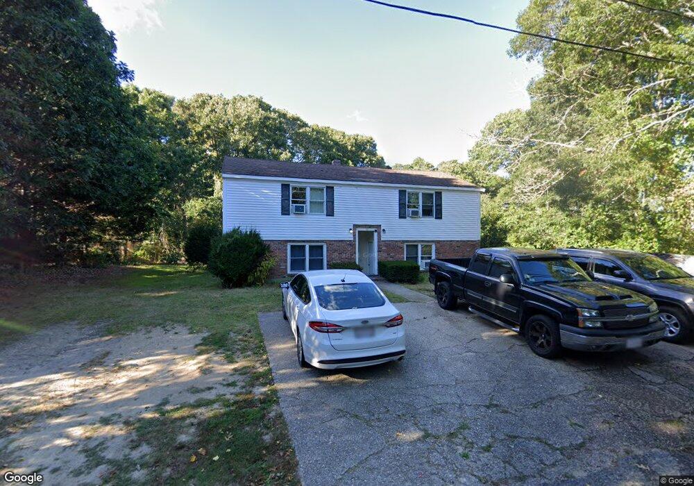
32 Cook Cir Hyannis, MA 02601
Hyannis NeighborhoodEstimated Value: $482,814 - $754,000
4
Beds
2
Baths
960
Sq Ft
$624/Sq Ft
Est. Value
About This Home
This home is located at 32 Cook Cir, Hyannis, MA 02601 and is currently estimated at $598,704, approximately $623 per square foot. 32 Cook Cir is a home located in Barnstable County with nearby schools including Hyannis West Elementary School, Barnstable United Elementary School, and Barnstable Intermediate School.
Ownership History
Date
Name
Owned For
Owner Type
Purchase Details
Closed on
Dec 10, 2015
Sold by
Dalo Carol
Bought by
Bayridge Realty Llc
Current Estimated Value
Purchase Details
Closed on
Jun 11, 2008
Sold by
Feder William
Bought by
Dalo Carol and Dalo William J
Purchase Details
Closed on
Sep 2, 2003
Sold by
Dwyer Daniel and Dwyer Debra A
Bought by
Feder William
Home Financials for this Owner
Home Financials are based on the most recent Mortgage that was taken out on this home.
Original Mortgage
$266,400
Interest Rate
5.69%
Mortgage Type
Purchase Money Mortgage
Purchase Details
Closed on
Nov 22, 1996
Sold by
Thomas J Roche Rlty
Bought by
Dwyer Daniel and Dwyer Debra A
Home Financials for this Owner
Home Financials are based on the most recent Mortgage that was taken out on this home.
Original Mortgage
$88,100
Interest Rate
7.81%
Mortgage Type
Purchase Money Mortgage
Create a Home Valuation Report for This Property
The Home Valuation Report is an in-depth analysis detailing your home's value as well as a comparison with similar homes in the area
Home Values in the Area
Average Home Value in this Area
Purchase History
We collect this data history from publicly available records. To have your information removed, we recommend requesting removal directly through your county’s website.
| Date | Buyer | Sale Price | Title Company |
|---|---|---|---|
| Bayridge Realty Llc | $170,000 | -- | |
| Dalo Carol | $240,000 | -- | |
| Dalo Carol | $240,000 | -- | |
| Feder William | $296,000 | -- | |
| Feder William | $296,000 | -- | |
| Dwyer Daniel | $92,000 | -- | |
| Dwyer Daniel | $92,000 | -- |
Source: Public Records
Mortgage History
We collect this data history from publicly available records. To have your information removed, we recommend requesting removal directly through your county’s website.
| Date | Status | Borrower | Loan Amount |
|---|---|---|---|
| Previous Owner | Feder William | $266,400 | |
| Previous Owner | Dwyer Daniel | $88,100 |
Source: Public Records
Tax History
| Year | Tax Paid | Tax Assessment Tax Assessment Total Assessment is a certain percentage of the fair market value that is determined by local assessors to be the total taxable value of land and additions on the property. | Land | Improvement |
|---|---|---|---|---|
| 2025 | $4,172 | $450,100 | $179,200 | $270,900 |
| 2024 | $4,109 | $454,000 | $179,200 | $274,800 |
| 2023 | $3,952 | $413,000 | $177,100 | $235,900 |
| 2022 | $3,767 | $325,600 | $125,900 | $199,700 |
| 2021 | $3,575 | $300,200 | $125,900 | $174,300 |
| 2020 | $3,629 | $294,300 | $125,900 | $168,400 |
| 2019 | $3,608 | $286,800 | $125,900 | $160,900 |
| 2018 | $4,012 | $261,300 | $138,100 | $123,200 |
| 2017 | $3,122 | $260,400 | $138,100 | $122,300 |
| 2016 | $3,070 | $261,700 | $139,400 | $122,300 |
| 2015 | $3,137 | $271,100 | $136,200 | $134,900 |
Source: Public Records
Map
Nearby Homes
- 138 Chase St
- 65 Marsh Ln
- 6 Stanley Place
- 287 Ocean St Unit C2
- 287 Ocean St Unit 2 BLDG C
- 287 Ocean St Unit D2
- 287 Ocean St Unit D2
- 25 Ripple Cove Rd
- 62 Pine Ave
- 125 Sea St
- 189 Breakwater Shores Dr
- 7 Bay Shore Rd
- 388 Sea St
- 388 Sea St
- 28 Janice Ln
- 28 Crocker Dr Unit 4
- 28 Crocker Dr Unit C
- 115 School St Unit W206
- 110 School St Unit E203
- 110 School St Unit E113
- 32 Cook Cir Unit A & B
- 20 Cook Cir
- 194 Old Colony Rd
- 180 Old Colony Rd
- 164 Old Colony Rd
- 164 Old Colony Rd Unit 2
- 162 Old Colony Rd Unit 2
- 162 Old Colony Rd
- 56 Cook Cir
- 60 Snow Creek Dr
- 190 Old Colony Rd
- 63 Snow Creek Dr
- 196 Old Colony Rd
- 71 Snow Creek Dr
- 7 Foster Rd
- 7 Foster Rd
- 69 Snow Creek Dr
- 3 Cook Cir
- 206 Old Colony Rd
- 4 Foster Rd
Your Personal Tour Guide
Ask me questions while you tour the home.