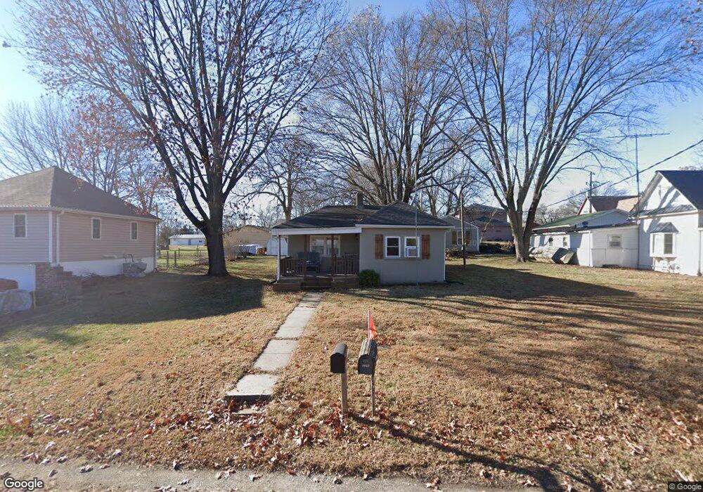
320 2nd St Trimble, MO 64492
Estimated Value: $98,651 - $215,000
1
Bed
1
Bath
696
Sq Ft
$251/Sq Ft
Est. Value
About This Home
This home is located at 320 2nd St, Trimble, MO 64492 and is currently estimated at $174,413, approximately $250 per square foot. 320 2nd St is a home located in Clinton County with nearby schools including Ellis Elementary School, Clinton County R-III Middle School, and Plattsburg High School.
Ownership History
Date
Name
Owned For
Owner Type
Purchase Details
Closed on
Sep 13, 2022
Sold by
Eugene Pulka John and Eugene Ann Debra
Bought by
Spiers Eric
Current Estimated Value
Home Financials for this Owner
Home Financials are based on the most recent Mortgage that was taken out on this home.
Original Mortgage
$127,449
Outstanding Balance
$120,606
Interest Rate
4.99%
Mortgage Type
FHA
Estimated Equity
$53,807
Purchase Details
Closed on
Aug 26, 2020
Sold by
Aleece Nicole
Bought by
Pulka John E
Purchase Details
Closed on
Dec 1, 2006
Bought by
Holdsworth Abijah C
Create a Home Valuation Report for This Property
The Home Valuation Report is an in-depth analysis detailing your home's value as well as a comparison with similar homes in the area
Purchase History
| Date | Buyer | Sale Price | Title Company |
|---|---|---|---|
| Spiers Eric | -- | -- | |
| Pulka John E | -- | Stewart Title | |
| Holdsworth Abijah C | -- | -- |
Source: Public Records
Mortgage History
| Date | Status | Borrower | Loan Amount |
|---|---|---|---|
| Open | Spiers Eric | $127,449 |
Source: Public Records
Tax History
| Year | Tax Paid | Tax Assessment Tax Assessment Total Assessment is a certain percentage of the fair market value that is determined by local assessors to be the total taxable value of land and additions on the property. | Land | Improvement |
|---|---|---|---|---|
| 2025 | $545 | $7,952 | $1,334 | $6,618 |
| 2024 | $545 | $7,099 | $1,191 | $5,908 |
| 2023 | $499 | $7,099 | $1,191 | $5,908 |
| 2022 | $464 | $6,562 | $1,191 | $5,371 |
| 2021 | $460 | $6,562 | $1,191 | $5,371 |
| 2020 | $422 | $5,966 | $1,083 | $4,883 |
| 2019 | $421 | $5,966 | $1,083 | $4,883 |
| 2018 | $420 | $5,966 | $1,083 | $4,883 |
| 2017 | $419 | $5,966 | $1,083 | $4,883 |
| 2016 | $427 | $5,966 | $1,083 | $4,883 |
| 2013 | -- | $5,970 | $0 | $0 |
Source: Public Records
Map
Nearby Homes
- 501 Port Arthur Rd
- 10A Highway 169
- 7364 SW Crystal Ln
- 7385 SW Karen Rd
- 6320 NE 164th St
- 6009 SW Walnut Cove
- 1405 NE 196th Ct
- Lot 2 Z Hwy
- Lot 1, 2 Z Hwy
- Z Highway Lot: 1 Unit 2
- 8894 Ssr-Z Hwy
- 8894 SW Highway Z
- 901 NE 194th Terrace
- 100 Lake Meadows Dr
- 102 Lake Meadows Dr
- Lot 3 Z Hwy
- 5050 SW O Hwy
- 0 SW Short Rd
- 18600 Woodruff St
- 18410 Rock Creek Dr
Your Personal Tour Guide
Ask me questions while you tour the home.