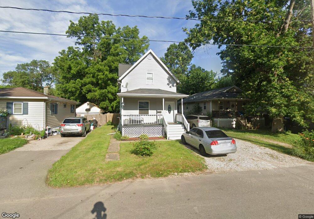
320 Powers Ave Madison, WI 53714
Worthington Park NeighborhoodEstimated Value: $342,000 - $420,000
4
Beds
3
Baths
1,700
Sq Ft
$214/Sq Ft
Est. Value
About This Home
This home is located at 320 Powers Ave, Madison, WI 53714 and is currently estimated at $363,184, approximately $213 per square foot. 320 Powers Ave is a home located in Dane County with nearby schools including Lowell Elementary School, O'Keeffe Middle, and East High School.
Ownership History
Date
Name
Owned For
Owner Type
Purchase Details
Closed on
Dec 30, 2025
Sold by
Valencia Julio Cesar Hernandez
Bought by
Maldonado David J and Valencia Marisol Hernandez
Current Estimated Value
Home Financials for this Owner
Home Financials are based on the most recent Mortgage that was taken out on this home.
Original Mortgage
$123,200
Outstanding Balance
$122,812
Interest Rate
5.75%
Mortgage Type
New Conventional
Estimated Equity
$240,372
Purchase Details
Closed on
Sep 15, 2008
Sold by
Kraft Ryan T and Kraft Angela N
Bought by
Maldonado David J and Valencia Marisol Hernandez
Home Financials for this Owner
Home Financials are based on the most recent Mortgage that was taken out on this home.
Original Mortgage
$161,505
Interest Rate
6.62%
Mortgage Type
Purchase Money Mortgage
Purchase Details
Closed on
May 11, 2007
Sold by
Selvaag Shawn
Bought by
Kraft Ryan T
Home Financials for this Owner
Home Financials are based on the most recent Mortgage that was taken out on this home.
Original Mortgage
$22,150
Interest Rate
8%
Mortgage Type
Construction
Create a Home Valuation Report for This Property
The Home Valuation Report is an in-depth analysis detailing your home's value as well as a comparison with similar homes in the area
Home Values in the Area
Average Home Value in this Area
Purchase History
We collect this data history from publicly available records. To have your information removed, we recommend requesting removal directly through your county’s website.
| Date | Buyer | Sale Price | Title Company |
|---|---|---|---|
| Maldonado David J | $92,066 | None Listed On Document | |
| Maldonado David J | $166,500 | None Available | |
| Kraft Ryan T | $78,000 | None Available |
Source: Public Records
Mortgage History
We collect this data history from publicly available records. To have your information removed, we recommend requesting removal directly through your county’s website.
| Date | Status | Borrower | Loan Amount |
|---|---|---|---|
| Open | Maldonado David J | $123,200 | |
| Previous Owner | Maldonado David J | $161,505 | |
| Previous Owner | Kraft Ryan T | $22,150 | |
| Previous Owner | Kraft Ryan T | $118,250 |
Source: Public Records
Tax History
| Year | Tax Paid | Tax Assessment Tax Assessment Total Assessment is a certain percentage of the fair market value that is determined by local assessors to be the total taxable value of land and additions on the property. | Land | Improvement |
|---|---|---|---|---|
| 2025 | $3,491 | $276,200 | $61,000 | $215,200 |
| 2024 | $3,048 | $276,200 | $61,000 | $215,200 |
| 2023 | $3,384 | $186,100 | $34,000 | $152,100 |
| 2022 | $3,156 | $186,100 | $34,000 | $152,100 |
| 2021 | $2,941 | $186,100 | $34,000 | $152,100 |
| 2020 | $2,871 | $186,100 | $34,000 | $152,100 |
| 2019 | $2,842 | $186,100 | $34,000 | $152,100 |
| 2018 | $3,129 | $166,500 | $34,000 | $132,500 |
| 2017 | $3,509 | $166,500 | $34,000 | $132,500 |
| 2016 | $3,006 | $166,500 | $34,000 | $132,500 |
| 2015 | $3,146 | $166,500 | $34,000 | $132,500 |
| 2014 | $3,369 | $166,500 | $34,000 | $132,500 |
| 2013 | $3,748 | $166,500 | $34,000 | $132,500 |
Source: Public Records
Map
Nearby Homes
- 420 Gannon Ave
- 113 Rosemary Ave
- 2925 Sachs St
- 3140 James St
- 2926 Milwaukee St
- 248 N Marquette St
- 2817 Milwaukee St
- 202 Oak St
- 2830 Hoard St
- 206 Dixon St
- 2741 Milwaukee St
- 2737 Union St
- 53 Walter St
- 1027 Melvin Ct
- 3010 Fairview St
- 58 Bradford Ln
- 515 Pawling St
- 205 Dixon St
- 1224 Carpenter St
- 914 N Oak St
- 316 Powers Ave
- 324 Powers Ave
- 312 Powers Ave
- 3213 Thurber Ave
- 3207 Thurber Ave
- 308 Powers Ave
- 317 Memphis Ave
- 313 Memphis Ave
- 304 Powers Ave
- 329 Memphis Ave
- 400 Powers Ave
- 309 Memphis Ave
- 321 Powers Ave
- 317 Powers Ave
- 325 Powers Ave
- 300 Powers Ave
- 3232 Worthington Ave
- 309 Powers Ave
- 404 Powers Ave
- 401 Memphis Ave
Your Personal Tour Guide
Ask me questions while you tour the home.