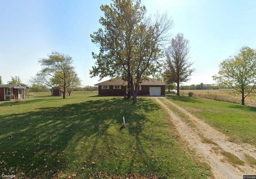
32001 E State Route P Pleasant Hill, MO 64080
Estimated Value: $218,000 - $349,000
3
Beds
1
Bath
1,271
Sq Ft
$242/Sq Ft
Est. Value
About This Home
This home is located at 32001 E State Route P, Pleasant Hill, MO 64080 and is currently estimated at $307,082, approximately $241 per square foot. 32001 E State Route P is a home located in Cass County with nearby schools including Pleasant Hill Primary School, Pleasant Hill Elementary School, and Pleasant Hill Middle School.
Ownership History
Date
Name
Owned For
Owner Type
Purchase Details
Closed on
May 23, 2016
Sold by
Brandes Elgin and Brandes Katherine Elaine
Bought by
Brandes Elgin and Elaine Katherine
Current Estimated Value
Home Financials for this Owner
Home Financials are based on the most recent Mortgage that was taken out on this home.
Original Mortgage
$89,300
Interest Rate
3.66%
Mortgage Type
New Conventional
Create a Home Valuation Report for This Property
The Home Valuation Report is an in-depth analysis detailing your home's value as well as a comparison with similar homes in the area
Purchase History
| Date | Buyer | Sale Price | Title Company |
|---|---|---|---|
| Brandes Elgin | -- | Coffelt Land Title |
Source: Public Records
Mortgage History
| Date | Status | Borrower | Loan Amount |
|---|---|---|---|
| Closed | Brandes Elgin | $89,300 |
Source: Public Records
Tax History
| Year | Tax Paid | Tax Assessment Tax Assessment Total Assessment is a certain percentage of the fair market value that is determined by local assessors to be the total taxable value of land and additions on the property. | Land | Improvement |
|---|---|---|---|---|
| 2025 | $1,506 | $28,490 | $3,740 | $24,750 |
| 2024 | $1,506 | $24,910 | $3,400 | $21,510 |
| 2023 | $1,501 | $24,910 | $3,400 | $21,510 |
| 2022 | $1,357 | $22,210 | $3,400 | $18,810 |
| 2021 | $1,312 | $22,210 | $3,400 | $18,810 |
| 2020 | $1,235 | $21,540 | $3,400 | $18,140 |
| 2019 | $1,215 | $21,540 | $3,400 | $18,140 |
| 2018 | $1,163 | $19,550 | $2,720 | $16,830 |
| 2017 | $1,107 | $19,550 | $2,720 | $16,830 |
| 2016 | $1,107 | $18,590 | $2,720 | $15,870 |
| 2015 | $1,124 | $18,590 | $2,720 | $15,870 |
| 2014 | $1,130 | $18,590 | $2,720 | $15,870 |
| 2013 | -- | $18,590 | $2,720 | $15,870 |
Source: Public Records
Map
Nearby Homes
- 41 Acres S Pryor Rd
- Tract 2 S Pryor Rd
- Tract 4 S Pryor Rd
- Tract 3 S Pryor Rd
- 20402 S Pryor Rd
- 30109 E 222nd Ct
- 19418 S Sherwood Rd
- Lot 3 E 227 St
- 22805 Bethel Rd
- 0000 E State Route P
- S Staley Mound Rd
- 212 S State Route Cc Rural Route
- 21 Acres Staley Mound Rd
- 402 W Mill St
- 26103 E 203rd St
- 26408 E 227th St
- 504 Washington St
- 503 East St
- 28605 E 239th St
- 500 Pennsylvania Ave
- 32010 E State Route P
- 32010 E State Route P
- 32201 E State Route P
- 31802 E State Route P
- 21020 S Parris Rd
- 22512 State Highway P
- 21023 S Parris Rd
- 31600 E State Route P
- 21207 S State Route K
- 21415 S State Route K
- 32210 E State Route P
- 20606 S Parris Rd
- 21611 S State Route K
- 30901 E State Route P
- 21616 S State Route K
- 33009 E State Route P
- 33901 E State Route P
- 33202 E State Route P
- 20619 S Parris Rd
- 33304 E State Route P
Your Personal Tour Guide
Ask me questions while you tour the home.