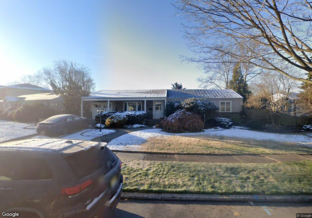
321 Taft Rd River Edge, NJ 07661
River Edge AreaEstimated Value: $754,000 - $955,000
About This Home
This home is located at 321 Taft Rd, River Edge, NJ 07661 and is currently estimated at $863,273, approximately $509 per square foot. 321 Taft Rd is a home located in Bergen County with nearby schools including Cherry Hill School, River Dell Middle School, and River Dell Regional High School.
Ownership History
We collect this data history from publicly available records. To have your information removed, we recommend requesting removal directly through your county’s website.
Purchase Details
Purchase Details
Purchase Details
Home Values in the Area
Average Home Value in this Area
Purchase History
We collect this data history from publicly available records. To have your information removed, we recommend requesting removal directly through your county’s website.
| Date | Buyer | Sale Price | Title Company |
|---|---|---|---|
| -- | Tom Mary | ||
| $485,000 | -- | ||
| $335,000 | -- |
Tax History
We collect this data history from publicly available records. To have your information removed, we recommend requesting removal directly through your county’s website.
| Year | Tax Paid | Tax Assessment Tax Assessment Total Assessment is a certain percentage of the fair market value that is determined by local assessors to be the total taxable value of land and additions on the property. | Land | Improvement |
|---|---|---|---|---|
| 2026 | $14,861 | $654,500 | $383,300 | $271,200 |
| 2025 | $13,893 | $614,100 | $355,800 | $258,300 |
| 2024 | $13,546 | $350,400 | $211,200 | $139,200 |
| 2023 | $12,965 | $350,400 | $211,200 | $139,200 |
| 2022 | $12,965 | $350,400 | $211,200 | $139,200 |
| 2021 | $12,709 | $350,400 | $211,200 | $139,200 |
| 2020 | $12,509 | $350,400 | $211,200 | $139,200 |
| 2019 | $12,152 | $350,400 | $211,200 | $139,200 |
| 2018 | $11,896 | $350,400 | $211,200 | $139,200 |
| 2017 | $11,780 | $350,400 | $211,200 | $139,200 |
| 2016 | $11,514 | $350,400 | $211,200 | $139,200 |
| 2015 | $11,272 | $350,400 | $211,200 | $139,200 |
| 2014 | $11,293 | $350,400 | $211,200 | $139,200 |
Map
- 252 Valley Rd
- 302 Howland Ave
- 283 Taft Rd
- 34 Eastbrook Dr
- 392 Oak Ave
- 16 Coles Ct
- 19 Coles Ct
- 405 Valley Rd
- 160 Lozier Terrace
- 457 the Fenway
- 12 Gainesborough Terrace Unit 1B
- 4 Gainesborough Terrace Unit 1B
- 444 Elm Ave
- 293 Bogert Rd
- 255 Bogert Rd Unit 2A
- 270 Kensington Rd
- 175 Manning Ave
- 20 Wayne Ave
- 189 Forest Ave Unit 307
- 189 Forest Ave Unit 213
Ask me questions while you tour the home.