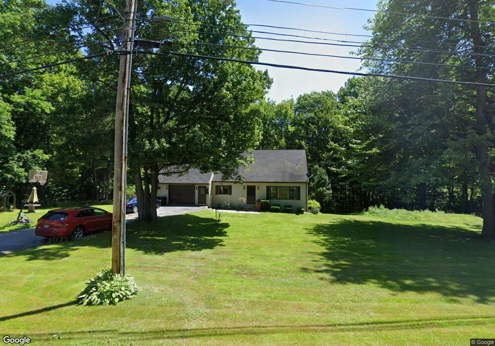
321 Townsend Brook Rd Auburn, ME 04210
Estimated Value: $340,000 - $407,000
3
Beds
2
Baths
1,512
Sq Ft
$247/Sq Ft
Est. Value
About This Home
This home is located at 321 Townsend Brook Rd, Auburn, ME 04210 and is currently estimated at $372,720, approximately $246 per square foot. 321 Townsend Brook Rd is a home located in Androscoggin County with nearby schools including East Auburn Community School, Auburn Middle School, and Edward Little High School.
Ownership History
Date
Name
Owned For
Owner Type
Purchase Details
Closed on
Jul 22, 2005
Sold by
Violette Kenneth N and Violette Cynthia A
Bought by
Libby Richard D and Libby Tracey M
Current Estimated Value
Home Financials for this Owner
Home Financials are based on the most recent Mortgage that was taken out on this home.
Original Mortgage
$175,750
Outstanding Balance
$87,793
Interest Rate
5.59%
Mortgage Type
Purchase Money Mortgage
Estimated Equity
$284,927
Create a Home Valuation Report for This Property
The Home Valuation Report is an in-depth analysis detailing your home's value as well as a comparison with similar homes in the area
Home Values in the Area
Average Home Value in this Area
Purchase History
| Date | Buyer | Sale Price | Title Company |
|---|---|---|---|
| Libby Richard D | -- | -- |
Source: Public Records
Mortgage History
| Date | Status | Borrower | Loan Amount |
|---|---|---|---|
| Open | Libby Richard D | $175,750 |
Source: Public Records
Tax History
| Year | Tax Paid | Tax Assessment Tax Assessment Total Assessment is a certain percentage of the fair market value that is determined by local assessors to be the total taxable value of land and additions on the property. | Land | Improvement |
|---|---|---|---|---|
| 2025 | $5,603 | $244,900 | $41,400 | $203,500 |
| 2024 | $5,449 | $244,900 | $41,400 | $203,500 |
| 2023 | $4,953 | $217,700 | $36,700 | $181,000 |
| 2022 | $4,953 | $217,700 | $36,700 | $181,000 |
| 2021 | $4,323 | $181,500 | $30,600 | $150,900 |
| 2020 | $4,311 | $181,500 | $30,600 | $150,900 |
| 2019 | $4,311 | $181,500 | $30,600 | $150,900 |
| 2018 | $4,298 | $181,500 | $30,600 | $150,900 |
| 2017 | $4,173 | $181,500 | $30,600 | $150,900 |
| 2016 | $4,072 | $182,200 | $30,600 | $151,600 |
| 2015 | $3,872 | $182,200 | $30,600 | $151,600 |
| 2013 | -- | $183,900 | $30,600 | $153,300 |
Source: Public Records
Map
Nearby Homes
- 329 Townsend Brook Rd
- 273 Townsend Brook Rd
- 340 Townsend Brook Rd
- 345 Townsend Brook Rd
- 0 Auburn Rte 4
- 00 Auburn Rd
- LOT 0 Auburn Rd
- 0 Rte 4 Lot 5 Auburn
- 270 Townsend Brook Rd
- 261 Townsend Brook Rd
- Lot 0 Stone & Lot 0 Townsend Brook Rd
- 248 Townsend Brook Rd
- 251 Townsend Brook Rd
- Lots #1-4 Stagecoach Dr
- 140 Chickadee Dr
- 241 Townsend Brook Rd
- 241 Townsend Brook Rd
- 114 Chickadee Dr
- 230 Townsend Brook Rd
Your Personal Tour Guide
Ask me questions while you tour the home.