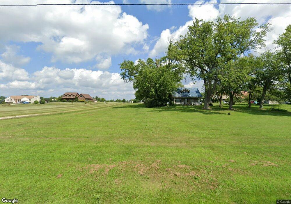
3222 Gallant Rd Radnor, OH 43066
Estimated Value: $447,000 - $659,000
3
Beds
3
Baths
2,125
Sq Ft
$270/Sq Ft
Est. Value
About This Home
This home is located at 3222 Gallant Rd, Radnor, OH 43066 and is currently estimated at $573,392, approximately $269 per square foot. 3222 Gallant Rd is a home located in Delaware County with nearby schools including Buckeye Valley High School.
Ownership History
Date
Name
Owned For
Owner Type
Purchase Details
Closed on
Jul 8, 2010
Sold by
Noel Bobbie S
Bought by
Noel Forest D
Current Estimated Value
Purchase Details
Closed on
Jun 16, 2003
Sold by
Vista Land Co Llc
Bought by
Noel Forest D and Noel Bobbie S
Home Financials for this Owner
Home Financials are based on the most recent Mortgage that was taken out on this home.
Original Mortgage
$227,200
Interest Rate
5.71%
Mortgage Type
Construction
Create a Home Valuation Report for This Property
The Home Valuation Report is an in-depth analysis detailing your home's value as well as a comparison with similar homes in the area
Home Values in the Area
Average Home Value in this Area
Purchase History
| Date | Buyer | Sale Price | Title Company |
|---|---|---|---|
| Noel Forest D | -- | Attorney | |
| Noel Forest D | $70,500 | -- |
Source: Public Records
Mortgage History
| Date | Status | Borrower | Loan Amount |
|---|---|---|---|
| Closed | Noel Forest D | $227,200 |
Source: Public Records
Tax History
| Year | Tax Paid | Tax Assessment Tax Assessment Total Assessment is a certain percentage of the fair market value that is determined by local assessors to be the total taxable value of land and additions on the property. | Land | Improvement |
|---|---|---|---|---|
| 2024 | $6,455 | $173,540 | $53,170 | $120,370 |
| 2023 | $6,458 | $173,540 | $53,170 | $120,370 |
| 2022 | $5,753 | $137,100 | $35,460 | $101,640 |
| 2021 | $5,759 | $137,100 | $35,460 | $101,640 |
| 2020 | $5,787 | $137,100 | $35,460 | $101,640 |
| 2019 | $4,943 | $115,540 | $30,840 | $84,700 |
| 2018 | $5,016 | $115,540 | $30,840 | $84,700 |
| 2017 | $4,486 | $107,110 | $27,200 | $79,910 |
| 2016 | $4,137 | $107,110 | $27,200 | $79,910 |
| 2015 | $4,361 | $107,110 | $27,200 | $79,910 |
| 2014 | $4,096 | $107,110 | $27,200 | $79,910 |
| 2013 | $4,187 | $104,030 | $27,200 | $76,830 |
Source: Public Records
Map
Nearby Homes
- 3935 N Section Line Rd
- 4005 Ohio 203
- 1817 Lawrence Rd
- 240 Glemsbury Dr
- 2131 Farmland Dr
- 5734 U S Highway 23 N
- 5718 U S Highway 23 N
- 2199 Hope Ln
- 370 Timbersmith Dr
- 244 Cambridge Rd
- 762 Sunny Vale Dr
- 3734 Warrensburg Rd
- 443 Garnet Ranch Dr
- 442 Garnet Ranch Dr
- 3680 Warrensburg Rd
- 436 Garnet Ranch Dr
- 412 Garnet Ranch Dr
- 525 Ablemarle Cir
- 2961 Warrensburg Rd
- 58 Aldersgate Dr
- 3296 Gallant Rd
- 3284 Gallant Rd
- 3188 Gallant Rd
- 3334 Gallant Rd
- 3326 Gallant Rd
- 0 Gallant Rd Unit Lt18 2612225
- 0 Gallant Rd Unit Lt9 2542107
- 0 Gallant Rd Unit Lt18 2542055
- Lot 22 Gallant Rd
- Tract #7 Gallant Rd
- 0 Gallant Rd Unit 2417033
- 0 Gallant Rd Unit Lt 13 2217857
- 0 Gallant Rd Unit LT 27 2217875
- 0 Gallant Rd Unit LT14 2217860
- 0 Gallant Rd Unit LT 23 2217871
- 0 Gallant Rd Unit LT 21 2217870
- 0 Gallant Rd Unit LT 12 2217849
- 0 Gallant Rd Unit LT 25 2214084
- 0 Gallant Rd Unit LT 24 2214097
- 0 Gallant Rd Unit 29 2206265
Your Personal Tour Guide
Ask me questions while you tour the home.