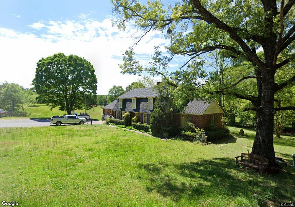
3249 Browns Bridge Rd Bowman, GA 30624
Estimated Value: $380,000 - $740,000
Studio
3
Baths
3,324
Sq Ft
$161/Sq Ft
Est. Value
About This Home
This home is located at 3249 Browns Bridge Rd, Bowman, GA 30624 and is currently estimated at $534,762, approximately $160 per square foot. 3249 Browns Bridge Rd is a home located in Elbert County with nearby schools including Elbert County Elementary School, Elbert County Primary School, and Elbert County Middle School.
Ownership History
Date
Name
Owned For
Owner Type
Purchase Details
Closed on
Sep 14, 2020
Sold by
Bennett Carolyn Ann
Bought by
Bennett Joe Roger
Current Estimated Value
Purchase Details
Closed on
Feb 18, 2002
Sold by
Bennett Joe Roger
Bought by
Bennett Joe Roger and Carolyn Ann
Purchase Details
Closed on
Nov 1, 1977
Purchase Details
Closed on
Jun 1, 1977
Create a Home Valuation Report for This Property
The Home Valuation Report is an in-depth analysis detailing your home's value as well as a comparison with similar homes in the area
Purchase History
| Date | Buyer | Sale Price | Title Company |
|---|---|---|---|
| Bennett Joe Roger | -- | -- | |
| Bennett Joe Roger | -- | -- | |
| -- | -- | -- | |
| -- | -- | -- |
Source: Public Records
Tax History
| Year | Tax Paid | Tax Assessment Tax Assessment Total Assessment is a certain percentage of the fair market value that is determined by local assessors to be the total taxable value of land and additions on the property. | Land | Improvement |
|---|---|---|---|---|
| 2025 | $3,357 | $172,915 | $46,553 | $126,362 |
| 2024 | $3,591 | $159,770 | $40,481 | $119,289 |
| 2023 | $3,591 | $159,770 | $40,481 | $119,289 |
| 2022 | $2,185 | $101,114 | $24,096 | $77,018 |
| 2021 | $2,188 | $101,114 | $24,096 | $77,018 |
| 2020 | $1,713 | $73,004 | $19,277 | $53,727 |
| 2019 | $1,779 | $73,004 | $19,277 | $53,727 |
| 2018 | $1,833 | $73,004 | $19,277 | $53,727 |
| 2017 | $2,013 | $74,069 | $19,277 | $54,792 |
| 2016 | $1,880 | $74,069 | $19,277 | $54,792 |
| 2015 | -- | $74,069 | $19,277 | $54,792 |
| 2014 | -- | $74,069 | $19,277 | $54,792 |
| 2013 | -- | $74,069 | $19,277 | $54,792 |
Source: Public Records
Map
Nearby Homes
- 2115 Dusty Rd
- 8714 Georgia 172
- 0 Dusty Rd Unit 10569563
- 0 Dusty Rd Unit 7619983
- 494 S Broad St
- 225 Rehoboth Rd
- 3272 Horace Rd
- 100 S Broad St
- 0 Bowers St Unit LOT 1-8 10576344
- 0 Bowers St Unit LOT 1-8
- 231 Roosevelt Cir
- 260 Roosevelt Cir
- 2970 Davids Home Church Rd
- 1541 Turman Rd
- 1271 Della Slaton Rd
- 0 Five Forks Rd Unit 10619685
- 2660 Parham Town Rd
- 0 Fork Creek Rd Unit CL350628
- 0 Fork Creek Rd Unit 7728987
- 0 Fork Creek Rd Unit 10702901
- 1908 Roberts Rd
- 3237 Browns Bridge Rd
- 3256 Browns Bridge Rd
- 3283 Browns Bridge Rd
- 1886 Massey Rd
- 3321 Browns Bridge Rd
- 1912 Massey Rd
- 0 Massey Rd Unit 8261349
- 0 Massey Rd Unit 10010650
- 0 Massey Rd Unit 9010313
- 1919 Massey Rd
- 2016 John Tate Dr
- 127 ac Massey Rd
- 3314 Browns Bridge Rd
- 3194 Browns Bridge Rd
- 2018 John Tate Dr
- 3317 Deep Creek Rd
- 3319 Browns Bridge Rd
- 3173 Browns Bridge Rd
- 0 Browns Bridge Rd Unit 3262370
Your Personal Tour Guide
Ask me questions while you tour the home.