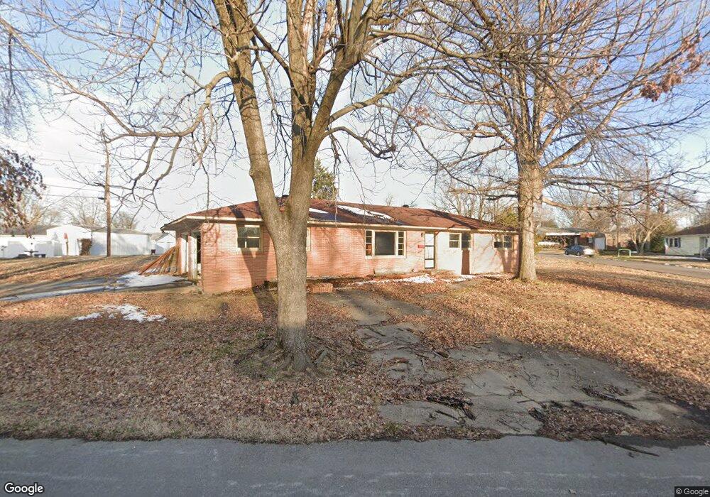
325 Forrest St Dexter, MO 63841
Estimated Value: $140,000 - $198,000
About This Home
This home is located at 325 Forrest St, Dexter, MO 63841 and is currently estimated at $165,629, approximately $98 per square foot. 325 Forrest St is a home located in Stoddard County with nearby schools including Southwest Elementary School, Central Elementary School, and T.S. Hill Middle School.
Ownership History
We collect this data history from publicly available records. To have your information removed, we recommend requesting removal directly through your county’s website.
Purchase Details
Home Financials for this Owner
Home Financials are based on the most recent Mortgage that was taken out on this home.Home Values in the Area
Average Home Value in this Area
Purchase History
We collect this data history from publicly available records. To have your information removed, we recommend requesting removal directly through your county’s website.
| Date | Buyer | Sale Price | Title Company |
|---|---|---|---|
| $50,812 | National Title & Escrow Inc |
Mortgage History
We collect this data history from publicly available records. To have your information removed, we recommend requesting removal directly through your county’s website.
| Date | Status | Borrower | Loan Amount |
|---|---|---|---|
| Open | $40,650 |
Tax History
We collect this data history from publicly available records. To have your information removed, we recommend requesting removal directly through your county’s website.
| Year | Tax Paid | Tax Assessment Tax Assessment Total Assessment is a certain percentage of the fair market value that is determined by local assessors to be the total taxable value of land and additions on the property. | Land | Improvement |
|---|---|---|---|---|
| 2025 | $797 | $14,858 | $0 | $0 |
| 2024 | $7 | $14,060 | $0 | $0 |
| 2023 | $650 | $14,060 | $0 | $0 |
| 2022 | $614 | $13,300 | $0 | $0 |
| 2021 | $614 | $13,300 | $0 | $0 |
| 2020 | $581 | $12,388 | $0 | $0 |
| 2019 | $580 | $12,521 | $0 | $0 |
| 2018 | $570 | $12,388 | $0 | $0 |
| 2016 | $543 | $12,160 | $0 | $0 |
| 2015 | -- | $12,160 | $0 | $0 |
| 2014 | -- | $12,141 | $0 | $0 |
| 2013 | -- | $0 | $0 | $0 |
Map
- 805 W Bain St
- 315 S Park Ln
- 421 Chautauqua Ln
- 809 Boucher St
- 404 Moore St
- 707 Moore St
- 804 Susan St Unit A & B
- 2 S One Mile Rd
- 106 W Grant St
- 909 Saddle Spur Rd
- 804 Rannell St
- 829 Whitman St
- 128 S Mulberry St
- 707 Trotter Ln
- 0 Lewis & Albert St Unit MAR25013843
- 331 S Mulberry St
- 902 Albert St
- 328 W Oak St
- 1014 S Woodland Dr
- 113 Whitman St
- 620 Alice St
- 324 Forrest St
- 625 W Fannetta St
- 328 Rannell St
- 320 Rannell St
- 615 W Fannetta St
- 625 Alice St
- 621 Alice St
- 718 Alice St
- 302 Forrest St
- 338 Rannell St
- 338 Forrest St
- 310 Rannell St
- 707 W Fannetta St
- 340 Rannell St
- 340 Forrest St
- 720 Alice St
- 610 W Grant St
- 612 W Grant St
- 709 W Fannetta St
Ask me questions while you tour the home.