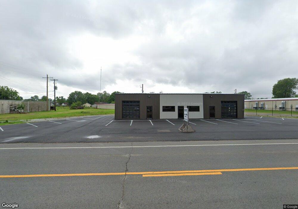
325 Highway 463 S Trumann, AR 72472
Estimated Value: $310,464
Studio
--
Bath
2,356
Sq Ft
$132/Sq Ft
Est. Value
About This Home
This home is located at 325 Highway 463 S, Trumann, AR 72472 and is currently priced at $310,464, approximately $131 per square foot. 325 Highway 463 S is a home located in Poinsett County with nearby schools including Trumann Elementary School, Trumann Intermediate School 5-6, and Trumann Middle School.
Ownership History
Date
Name
Owned For
Owner Type
Purchase Details
Closed on
Mar 22, 2024
Sold by
Osment Rentals Llc
Bought by
Parsley Emily P and Battles Donald L
Current Estimated Value
Purchase Details
Closed on
Feb 23, 2022
Sold by
Bradway Dena L and Bradway Kenneth
Bought by
Osment Rentals Llc
Purchase Details
Closed on
Oct 7, 1999
Sold by
Not Provided
Bought by
Farmer James R
Create a Home Valuation Report for This Property
The Home Valuation Report is an in-depth analysis detailing your home's value as well as a comparison with similar homes in the area
Home Values in the Area
Average Home Value in this Area
Purchase History
We collect this data history from publicly available records. To have your information removed, we recommend requesting removal directly through your county’s website.
| Date | Buyer | Sale Price | Title Company |
|---|---|---|---|
| Parsley Emily P | $109,900 | None Listed On Document | |
| Osment Rentals Llc | $20,000 | None Listed On Document | |
| Farmer James R | -- | -- |
Source: Public Records
Tax History
| Year | Tax Paid | Tax Assessment Tax Assessment Total Assessment is a certain percentage of the fair market value that is determined by local assessors to be the total taxable value of land and additions on the property. | Land | Improvement |
|---|---|---|---|---|
| 2025 | $2,998 | $58,360 | $3,350 | $55,010 |
| 2024 | $2,836 | $58,360 | $3,350 | $55,010 |
| 2023 | $2,994 | $8,040 | $3,350 | $4,690 |
| 2022 | $301 | $8,040 | $3,350 | $4,690 |
| 2021 | $275 | $5,150 | $3,350 | $1,800 |
| 2020 | $275 | $5,150 | $3,350 | $1,800 |
| 2019 | $275 | $5,150 | $3,350 | $1,800 |
| 2018 | $255 | $5,150 | $3,350 | $1,800 |
| 2017 | $200 | $5,150 | $3,350 | $1,800 |
| 2016 | $181 | $3,960 | $2,520 | $1,440 |
| 2015 | $181 | $3,960 | $2,520 | $1,440 |
| 2014 | $181 | $3,960 | $2,520 | $1,440 |
Source: Public Records
Map
Nearby Homes
- 304 Plaza Ave
- 353 Holly Ave
- 116 Mallard Cove
- 149 Rosewood Dr
- 508 W Main St
- 615 W Main St
- 39 W Main St
- 39.10 Acres W Main St Unit 39.10 Acres West Mai
- 514 Maple St
- 612 Circle Dr
- 1117 Mulberry Dr
- 1201 Mulberry Dr
- 100 N Magnolia Dr
- 304 Norma Jean Dr
- 1200 Mulberry Dr
- 217 Oak St Unit 301 Oak St
- 115 N Crest
- 115 N Crest Ave
- 120 E Speedway St
- 141 Cypress Dr
- 0 Arkansas 463
- 309 Arkansas 463
- 501 Plaza Ave
- 511 Plaza Ave
- 0 Plaza Ave
- 509 Plaza Ave
- 541 Plaza Ave
- 0 Highway 463 S Unit 17026694
- 437 Olive St
- 519 Plaza Ave
- 508 Olive St
- 405 Highway 463 S
- 405 Highway 463 S Unit 405 Hwy 463 S (Couch
- 433 Olive St
- 411 Plaza Ave
- 305 Highway 463 S
- 305 Hwy 463 S
- 305 Highway 463 S
- 412 Arkansas 463
- 429 Olive St
Your Personal Tour Guide
Ask me questions while you tour the home.